File:Oceania Political Map (EEZ based).png
Size of this preview: 800 × 495 pixels. Other resolutions: 320 × 198 pixels | 640 × 396 pixels | 1,024 × 634 pixels | 1,347 × 834 pixels.
Original file (1,347 × 834 pixels, file size: 51 KB, MIME type: image/png)
Captions
Captions
Add a one-line explanation of what this file represents
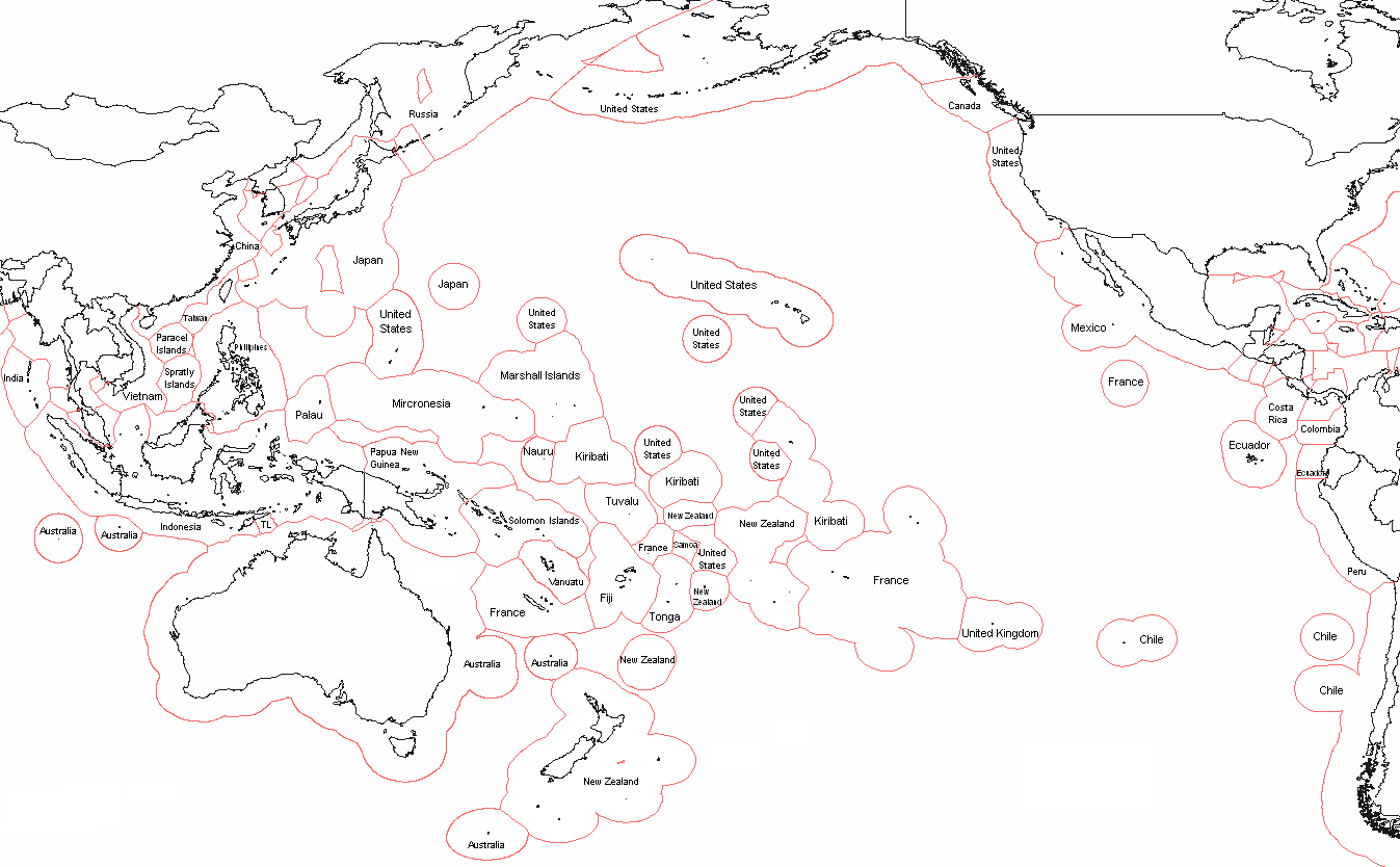
| Description | Political map of Oceania - based on EEZ borders | ||
| Date | |||
| Source | I, Alinor (talk) created this work entirely by myself. | ||
| Author | Alinor (talk) | ||
| Permission (Reusing this file) |
I, the copyright holder of this work, hereby publish it under the following licenses: This file is licensed under the Creative Commons Attribution-Share Alike 3.0 Unported license.
You may select the license of your choice. |
||
| Other versions | based on File:Realm of New Zealand Exclusive Economic Zones.png |

File history
Click on a date/time to view the file as it appeared at that time.
| Date/Time | Thumbnail | Dimensions | User | Comment | |
|---|---|---|---|---|---|
| current | 20:47, 2 June 2018 | | 1,347 × 834 (51 KB) | Janitoalevic (talk | contribs) | . |
| 20:33, 2 June 2018 |  | 1,347 × 834 (51 KB) | Janitoalevic (talk | contribs) | Updated Chile-Peru maritime border | |
| 13:26, 21 September 2013 |  | 1,347 × 834 (84 KB) | Avenue (talk | contribs) | Reverted to version as of 05:59, 2 February 2012 - Tokelau isn't Niue | |
| 21:35, 20 April 2012 |  | 1,347 × 834 (75 KB) | Spesh531 (talk | contribs) | niue and cook islands | |
| 05:59, 2 February 2012 |  | 1,347 × 834 (84 KB) | Che829 (talk | contribs) | Reverted to version as of 13:03, 28 September 2010 Deceiving edit summary by 23prootie. The UNCLOS (http://www.un.org/Depts/los/convention_agreements/texts/unclos/closindx.htm) doesn't have any statements to broaden the EEZs of Japan and the Philippines. | |
| 00:13, 1 June 2011 |  | 1,347 × 834 (99 KB) | 23prootie~commonswiki (talk | contribs) | Updated. Source: UNCLOS. | |
| 13:03, 28 September 2010 |  | 1,347 × 834 (84 KB) | Frank50 s (talk | contribs) | {{Information |Description = Political map of Oceania - based on EEZ borders |Source = I,Alinor (talk)) created this work entirely by myself. |Date = 17.8 |
You cannot overwrite this file.
File usage on Commons
The following page uses this file:
File usage on other wikis
The following other wikis use this file:
- Usage on ar.wikipedia.org
- Usage on ca.wikipedia.org
- Usage on el.wikipedia.org
- Usage on en.wikipedia.org
- Usage on eo.wikipedia.org
- Usage on es.wikipedia.org
- Usage on fo.wikipedia.org
- Usage on fr.wikipedia.org
- Usage on gl.wikipedia.org
- Usage on it.wikipedia.org
- Usage on la.wikipedia.org
- Usage on lfn.wikipedia.org
- Usage on mk.wikipedia.org
- Usage on sd.wikipedia.org
.png&oldid=482923893)