File:Oceania Population Density (5485515167).jpg
Size of this preview: 451 × 600 pixels. Other resolutions: 180 × 240 pixels | 361 × 480 pixels | 577 × 768 pixels | 770 × 1,024 pixels | 2,386 × 3,174 pixels.
Original file (2,386 × 3,174 pixels, file size: 735 KB, MIME type: image/jpeg)
Captions
Captions
Add a one-line explanation of what this file represents
Summary edit
.jpg&action=edit§ion=1)
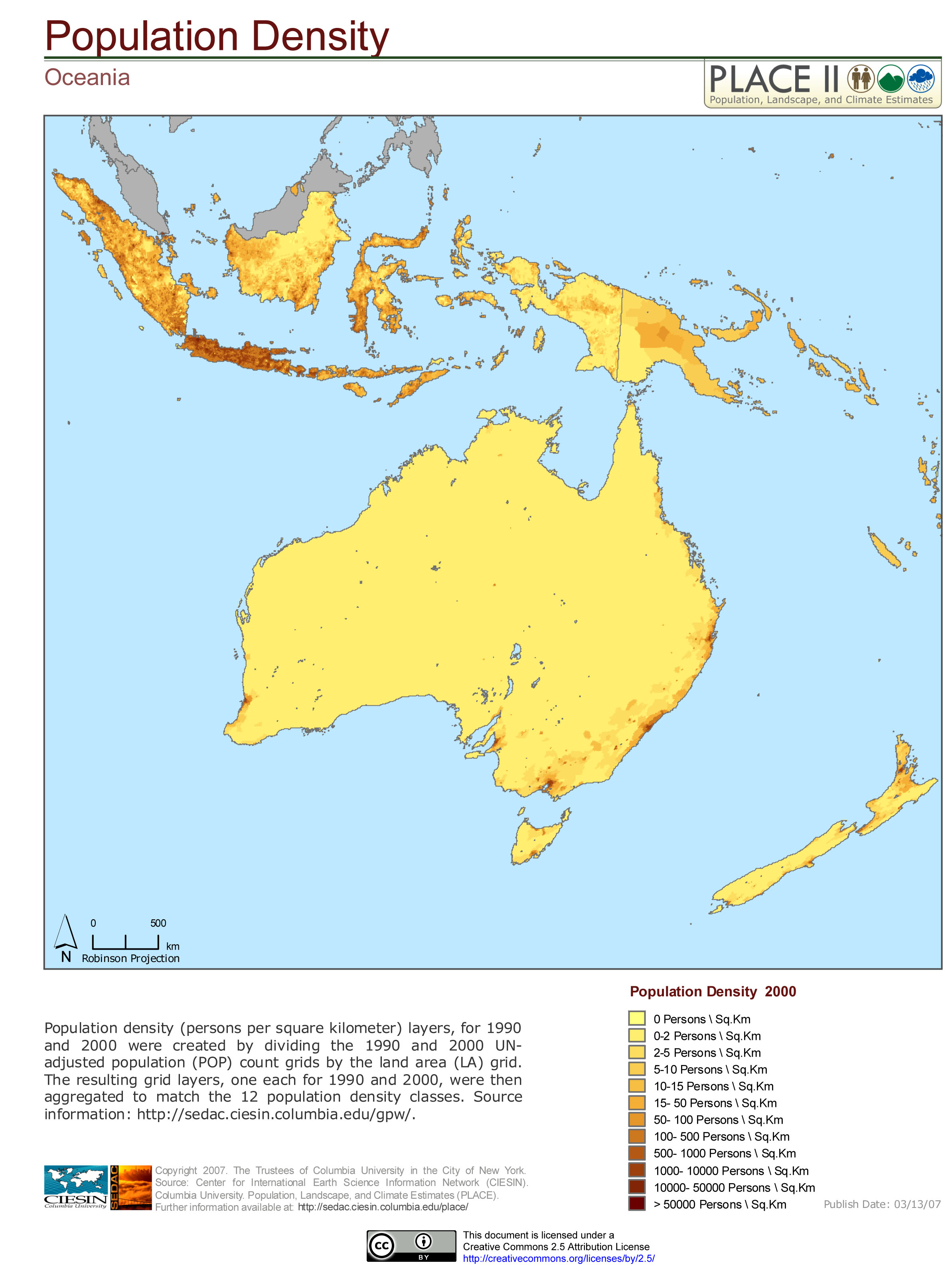
| Description | Population Density (per person per square kilometer) layers, for 1990 and 2000 were created by dividing the 1990 and 2000 UN-adjusted population (POP) count grids by the land area (LA) grid. The resulting grid layers, one each for 1990 and 2000 were then aggregated to match the 12 population density classes. Source Information: <a href="http://sedac.ciesin.columbia.edu/gpw/" rel="nofollow">sedac.ciesin.columbia.edu/gpw/</a>. |
| Date | |
| Source | Oceania: Population Density |
| Author | SEDACMaps |
Licensing edit
.jpg&action=edit§ion=2)
This file is licensed under the Creative Commons Attribution 2.0 Generic license.
- You are free:
- to share – to copy, distribute and transmit the work
- to remix – to adapt the work
- Under the following conditions:
- attribution – You must give appropriate credit, provide a link to the license, and indicate if changes were made. You may do so in any reasonable manner, but not in any way that suggests the licensor endorses you or your use.
| This image was originally posted to Flickr by SEDACMaps at https://flickr.com/photos/54545503@N04/5485515167 (archive). It was reviewed on 21 December 2019 by FlickreviewR 2 and was confirmed to be licensed under the terms of the cc-by-2.0. |
File history
Click on a date/time to view the file as it appeared at that time.
| Date/Time | Thumbnail | Dimensions | User | Comment | |
|---|---|---|---|---|---|
| current | 02:40, 21 December 2019 | | 2,386 × 3,174 (735 KB) | Ser Amantio di Nicolao (talk | contribs) | Transferred from Flickr via #flickr2commons |
You cannot overwrite this file.
File usage on Commons
There are no pages that use this file.
.jpg&oldid=564923885)