File:Oh forests.png

Size of this preview: 765 × 600 pixels. Other resolutions: 306 × 240 pixels | 612 × 480 pixels | 1,000 × 784 pixels.
Original file (1,000 × 784 pixels, file size: 1.23 MB, MIME type: image/png)
Captions
Captions
Add a one-line explanation of what this file represents
Summary edit
| Description |
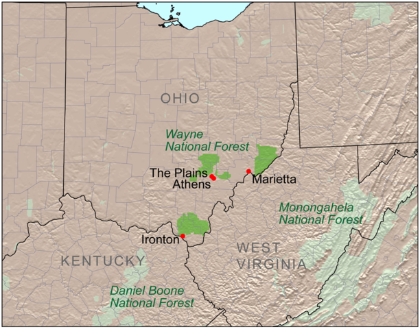
English: Map showing the location of Wayne National Forest in Ohio. Daniel Boone National Forest in Kentucky and Monongahela National Forest in West Virginia are also shown. |
| Date | |
| Source | Self-made, based on USGS data. |
| Author | Kmusser |
Licensing edit
I, the copyright holder of this work, hereby publish it under the following license:
This file is licensed under the Creative Commons Attribution-Share Alike 3.0 Unported license.
- You are free:
- to share – to copy, distribute and transmit the work
- to remix – to adapt the work
- Under the following conditions:
- attribution – You must give appropriate credit, provide a link to the license, and indicate if changes were made. You may do so in any reasonable manner, but not in any way that suggests the licensor endorses you or your use.
- share alike – If you remix, transform, or build upon the material, you must distribute your contributions under the same or compatible license as the original.
File history
Click on a date/time to view the file as it appeared at that time.
| Date/Time | Thumbnail | Dimensions | User | Comment | |
|---|---|---|---|---|---|
| current | 17:31, 21 January 2009 | | 1,000 × 784 (1.23 MB) | Kmusser (talk | contribs) | == Summary == {{Information |Description=Map showing the location of the Wayne National Forest. |Source=Self-made, based on USGS data. |Author=Kmusser |Date=January 21, 2009 |Permission= |other_v |
You cannot overwrite this file.
File usage on Commons
The following page uses this file:
File usage on other wikis
The following other wikis use this file:
- Usage on en.wikipedia.org
- Usage on en.wikivoyage.org
- Usage on es.wikipedia.org
- Usage on es.wikivoyage.org
- Usage on ml.wikipedia.org
- Usage on www.wikidata.org