File:Oil and gas yielding formations of California (1900) (14763862224).jpg
Original file(2,976 × 1,858 pixels, file size: 1.03 MB, MIME type: image/jpeg)

Captions

Captions

Add a one-line explanation of what this file represents

Summary edit

Description
English:
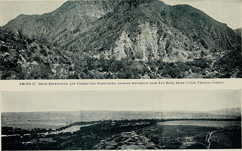
Upper: Sespe Canyon, Ventura County, CA; Lower: Kern River Oil Field, CA

Identifier: califoilgasyield00wattrich (find matches)
Title: Oil and gas yielding formations of California
Year: 1900 (1900s)
Authors: Watts, William Lord, b. 1850
Subjects: Natural gas Petroleum
Publisher: Sacramento, A.J. Johnston, superintendent State printing
Contributing Library: University of California Libraries
Digitizing Sponsor: Kahle/Austin Foundation and Omidyar Network

View Book Page: Book Viewer
About This Book: Catalog Entry
View All Images: All Images From Book
Click here to view book online to see this illustration in context in a browseable online version of this book.

Text Appearing Before Image:
ern River oil-field. CHAPTER 3. KERN RIVER OIL-DISTRICT. 7.3.1. During the past twelve months an extensive and promisingoil-field has been developed near the Kern River on the eastern side of theSan Joaquin Valley in Kern County. (See Fig. J and Photo No. 28.) It isinteresting to note that the initial developments in this field were madein a township to which attention had been drawn by the CaliforniaState Mining Bureau, on account of the evidences of petroleum thereincontained. Indeed, the outcrop of bituminous sand which led to thedrilling of the first well in the Kern River oil-field was described, andits position noted, in the Vllth Report of the California State MiningBureau, page 63, and in Bulletin No. 3 on The Oil and Gas YieldingFormations of the Central Valley of California. The Kern River oil-field, as far as it has been developed, comprisesan area of about 12 square miles, and is situated partly in T. 28 S.,R. 27 and 28 E., and partly in T. 29 S., R. 28 E., M. D. M. Within
Text Appearing After Image:
KERN RIVER OIL-DISTRICT. Ill this area in August, 1900, about 130 wells had been drilled, and many-others had been commenced. These wells are drilled in groups, andsome of the groups are nearly a mile apart. The depth of these wellsvaries from 450 to more than 1000. The formation penetrated is:First, alluvium or drift, which in few places exceeds 50 in thickness;then a stratum of blue clay from 25 to 350 thick; beneath the blueclay is a water-sand from 10 to 100 in thickness; beneath the water-sand the formation consists of alternate strata of clay and sand. Thewell records show that most of these sands contain oil, and that in someinstances they aggregate a thickness of more than 300. The recordsshown in the accompanying table give an idea of the formation pene-trated in the Kern River oil-field. TABLE OF WELL RECORDSShowing Formations Penetrated in the Kern River Oil-Field. Reed Crude Oil Co. Reed Crude Oil Co. Petroleum CenterOil Co. Independent Oil andDevelopment Co. Sec. 34, T. 2

Note About Images

Please note that these images are extracted from scanned page images that may have been digitally enhanced for readability - coloration and appearance of these illustrations may not perfectly resemble the original work.
Date
Source

https://www.flickr.com/photos/internetarchivebookimages/14763862224/

Author Watts, William Lord, b. 1850
Permission
(Reusing this file)
At the time of upload, the image license was automatically confirmed using the Flickr API. For more information see Flickr API detail.
Flickr tags
InfoField
  • bookid:califoilgasyield00wattrich
  • bookyear:1900
  • bookdecade:1900
  • bookcentury:1900
  • bookauthor:Watts__William_Lord__b__1850
  • booksubject:Natural_gas
  • booksubject:Petroleum
  • bookpublisher:Sacramento__A_J__Johnston__superintendent_State_printing
  • bookcontributor:University_of_California_Libraries
  • booksponsor:Kahle_Austin_Foundation_and_Omidyar_Network
  • bookleafnumber:144
  • bookcollection:caminesgeo
  • bookcollection:ucdavis
  • bookcollection:americana
Flickr posted date
InfoField
28 July 2014

Licensing edit

This image was taken from Flickr's The Commons. The uploading organization may have various reasons for determining that no known copyright restrictions exist, such as:
  1. The copyright is in the public domain because it has expired;
  2. The copyright was injected into the public domain for other reasons, such as failure to adhere to required formalities or conditions;
  3. The institution owns the copyright but is not interested in exercising control; or
  4. The institution has legal rights sufficient to authorize others to use the work without restrictions.

More information can be found at https://flickr.com/commons/usage/.


Please add additional copyright tags to this image if more specific information about copyright status can be determined. See Commons:Licensing for more information.
This image was originally posted to Flickr by Internet Archive Book Images at https://flickr.com/photos/126377022@N07/14763862224. It was reviewed on 5 October 2015 by FlickreviewR and was confirmed to be licensed under the terms of the No known copyright restrictions.

5 October 2015

File history

Click on a date/time to view the file as it appeared at that time.

Date/TimeThumbnailDimensionsUserComment
current06:01, 7 October 2015Thumbnail for version as of 06:01, 7 October 20152,976 × 1,858 (1.03 MB)SteinsplitterBot (talk | contribs)Bot: Image rotated by 90°
14:41, 5 October 2015Thumbnail for version as of 14:41, 5 October 20151,858 × 2,978 (1.04 MB) (talk | contribs)== {{int:filedesc}} == {{information |description={{en|1=<br> '''Identifier''': califoilgasyield00wattrich ([https://commons.wikimedia.org/w/index.php?title=Special%3ASearch&profile=default&fulltext=Search&search=insource%3A%2Fcalifoilgasyield00wattric...

There are no pages that use this file.