File:Oklahoma City Metro.svg

Size of this PNG preview of this SVG file: 800 × 399 pixels. Other resolutions: 320 × 160 pixels | 640 × 320 pixels | 1,024 × 511 pixels | 1,280 × 639 pixels | 2,560 × 1,278 pixels | 7,784 × 3,886 pixels.
Original file (SVG file, nominally 7,784 × 3,886 pixels, file size: 70 KB)
Captions
Captions
Add a one-line explanation of what this file represents
Summary edit
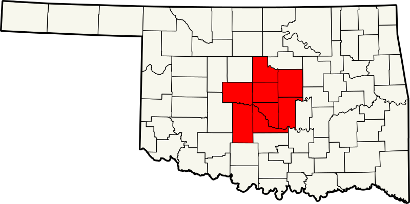
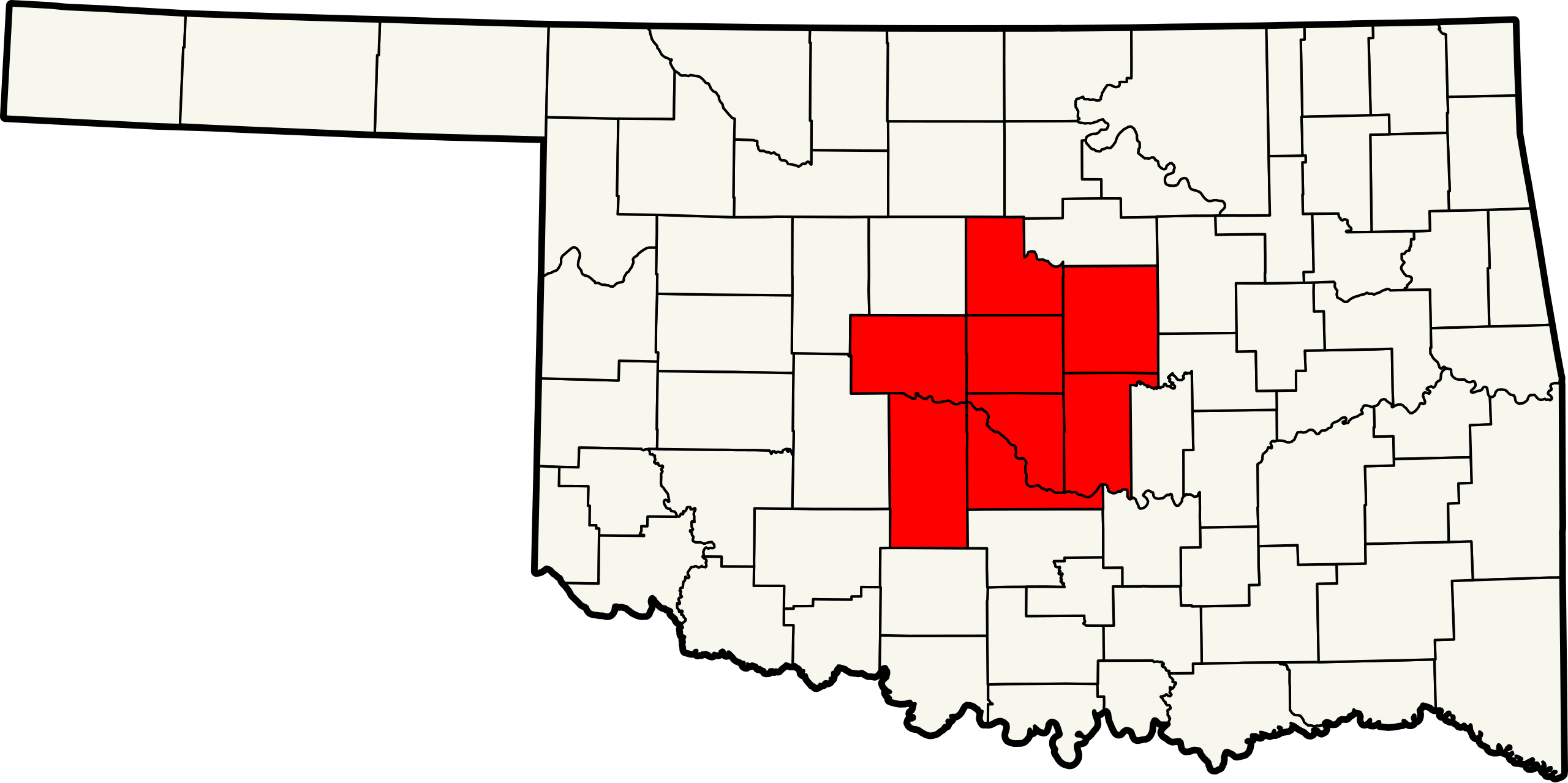
| Description | A map highlighting counties included in the Oklahoma City metropolitan area. |
| Date | |
| Source | Based on Image:Map of Oklahoma highlighting Alfalfa County.svg by David Benbennick |
| Author | Scott Nazelrod |
| Permission (Reusing this file) |
PD |
Licensing edit
| I, the copyright holder of this work, release this work into the public domain. This applies worldwide. In some countries this may not be legally possible; if so: I grant anyone the right to use this work for any purpose, without any conditions, unless such conditions are required by law. |
File history
Click on a date/time to view the file as it appeared at that time.
| Date/Time | Thumbnail | Dimensions | User | Comment | |
|---|---|---|---|---|---|
| current | 09:48, 26 October 2013 | | 7,784 × 3,886 (70 KB) | Scott5114 (talk | contribs) | better crop |
| 06:09, 13 August 2007 |  | 7,730 × 3,832 (106 KB) | Scott5114 (talk | contribs) | {{Information |Description=A map highlighting counties included in the Oklahoma City metropolitan area. |Source=Based on Image:Map of Oklahoma highlighting Alfalfa County.svg by User:David Benbennick |Date=2007-08-13 |Author=[[User:Scott |
You cannot overwrite this file.
File usage on Commons
There are no pages that use this file.