File:Olivine-bearing anthill sediments (Black Rock, Leucite Hills, Wyoming, USA) 1 (48983366743).jpg
Original file (4,000 × 3,000 pixels, file size: 9.31 MB, MIME type: image/jpeg)
Captions
Captions
Summary edit
_1_(48983366743).jpg&action=edit§ion=1)
| Description |
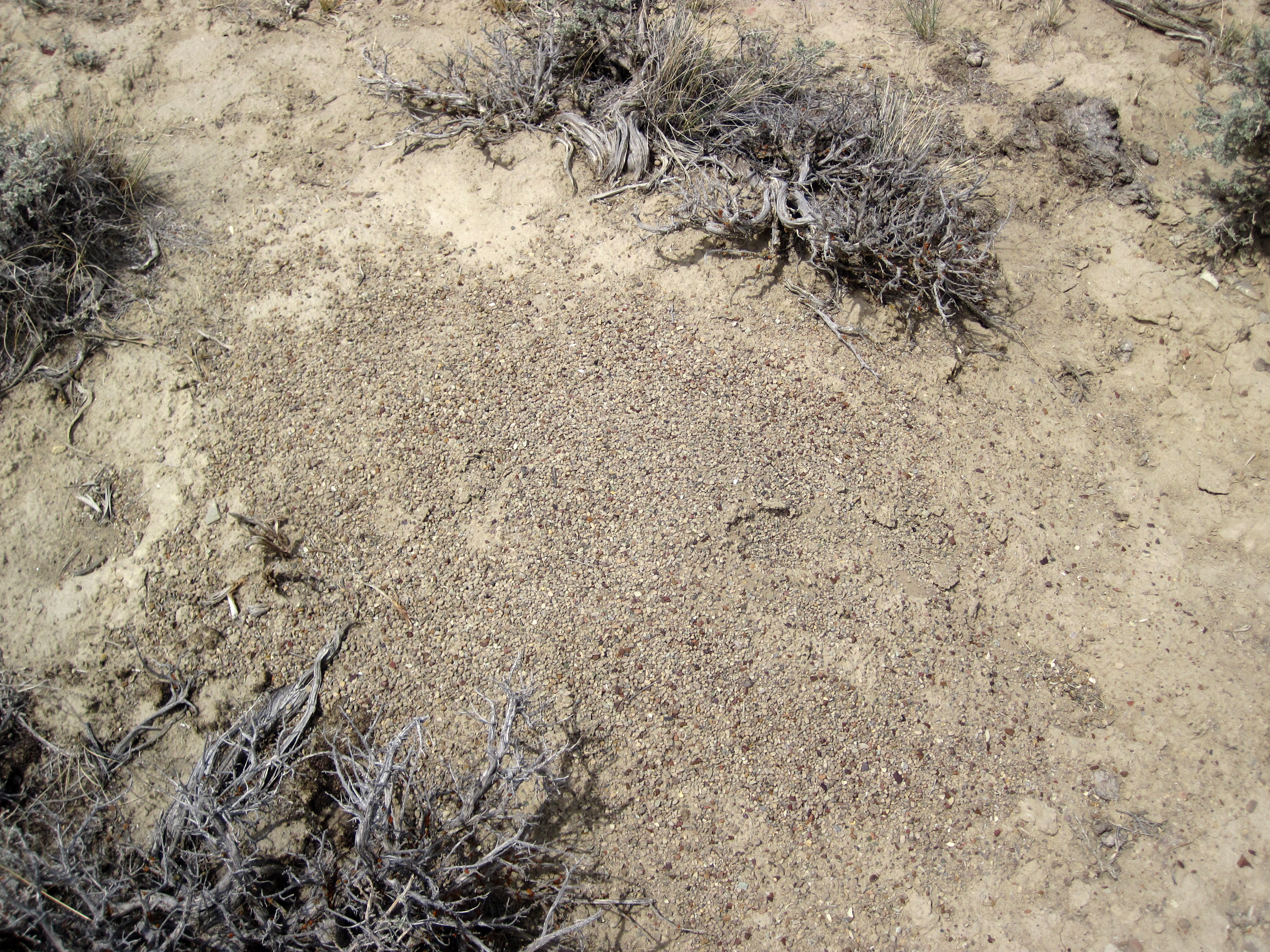
Southwestern Wyoming's Leucite Hills are a group of Pliocene to Pleistocene volcanic centers that erupted lamproite lavas, a rare extrusive igneous lithology. Based on chemistry and mineral content, the Leucite Hills lamproite lavas have been categorized as wyomingite, orendite, or madupite. Seen here is an anthill composed of loose sediments (principally granules) derived from orendite lamproite lava at Black Rock, a volcanic center in the eastern Leucite Hills. Orendite is a diopside-sanidine-phlogopite lamproite having leucite, diopside pyroxene, phlogopite mica, sanidine, plus minor hornblende amphibole and rutile. Lavas at Black Rock include orendites and olivine orendites, the latter having noticeable to subtle, scattered olivine xenocrysts. Either lithology may be non-vesicular or vesicular (with fairly small vesicles) or pumiceous. Black Rock orendites have had their groundmass leucite partially altered to analcime. Sedimentary xenoliths of varying sizes are fairly common. Small, dark red objects are often seen - most are non-vitreous in luster and resemble jasper, while some are vitreous - I suspect they are all garnet xenocrysts (?). Chemical analysis has shown that orendite is mafic (50 to 56 wt.% silica), magnesian (1.2 Ga (the latter event may have been caused by Precambrian subduction along the Wyoming Craton margin). Volcanism in the Leucite Hills may possibly be due to mantle melting by the subsurface fringe areas of the Yellowstone Hotspot track. Anthills at Black Rock are relatively concentrated with green olivine ("peridot"). The ants will react when olivine is plucked from these structures. Age: Pleistocene, 1.30 to 1.37 Ma Locality: northern slopes of Black Rock, eastern Leucite Hills Volcanic Province, Great Divide Basin, northeast of the town of Superior, southwestern Wyoming, USA (41° 52' 26.02" North, 108° 47' 41.13" West) Example references on Leucite Hills geology: Lange, R.A., I.S.E. Carmichael & C.M. Hall. 2000. 40Ar/39Ar chronology of the Leucite Hills, Wyoming: eruption rates, erosion rates, and an evolving temperature structure of the underlying mantle. Earth and Planetary Science Letters 174: 329-340. Schultz, A.R. & W. Cross. 1912. Potash-bearing rocks of the Leucite Hills, Sweetwater County, Wyoming. United States Geological Survey Bulletin 512. 39 pp. |
| Date | |
| Source | Olivine-bearing anthill sediments (Black Rock, Leucite Hills, Wyoming, USA) 1 |
| Author | James St. John |
Licensing edit
_1_(48983366743).jpg&action=edit§ion=2)
- You are free:
- to share – to copy, distribute and transmit the work
- to remix – to adapt the work
- Under the following conditions:
- attribution – You must give appropriate credit, provide a link to the license, and indicate if changes were made. You may do so in any reasonable manner, but not in any way that suggests the licensor endorses you or your use.
| This image was originally posted to Flickr by James St. John at https://flickr.com/photos/47445767@N05/48983366743 (archive). It was reviewed on 7 November 2019 by FlickreviewR 2 and was confirmed to be licensed under the terms of the cc-by-2.0. |
File history
Click on a date/time to view the file as it appeared at that time.
| Date/Time | Thumbnail | Dimensions | User | Comment | |
|---|---|---|---|---|---|
| current | 03:37, 7 November 2019 | | 4,000 × 3,000 (9.31 MB) | Ser Amantio di Nicolao (talk | contribs) | Transferred from Flickr via #flickr2commons |
You cannot overwrite this file.
File usage on Commons
There are no pages that use this file.
_1_(48983366743).jpg&oldid=657961464)