File:OpenRailwayMap North America OSI yard complex.png
Size of this preview: 800 × 288 pixels. Other resolutions: 320 × 115 pixels | 1,000 × 360 pixels.
Original file (1,000 × 360 pixels, file size: 16 KB, MIME type: image/png)
Captions
Captions
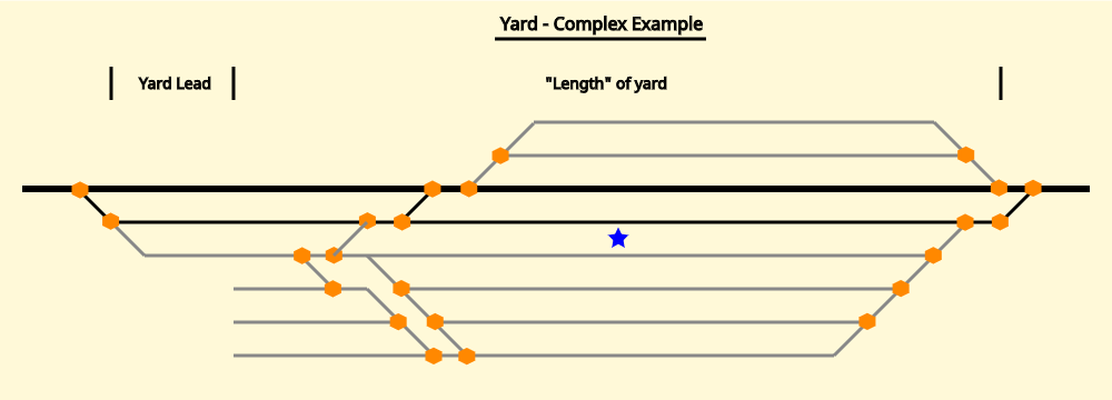
Illustration of a complex yard, with correct placement of the operating site node.
Summary
edit
| Description |
English: Railway yard illustration for use on an OpenStreetMap wiki page, intended to eventually end up on: OpenRailwayMap/Tagging in North America/Operating Sites and Interlockings |
| Date | |
| Source | Own work |
| Author | Chuck Sanders |
Licensing
edit
I, the copyright holder of this work, hereby publish it under the following license:
This file is licensed under the Creative Commons Attribution-Share Alike 4.0 International license.
- You are free:
- to share – to copy, distribute and transmit the work
- to remix – to adapt the work
- Under the following conditions:
- attribution – You must give appropriate credit, provide a link to the license, and indicate if changes were made. You may do so in any reasonable manner, but not in any way that suggests the licensor endorses you or your use.
- share alike – If you remix, transform, or build upon the material, you must distribute your contributions under the same or compatible license as the original.
File history
Click on a date/time to view the file as it appeared at that time.
| Date/Time | Thumbnail | Dimensions | User | Comment | |
|---|---|---|---|---|---|
| current | 00:41, 9 July 2020 | 1,000 × 360 (16 KB) | Nathhad (talk | contribs) | Uploaded own work with UploadWizard |
You cannot overwrite this file.
File usage on Commons
The following page uses this file: