File:OpenSeaMap Kiel Fjord.png

Size of this preview: 800 × 506 pixels. Other resolutions: 320 × 202 pixels | 640 × 405 pixels | 862 × 545 pixels.
Original file (862 × 545 pixels, file size: 410 KB, MIME type: image/png)
Captions
Captions
Add a one-line explanation of what this file represents
Summary edit
| Description |
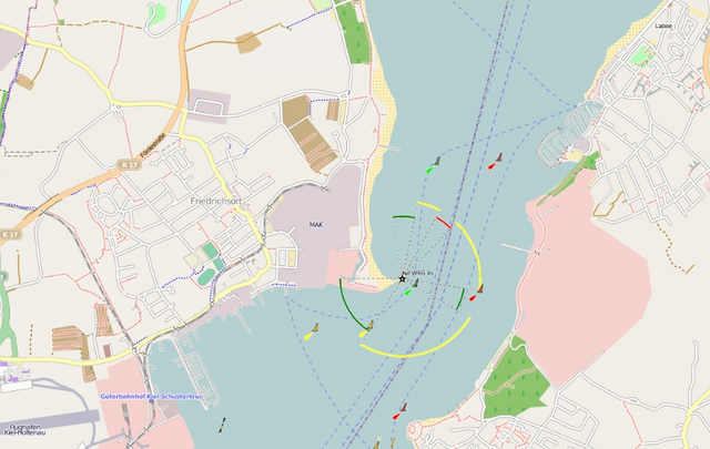
English: OpenSeaMap - nautical chart of Kiel Fjord (Germany) from Laboe to Mole Stickenhörn.
Deutsch: OpenSeaMap - Kartenausschnitt Kieler Förde: Laboe, Leuchtfeuer Friedrichsort, Sportboothafen Stickenhörn |
| Date | circa 2009 |
| Source | OpenSeaMap |
| Author | Mitarbeiter des Projekts. |
| Permission (Reusing this file) |
CC-BY-SA-2.0. |
Licensing edit
This file is licensed under the Creative Commons Attribution-Share Alike 2.0 Generic license.
- You are free:
- to share – to copy, distribute and transmit the work
- to remix – to adapt the work
- Under the following conditions:
- attribution – You must give appropriate credit, provide a link to the license, and indicate if changes were made. You may do so in any reasonable manner, but not in any way that suggests the licensor endorses you or your use.
- share alike – If you remix, transform, or build upon the material, you must distribute your contributions under the same or compatible license as the original.
File history
Click on a date/time to view the file as it appeared at that time.
| Date/Time | Thumbnail | Dimensions | User | Comment | |
|---|---|---|---|---|---|
| current | 10:02, 21 June 2009 | | 862 × 545 (410 KB) | Mattes (talk | contribs) | other file |
| 09:58, 21 June 2009 |  | 400 × 400 (147 KB) | Mattes (talk | contribs) | {{Information |Description= {{en|OpenSeaMap - nautical chart of Kiel Fjord (Germany) from Laboe to Mole Stickenhörn.}} {{de|OpenSeaMap - Kartenausschnitt Kieler Förde: Laboe, Leuchtfeuer Friedrichsort, Sportboothafen Stickenhörn}} |Source=[http://www.o |
You cannot overwrite this file.
File usage on Commons
The following page uses this file:
File usage on other wikis
The following other wikis use this file:
- Usage on da.wikipedia.org
- Usage on en.wikipedia.org
- Usage on hr.wikipedia.org
- Usage on lv.wikipedia.org
- Usage on mk.wikipedia.org
- Usage on nl.wikipedia.org
- Usage on no.wikipedia.org