File:Ordnance Survey Drawings - Hatfield (OSD 149).jpg

Size of this preview: 457 × 600 pixels. Other resolutions: 183 × 240 pixels | 366 × 480 pixels | 585 × 768 pixels | 780 × 1,024 pixels | 1,560 × 2,048 pixels | 3,048 × 4,000 pixels.
Original file (3,048 × 4,000 pixels, file size: 4.92 MB, MIME type: image/jpeg)
Captions
Captions
Add a one-line explanation of what this file represents
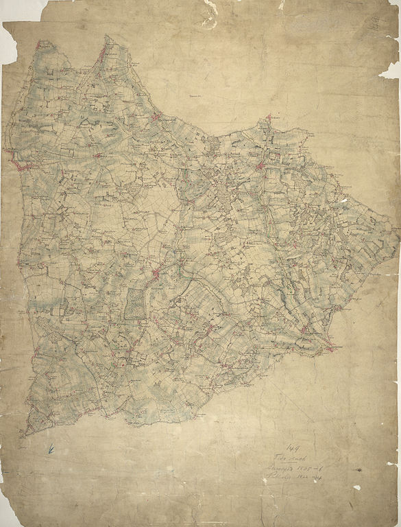
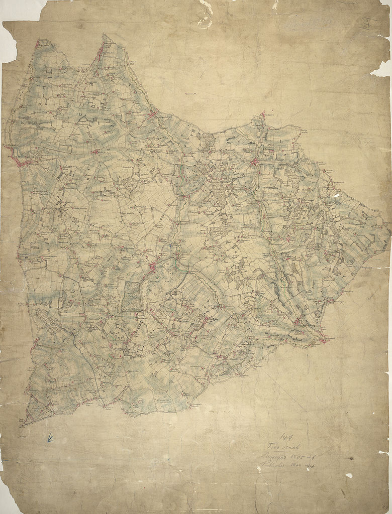
| Hatfield (OSD 149)
|
|||||
|---|---|---|---|---|---|
| Artist |
Hyett, William - Draughtsman |
.jpg) | |||
| Title |
Ordnance Survey Drawings: Hatfield (OSD 149) |
||||
| Object type |
manuscript map |
||||
| Description |
 Centre of map shown on a map of England
English: This map is not drawn with north at the top. Potters Bar appears at the bottom left, almost on a level with Hertford at the bottom right. The remains of the Old Royal Palace of Hatfield are shown near the centre of the map. This was the home of Elizabeth I (1533-1603) prior to her accession to the throne. Also featured is Hatfield, the house built in 1611 by the first Earl of Salisbury, Robert Cecil (1563-1612). A poorhouse is marked just outside the town..
This image has been georeferenced.
|
||||
| Language |
English |
||||
| Date | 1805 | ||||
| Medium | Pencil and ink on paper | ||||
| Dimensions | height: 360 mm (14.17 in); width: 280 mm (11.02 in) | ||||
| Collection | |||||
| Accession number |
Maps OSD 149 |
||||
| Credit line | British Library | ||||
| Notes |
Scale 2 inches : 1 mile (1:31680). Please note that the British Library provides these digital files "as-is"; materials will not be rephotographed under this programme. If resupply of files is required, the requestor will be required to purchase them at the standard rate. |
||||
| References |
http://www.bl.uk/onlinegallery/onlineex/ordsurvdraw/h/002osd000000009u00101000.html (English) |
||||
| Source/Photographer |
|
||||
| Permission (Reusing this file) |
|
||||


_(St_Edwards_Crown).svg)
.jpg¶ms=51.779684_N_-0.194414_E_)
.jpg¶ms=51.629932_N_-0.438649_E_)
.jpg¶ms=51.929437_N_0.049821_E_)
.jpg¶ms=51.800025_N_-0.438649_E_)
.jpg¶ms=51.629932_N_-0.16229_E_)
.jpg¶ms=51.759344_N_0.049821_E_)
.jpg¶ms=51.929437_N_-0.226538_E_)
File history
Click on a date/time to view the file as it appeared at that time.
| Date/Time | Thumbnail | Dimensions | User | Comment | |
|---|---|---|---|---|---|
| current | 23:41, 25 September 2013 | | 3,048 × 4,000 (4.92 MB) | LibraryBot (talk | contribs) | {{subst:User:Andrew Gray/OSD|ID= 002OSD000000009U00101000 |OSD_NUM= OSD 149 |MEDIUM= Pencil and ink on paper |TITLE= Hatfield |CREATOR= Hyett, William - Draughtsman |YEAR= 1805 |DESCRIPTION= This map is not drawn with north at the top. Potters Bar app... |
You cannot overwrite this file.
File usage on Commons
The following page uses this file:
File usage on other wikis
The following other wikis use this file:
- Usage on www.wikidata.org
.jpg&oldid=713430849)