File:Oronce Fine 1531.jpg

Size of this preview: 800 × 594 pixels. Other resolutions: 320 × 237 pixels | 640 × 475 pixels | 1,024 × 760 pixels | 1,280 × 950 pixels | 2,000 × 1,484 pixels.
Original file (2,000 × 1,484 pixels, file size: 1.31 MB, MIME type: image/jpeg)
Captions
Captions
Add a one-line explanation of what this file represents
| Description |
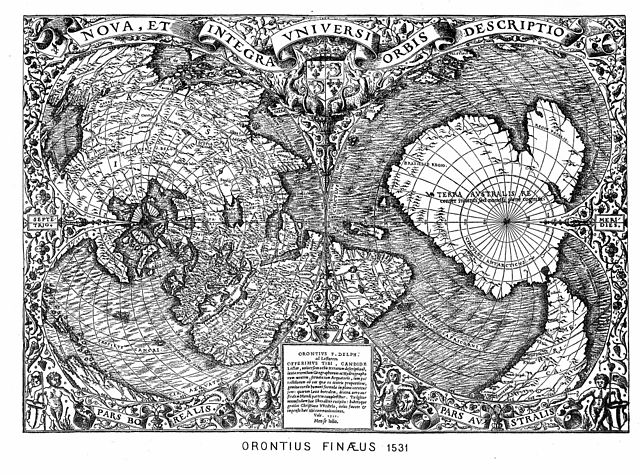
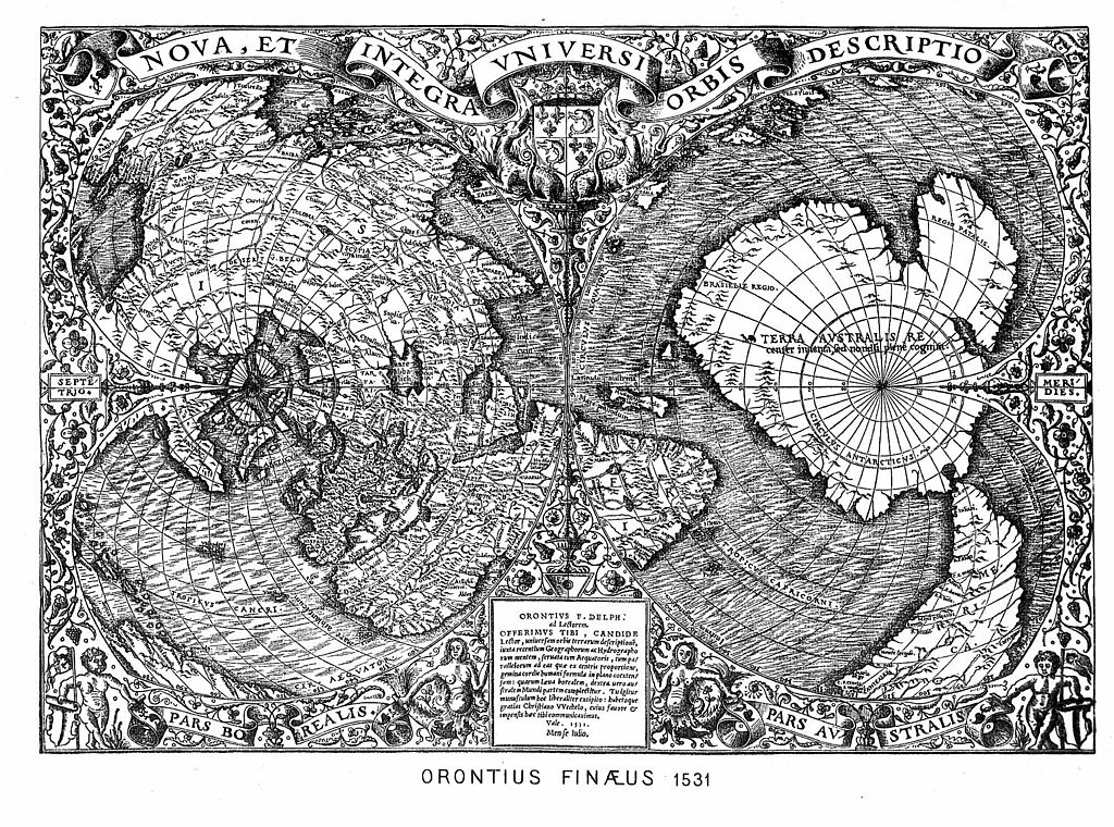
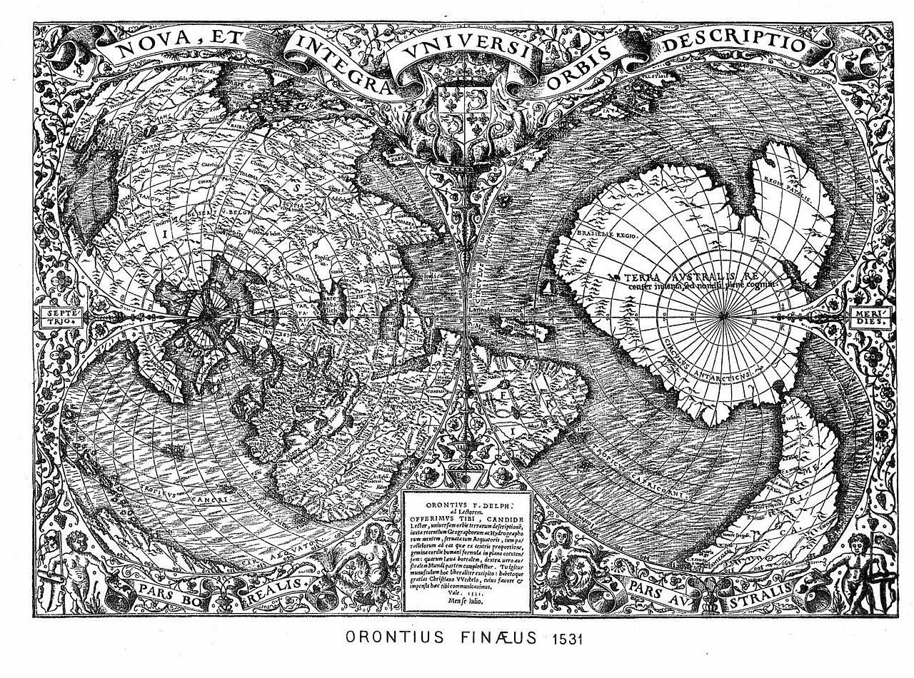
English: 1531 world map by the French Oronce Fine, in double cordiform projection. |
||||||||||||||||||||||||||
| Date | |||||||||||||||||||||||||||
| Source |
|
||||||||||||||||||||||||||
| Author |
|
||||||||||||||||||||||||||
| Attribution (required by the license) | http://en.wikipedia.org/wiki/User%3APortolanero / Wikimedia Commons / | ||||||||||||||||||||||||||

File history
Click on a date/time to view the file as it appeared at that time.
| Date/Time | Thumbnail | Dimensions | User | Comment | |
|---|---|---|---|---|---|
| current | 11:12, 14 December 2011 | | 2,000 × 1,484 (1.31 MB) | Portolanero (talk | contribs) | {{Information |Description={{en|1=The famous and extraordinary 1531 world map by the French scientist Oronce Fine. It is the first(?) Greenland as an island and the most detailed Antarctica. }} | Source = {{PD-old-100}} | Author = Oronce Fi |
You cannot overwrite this file.
File usage on Commons
There are no pages that use this file.
File usage on other wikis
The following other wikis use this file:
- Usage on ca.wikipedia.org
- Usage on de.wikipedia.org
- Usage on nl.wikipedia.org