File:Osmanu-vilajeti-misir.svg
Original file(SVG file, nominally 600 × 400 pixels, file size: 110 KB)

Captions

Captions

Add a one-line explanation of what this file represents

Summary edit

Kopsavilkums edit

Description
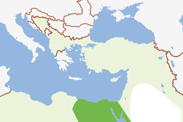
English: Location of Misir (Egypt, under British occupation) in the Ottoman Empire (1900)
Latviešu: Lielbritānijas okupētā Ēģipte Osmaņu impērijas teritorijā (1900)
Date
Source Own work
Author Juris Tiltins
SVG development
InfoField
 
The SVG code is valid.
 
This map was created with Adobe Illustrator.

Licensing edit

Public domain I, the copyright holder of this work, release this work into the public domain. This applies worldwide.
In some countries this may not be legally possible; if so:
I grant anyone the right to use this work for any purpose, without any conditions, unless such conditions are required by law.

File history

Click on a date/time to view the file as it appeared at that time.

Date/TimeThumbnailDimensionsUserComment
current10:42, 29 June 2008Thumbnail for version as of 10:42, 29 June 2008600 × 400 (110 KB)Juristiltins (talk | contribs){{Information |Description={{en|1=Location of Misir (Egypt, under British occupation) in the Ottoman Empire (1900)}} {{lv|1=Lielbritānijas okupētā Ēģipte Osmaņu impērijas teritorijā (1900)}} |Source=Own work |Author=Juris Tiltins |Date=29 June 200

There are no pages that use this file.

File usage on other wikis

The following other wikis use this file: