File:Ostplate Spiekeroogs 09.jpg

Size of this preview: 800 × 533 pixels. Other resolutions: 320 × 213 pixels | 640 × 427 pixels | 1,024 × 683 pixels | 1,280 × 853 pixels | 2,560 × 1,707 pixels | 5,426 × 3,617 pixels.
Original file (5,426 × 3,617 pixels, file size: 13.28 MB, MIME type: image/jpeg)
Captions
Captions
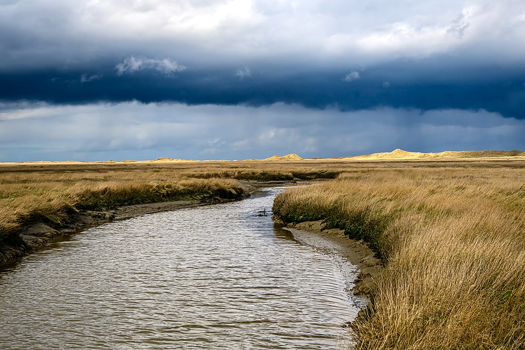
Saltmarsh in the east of Spiekeroog
Summary edit
| Description |
Deutsch: Die Ostplate Spiekeroogs ist ein Beispiel für eine weitgehend unberührte Naturlandschaft. Die Landschaft dort hat sich durch natürliche Sukzession ausgebildet: Im Norden zieht sich entlang des Strandes eine Dünenkette, südlich davon findet man große, von Prielen durchzogene, Salzwiesen, die in das Watt übergehen.
Das Bild wurde während einer amtlichen Brutvogelerfassung aufgenommen, das betreten der Ostplate, die zur Ruhezone des Nationalparks Niedersächsisches Wattenmeer gehört, ist außerhalb der gekennzeichneten Wege streng verboten! |
| Date | |
| Source | Own work |
| Author | Stephan Sprinz |
| Camera location | | View this and other nearby images on: OpenStreetMap |
|---|
Licensing edit
I, the copyright holder of this work, hereby publish it under the following license:
This file is licensed under the Creative Commons Attribution 4.0 International license.
- You are free:
- to share – to copy, distribute and transmit the work
- to remix – to adapt the work
- Under the following conditions:
- attribution – You must give appropriate credit, provide a link to the license, and indicate if changes were made. You may do so in any reasonable manner, but not in any way that suggests the licensor endorses you or your use.
This image was uploaded as part of Wiki Loves Earth 2023.
|
 |

|
This image won the 5th prize in the national contest of Germany in Wiki Loves Earth 2023 Other languages:
|
File history
Click on a date/time to view the file as it appeared at that time.
| Date/Time | Thumbnail | Dimensions | User | Comment | |
|---|---|---|---|---|---|
| current | 08:27, 2 May 2023 | | 5,426 × 3,617 (13.28 MB) | Stephan Sprinz (talk | contribs) | Uploaded own work with UploadWizard |
You cannot overwrite this file.
File usage on Commons
The following 4 pages use this file:
File usage on other wikis
The following other wikis use this file:
- Usage on de.wikipedia.org