File:Ostseegliederung.png

Size of this preview: 502 × 599 pixels. Other resolutions: 201 × 240 pixels | 402 × 480 pixels | 871 × 1,039 pixels.
Original file (871 × 1,039 pixels, file size: 80 KB, MIME type: image/png)
Captions
Captions
Add a one-line explanation of what this file represents
Summary edit
| Description |
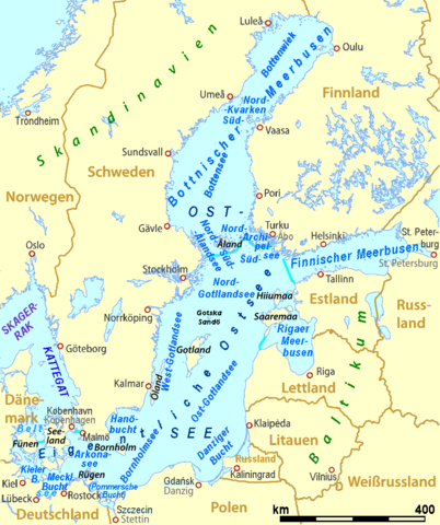
Deutsch: offizielle Einteilung der Ostsee
English: divisions of the Baltic Sea |
| Date | |
| Source | Own work, derivative work of Baltic Sea location map.svg and Übersichtskarte_Ostsee.svg (by User:NordNordWest) |
| Author | Ulamm |
| Other versions | File:Übersichtskarte_Ostsee.svg |
Sources of information edit
- Swedish Meteorological and Hydrological Institute: The Baltic Sea, Kattegat and Skagerak – sea areas and drainage basins archive copy at the Wayback Machine
Licensing edit
I, the copyright holder of this work, hereby publish it under the following licenses:

|
Permission is granted to copy, distribute and/or modify this document under the terms of the GNU Free Documentation License, Version 1.2 or any later version published by the Free Software Foundation; with no Invariant Sections, no Front-Cover Texts, and no Back-Cover Texts. A copy of the license is included in the section entitled GNU Free Documentation License. |
This file is licensed under the Creative Commons Attribution-Share Alike 3.0 Unported license.
- You are free:
- to share – to copy, distribute and transmit the work
- to remix – to adapt the work
- Under the following conditions:
- attribution – You must give appropriate credit, provide a link to the license, and indicate if changes were made. You may do so in any reasonable manner, but not in any way that suggests the licensor endorses you or your use.
- share alike – If you remix, transform, or build upon the material, you must distribute your contributions under the same or compatible license as the original.
You may select the license of your choice.
File history
Click on a date/time to view the file as it appeared at that time.
| Date/Time | Thumbnail | Dimensions | User | Comment | |
|---|---|---|---|---|---|
| current | 11:13, 28 April 2014 | | 871 × 1,039 (80 KB) | Ulamm (talk | contribs) | limits of Baltic Propper; layout |
| 12:57, 20 April 2014 |  | 871 × 1,039 (80 KB) | Ulamm (talk | contribs) | Skagerrak | |
| 16:15, 19 April 2014 |  | 871 × 1,039 (81 KB) | Ulamm (talk | contribs) | Rigaer Meerbusen | |
| 08:41, 19 April 2014 |  | 871 × 1,039 (81 KB) | Ulamm (talk | contribs) | one more section | |
| 23:03, 18 April 2014 |  | 871 × 1,039 (80 KB) | Ulamm (talk | contribs) | scale | |
| 22:45, 18 April 2014 |  | 871 × 1,039 (80 KB) | Ulamm (talk | contribs) | layout | |
| 22:35, 18 April 2014 |  | 871 × 1,039 (81 KB) | Ulamm (talk | contribs) | == {{int:filedesc}} == {{Information |Description= {{de|offizielle Einteilung der Ostsee}} {{en|divisions of the Baltic Sea}} |Source={{Own}}, derivative work of file:Baltic Sea location map.svg and [[:File:Über... |
You cannot overwrite this file.
File usage on Commons
There are no pages that use this file.
File usage on other wikis
The following other wikis use this file:
- Usage on de.wikipedia.org
- Usage on de.wikibooks.org
- Usage on de.wikiversity.org
- Usage on de.wiktionary.org