File:Pöggstall - Filialkirche St. Anna.JPG
Size of this preview: 800 × 533 pixels. Other resolutions: 320 × 213 pixels | 640 × 427 pixels | 1,024 × 683 pixels | 1,280 × 853 pixels | 2,560 × 1,706 pixels | 4,724 × 3,149 pixels.
Original file (4,724 × 3,149 pixels, file size: 12.36 MB, MIME type: image/jpeg)
Captions
Captions
Add a one-line explanation of what this file represents
Summary edit
| Description |
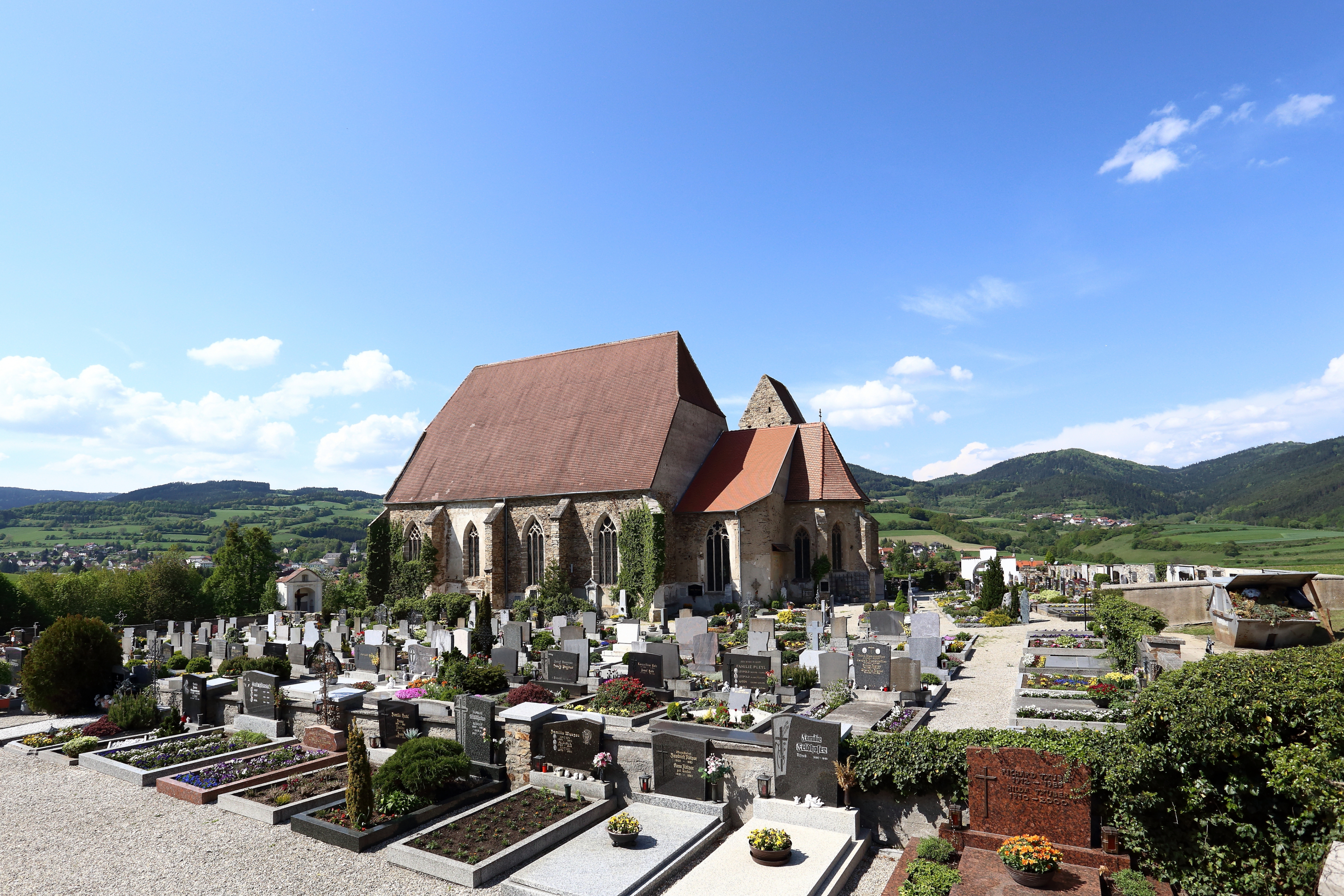
Deutsch: Katholische Filialkirche hl. Anna im Felde in der niederösterreichischen Marktgemeinde Pöggstall.
Die Kirche steht außerhalb des Marktes auf einer vom Weitenbach umflossenen Anhöhe und ist von einem Friedhof mit Umfassungsmauer umgeben. Sie ist der Nachfolgebau einer vom Stift Kremsmünster gegründeten und um 1140 geweihten Kirche. Die spätgotische Hallenkirche mit steilem Dach hat einen hochgotischen Chor und einen spätgotischen Nordturm. Nachdem Pöggstall 1330 eine eigenständige Pfarre wurde, erhielt die Kirche den Status Pfarrkirche und war vorher eine Filiale von Weiten. 1810 wurde die Schlosskirche in Pöggstall zur Pfarrkirche erhoben und die St.-Anna-Kirche wurde ausgeräumt und dem Verfall preisgegeben. Nach umfangreichen Instandsetzungsarbeiten ab 1953 präsentiert sich St. Anna im Felde wieder als würdiges Gotteshaus: [1]. English: South-southeast view of the Saint Anne Church in Pöggstall, Lower Austria.
|
| Date | |
| Source | Own work |
| Author | C.Stadler/Bwag |
| Permission (Reusing this file) |
Deutsch: Hallo, du darfst mein Foto kostenlos nutzen, aber nenne mich bitte als Fotograf, beispielsweise „Foto: C.Stadler/Bwag“ oder © C.Stadler/Bwag; CC-BY-SA-4.0. Auf mehr Angaben bestehe ich nicht - im Gegensatz zu manch anderen, die die Vorgaben der unten angeführten Lizenzierung auf Punkt und Beistrich einfordern. English: Feel free to use my photos, but please mention me as the author like © C.Stadler/Bwag or © C.Stadler/Bwag; CC-BY-SA-4.0 (that's good enough) and if you want send me a message: bwag@gmx.net. |
| Other versions |
|
.JPG)

| Camera location | | View this and other nearby images on: OpenStreetMap |
|---|
| Object location | | View this and other nearby images on: OpenStreetMap |
|---|
Licensing edit
This file is licensed under the Creative Commons Attribution 3.0 Unported license.
- You are free:
- to share – to copy, distribute and transmit the work
- to remix – to adapt the work
- Under the following conditions:
- attribution – You must give appropriate credit, provide a link to the license, and indicate if changes were made. You may do so in any reasonable manner, but not in any way that suggests the licensor endorses you or your use.
File history
Click on a date/time to view the file as it appeared at that time.
| Date/Time | Thumbnail | Dimensions | User | Comment | |
|---|---|---|---|---|---|
| current | 10:24, 12 May 2013 | | 4,724 × 3,149 (12.36 MB) | Bwag (talk | contribs) | {{Information |Description= {{de|1= Katholische Pfarrkirche Mariae Himmelfahrt in Neukirchen am Ostrong, ein Ortsteil der niederösterreichischen Marktgemeinde Pöggstall.}} {{Denkmalgeschütztes Objekt Österreich|1= 55416}} |Sourc... |
You cannot overwrite this file.
File usage on Commons
The following page uses this file:
File usage on other wikis
The following other wikis use this file: