File:Pętla Żerań Wschodni (schemat).png
Size of this preview: 800 × 516 pixels. Other resolutions: 320 × 206 pixels | 640 × 413 pixels | 934 × 602 pixels.
Original file (934 × 602 pixels, file size: 82 KB, MIME type: image/png)
Captions
Captions
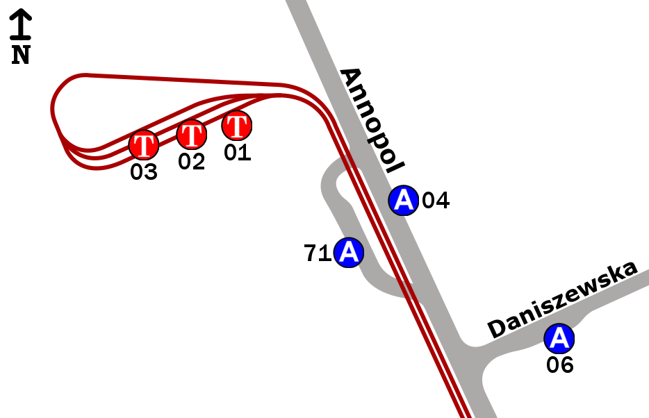
Diagram of the location of the stops in the "Żerań Wschodni" junction.
Summary edit
.png&action=edit§ion=1)
| Description |
Polski: Schemat rozmieszczenia przystanków w zespole przystankowym „Żerań Wschodni” w Warszawie.
English: Diagram of the location of the stops in the "Żerań Wschodni" junction in Warsaw. |
| Date | |
| Source | Own work |
| Author | Adam Klocusky |
Licensing edit
.png&action=edit§ion=2)
I, the copyright holder of this work, hereby publish it under the following license:
This file is licensed under the Creative Commons Attribution-Share Alike 4.0 International license.
- You are free:
- to share – to copy, distribute and transmit the work
- to remix – to adapt the work
- Under the following conditions:
- attribution – You must give appropriate credit, provide a link to the license, and indicate if changes were made. You may do so in any reasonable manner, but not in any way that suggests the licensor endorses you or your use.
- share alike – If you remix, transform, or build upon the material, you must distribute your contributions under the same or compatible license as the original.
File history
Click on a date/time to view the file as it appeared at that time.
| Date/Time | Thumbnail | Dimensions | User | Comment | |
|---|---|---|---|---|---|
| current | 10:41, 19 May 2023 | | 934 × 602 (82 KB) | Adam Klocusky (talk | contribs) | Dodanie |
| 22:14, 13 June 2022 |  | 934 × 602 (84 KB) | Adam Klocusky (talk | contribs) | Uploaded own work with UploadWizard |
You cannot overwrite this file.
File usage on Commons
The following 5 pages use this file:
File usage on other wikis
The following other wikis use this file:
- Usage on pl.wikipedia.org
.png&oldid=765053512)