File:PIA21458 - Scars of Erosion.jpg

Original file (2,880 × 1,800 pixels, file size: 478 KB, MIME type: image/jpeg)
Captions
Captions
Summary edit
| Description |
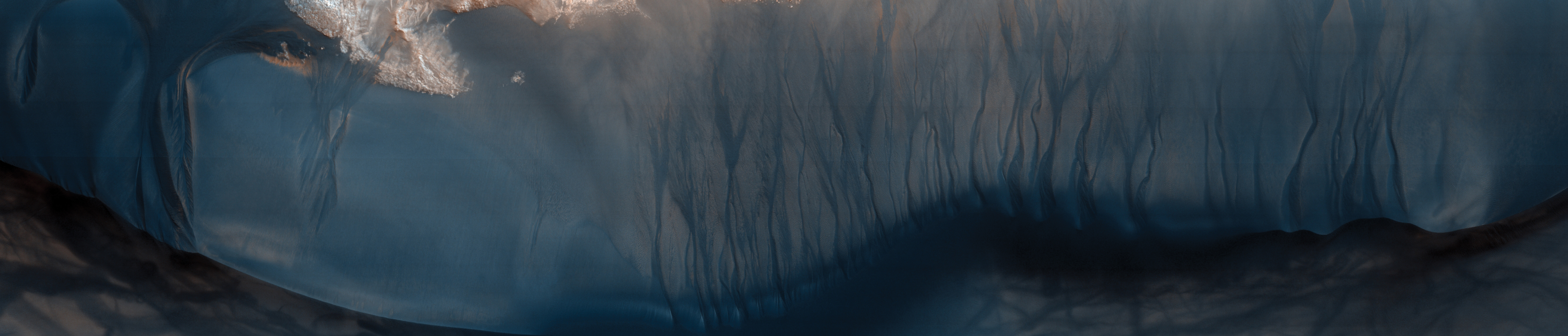
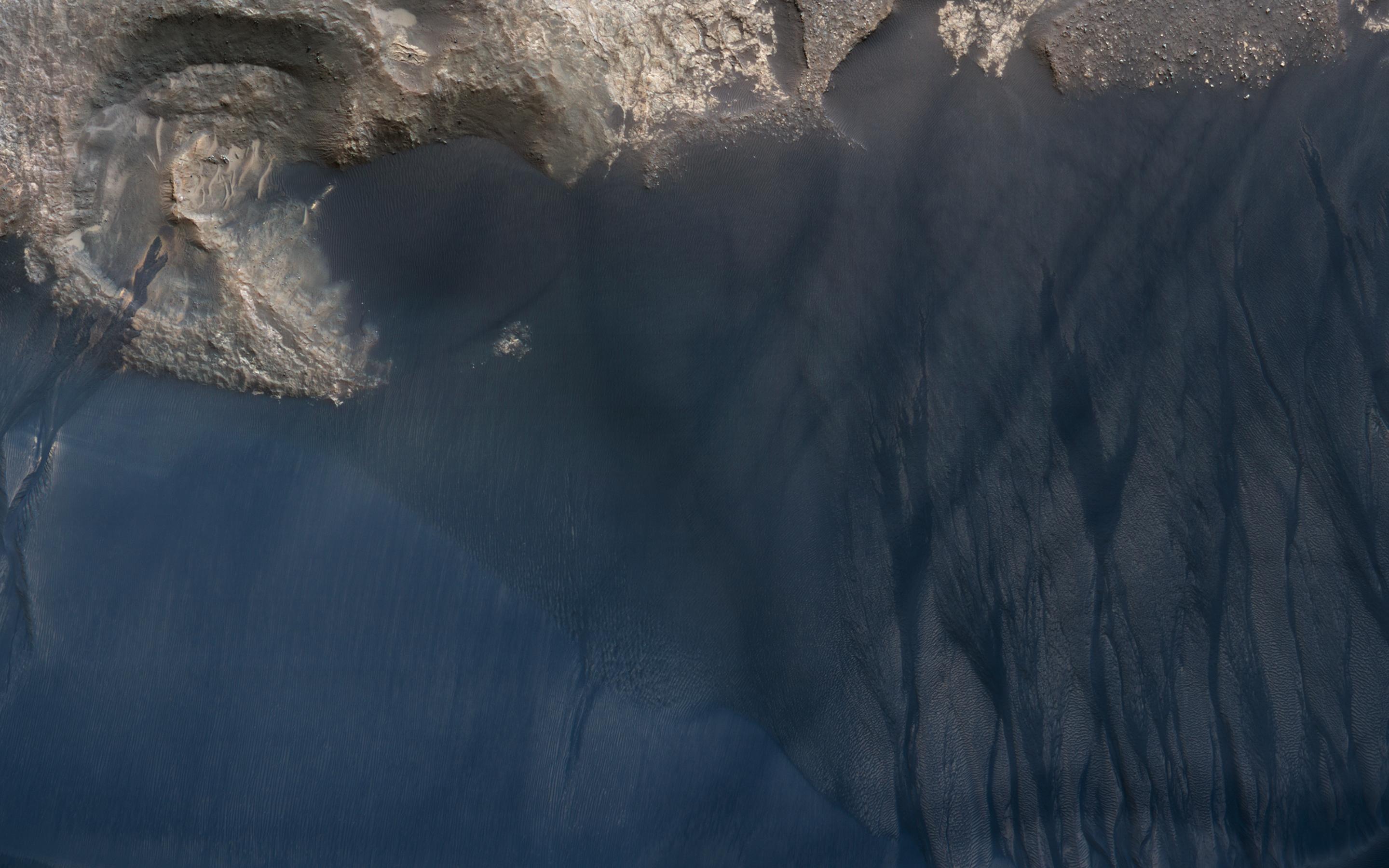
English: This large crescent dune in Kaiser Crater shows the scars of many types of seasonal erosional activities. Along its downwind slope are large gullies which are active during winter, when frost drives dune material downslope, carving out channels and creating fan-shaped aprons.
On the upwind slope (bottom), dust devil tracks are visible: dark lines and curliques created during the spring season by small wind vortices vacuuming up a thin layer of dust and exposing the dark dune sand. This is a stereo pair with ESP_021720_1330. Note: Both the cutout and the above image are rotated so that North is to the right. The map is projected here at a scale of 25 centimeters (9.8 inches) per pixel. [The original image scale is 25.3 centimeters (10 inches) per pixel (with 1 x 1 binning); objects on the order of 76 centimeters (30 inches) across are resolved.] North is up. The University of Arizona, Tucson, operates HiRISE, which was built by Ball Aerospace & Technologies Corp., Boulder, Colo. NASA's Jet Propulsion Laboratory, a division of Caltech in Pasadena, California, manages the Mars Reconnaissance Orbiter Project for NASA's Science Mission Directorate, Washington. |
| Date | 9 January 2011 (published 16 February 2017) |
| Source | Catalog page · Full-res (JPEG · TIFF) |
| Author | NASA/JPL-Caltech/Univ. of Arizona |
| Location on Mars | View this and other nearby images on: Google Maps |
|---|
This image or video was catalogued by Jet Propulsion Laboratory of the United States National Aeronautics and Space Administration (NASA) under Photo ID: PIA21458. This tag does not indicate the copyright status of the attached work. A normal copyright tag is still required. See Commons:Licensing. Other languages:
|
 |
This media is a product of the Mars Reconnaissance Orbiter mission Credit and attribution belongs to the High Resolution Imaging Science Experiment (HiRISE) team, NASA/JPL-Caltech/Univ. of Arizona |
Licensing edit
| This file is in the public domain in the United States because it was solely created by NASA. NASA copyright policy states that "NASA material is not protected by copyright unless noted". (See Template:PD-USGov, NASA copyright policy page or JPL Image Use Policy.) | ||
 |
Warnings:
|
File history
Click on a date/time to view the file as it appeared at that time.
| Date/Time | Thumbnail | Dimensions | User | Comment | |
|---|---|---|---|---|---|
| current | 07:22, 19 February 2017 | | 2,880 × 1,800 (478 KB) | PhilipTerryGraham (talk | contribs) | User created page with UploadWizard |
You cannot overwrite this file.
File usage on Commons
The following page uses this file: