File:PL Warszawa flood area.jpg

Size of this preview: 424 × 599 pixels. Other resolutions: 170 × 240 pixels | 339 × 480 pixels | 543 × 768 pixels | 724 × 1,024 pixels | 1,449 × 2,048 pixels | 4,140 × 5,851 pixels.
Original file (4,140 × 5,851 pixels, file size: 9.72 MB, MIME type: image/jpeg)
Captions
Captions
Add a one-line explanation of what this file represents
| Description |
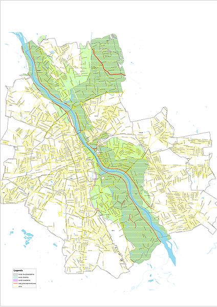
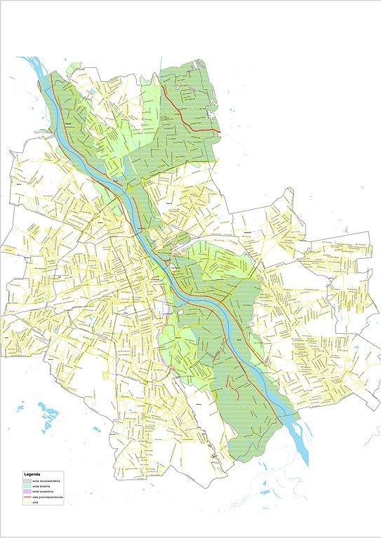
English: Area of possible flood in Warsaw
Polski: Obszar zalewowy w Warszawie |
|||
| Date | ||||
| Source | http://prasowy.um.warszawa.pl/mapapowodz/powodz.jpg | |||
| Author | Regionalny Zarząd Gospodarki Wodnej w Warszawie | |||
| Permission (Reusing this file) |
|

| Annotations | This image is annotated: View the annotations at Commons |
File history
Click on a date/time to view the file as it appeared at that time.
| Date/Time | Thumbnail | Dimensions | User | Comment | |
|---|---|---|---|---|---|
| current | 06:25, 23 May 2010 | | 4,140 × 5,851 (9.72 MB) | PawełMM (talk | contribs) | {{Information |Description={{en|1=Area of possible flood in Warsaw}} {{pl|1=Obszar zalewowy w Warszawie}} |Source=http://prasowy.um.warszawa.pl/mapapowodz/powodz.jpg |Author=Regionalny Zarząd Gospodarki Wodnej w Warszawie |Date=2010-05-22 |Permission={{P |
You cannot overwrite this file.
File usage on Commons
There are no pages that use this file.
File usage on other wikis
The following other wikis use this file:
- Usage on pl.wikipedia.org