File:PONT DE NIEPPE Route Nationale -maisons bombardées . carte postale.jpg

Size of this preview: 478 × 599 pixels. Other resolutions: 191 × 240 pixels | 383 × 480 pixels | 613 × 768 pixels | 817 × 1,024 pixels | 1,635 × 2,048 pixels | 3,448 × 4,320 pixels.
Original file (3,448 × 4,320 pixels, file size: 6.96 MB, MIME type: image/jpeg)
Captions
Captions
Add a one-line explanation of what this file represents
Summary edit
| Description |
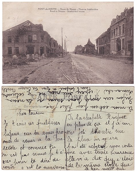
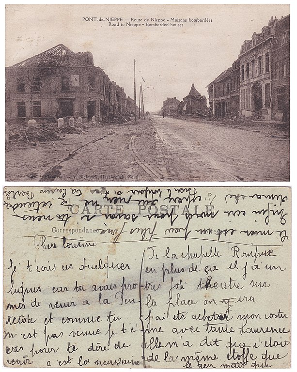
Français : carte postale recto verso ( neuvaine chapelle Pont Rompu"=> au Bizet en Belgique proche).
Pont de Nieppe après la 1ère Guerre Mondiale. Parvis de l'église Notre Dame du Bon Secours sur la gauche avec les plots en pierre bleue de Soignies , dont certains sont encore visibles 100 ans plus tard |
| Date | |
| Source | Collection personnelle |
| Author | Biebuyck à Hazebrouck (France / Nord) |
| Camera location | | View this and other nearby images on: OpenStreetMap |
|---|
Licensing edit
|
This work is in the public domain in its country of origin and other countries and areas where the copyright term is the author's life plus 70 years or fewer. This work is in the public domain in the United States because it was published (or registered with the U.S. Copyright Office) before January 1, 1929. | |
| This file has been identified as being free of known restrictions under copyright law, including all related and neighboring rights. | |
File history
Click on a date/time to view the file as it appeared at that time.
| Date/Time | Thumbnail | Dimensions | User | Comment | |
|---|---|---|---|---|---|
| current | 13:03, 29 April 2018 | | 3,448 × 4,320 (6.96 MB) | Jpcuvelier (talk | contribs) | User created page with UploadWizard |
You cannot overwrite this file.
File usage on Commons
The following page uses this file: