File:Padjelanta National Park hybrid map-fr.jpg

Size of this preview: 690 × 600 pixels. Other resolutions: 276 × 240 pixels | 552 × 480 pixels | 883 × 768 pixels | 1,178 × 1,024 pixels | 2,355 × 2,048 pixels | 3,657 × 3,180 pixels.
Original file (3,657 × 3,180 pixels, file size: 2.33 MB, MIME type: image/jpeg)
Captions
Captions
Add a one-line explanation of what this file represents
Summary edit
| Description |
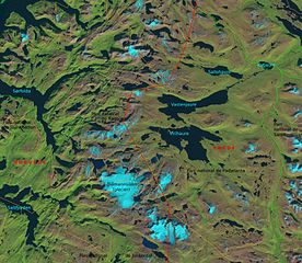
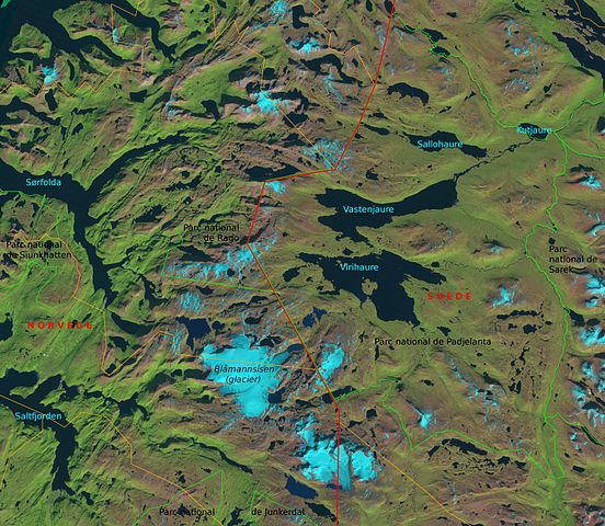
Français : Carte hybride (satellite/vectorielle) en français du parc national de Padjelanta et des glaciers et fjords norvégiens avoisinants.
Deutsch: Karte zum Nationalpark Padjelanta, in Französische.
English: Hybrid map (satellite/vector format) in French language of Padjelanta National Park.
Italiano: Carta topografica e amministrativa di Parco nazionale Padjelanta (en francese).
|
||
| Date | (UTC) | ||
| Source |
Création personnelle ;
|
||
| Author | © Bourrichon (talk) - fr:Bourrichon | ||
| Permission (Reusing this file) |
|
Licensing edit
I, the copyright holder of this work, hereby publish it under the following licenses:

|
Permission is granted to copy, distribute and/or modify this document under the terms of the GNU Free Documentation License, Version 1.2 or any later version published by the Free Software Foundation; with no Invariant Sections, no Front-Cover Texts, and no Back-Cover Texts. A copy of the license is included in the section entitled GNU Free Documentation License. |
This file is licensed under the Creative Commons Attribution-Share Alike 3.0 Unported, 2.5 Generic, 2.0 Generic and 1.0 Generic license.
- You are free:
- to share – to copy, distribute and transmit the work
- to remix – to adapt the work
- Under the following conditions:
- attribution – You must give appropriate credit, provide a link to the license, and indicate if changes were made. You may do so in any reasonable manner, but not in any way that suggests the licensor endorses you or your use.
- share alike – If you remix, transform, or build upon the material, you must distribute your contributions under the same or compatible license as the original.
You may select the license of your choice.
File history
Click on a date/time to view the file as it appeared at that time.
| Date/Time | Thumbnail | Dimensions | User | Comment | |
|---|---|---|---|---|---|
| current | 23:49, 11 November 2011 | | 3,657 × 3,180 (2.33 MB) | Bourrichon (talk | contribs) | == {{int:filedesc}} == {{Information |Description= {{fr|Carte hybride (satellite/vectorielle) en français du parc national de Padjelanta et des glaciers et fjords norvégiens avoisinants.}} {{de|Karte zum [[:de:Nation |
You cannot overwrite this file.
File usage on Commons
The following page uses this file:
File usage on other wikis
The following other wikis use this file:
- Usage on ca.wikipedia.org
- Usage on ceb.wikipedia.org
- Usage on fr.wikipedia.org
- Usage on www.wikidata.org