File:Palencia-loc.svg

Size of this PNG preview of this SVG file: 428 × 599 pixels. Other resolutions: 171 × 240 pixels | 343 × 480 pixels | 548 × 768 pixels | 731 × 1,024 pixels | 1,462 × 2,048 pixels | 512 × 717 pixels.
Original file (SVG file, nominally 512 × 717 pixels, file size: 461 KB)
Captions
Captions
Add a one-line explanation of what this file represents
Summary edit
| Description |
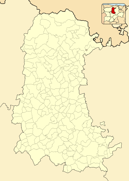
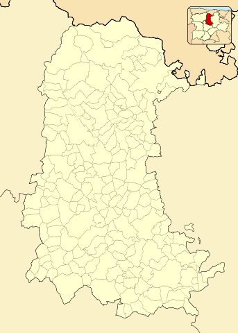
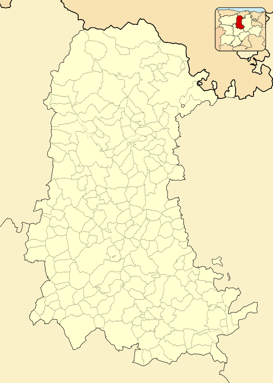
English: Location map of Province of Palencia
Equirectangular projection, N/S stretching 130 %. Geographic limits of the map:
Español: Mapa de localización de la Provincia de Palencia
Proyección equirrectangular (cilíndrica equidistante), N/S estirada 130 %. Límites geográficos del mapa:
|
|
| Date | ||
| Source | Own work based on: EspañaLoc.svg by HansenBCN | |
| Author | Miguillen | |
| SVG development |
|
Licensing edit
Miguillen, the copyright holder of this work, hereby publishes it under the following license:
This file is licensed under the Creative Commons Attribution-Share Alike 3.0 Unported license.
Attribution: Miguillen
- You are free:
- to share – to copy, distribute and transmit the work
- to remix – to adapt the work
- Under the following conditions:
- attribution – You must give appropriate credit, provide a link to the license, and indicate if changes were made. You may do so in any reasonable manner, but not in any way that suggests the licensor endorses you or your use.
- share alike – If you remix, transform, or build upon the material, you must distribute your contributions under the same or compatible license as the original.
File history
Click on a date/time to view the file as it appeared at that time.
| Date/Time | Thumbnail | Dimensions | User | Comment | |
|---|---|---|---|---|---|
| current | 11:09, 10 December 2010 | | 512 × 717 (461 KB) | Miguillen (talk | contribs) | colores según convención |
| 23:19, 12 November 2010 |  | 512 × 717 (215 KB) | Miguillen (talk | contribs) | == {{int:filedesc}} == {{Information |Description={{en|Location map of Province of Palencia}} Equirectangular projection, N/S stretching 130 %. Geographic limits of the map: * N: ° N * S: ° N * W: ° O * E: ° O {{es|Ma |
You cannot overwrite this file.
File usage on Commons
There are no pages that use this file.
File usage on other wikis
The following other wikis use this file:
- Usage on ar.wikipedia.org
- Usage on ba.wikipedia.org
- Usage on en.wikipedia.org
- Usage on eo.wikipedia.org
- Villaviudas
- Palencio
- Quintanilla de Onsoña
- Mudá
- Aguilar de Campoo
- Katedralo de Palencio
- Provinco Palencio
- Carrión de los Condes
- Frómista
- Municipoj de la provinco Palencio
- Barruelo de Santullán
- Ŝablono:Situo sur mapo Hispanio Provinco Palencio
- Berzosilla
- Brañosera
- Castrejón de la Peña
- Cervera de Pisuerga
- Dehesa de Montejo
- Guardo
- La Pernía
- Polentinos
- Pomar de Valdivia
- Respenda de la Peña
- Salinas de Pisuerga
- San Cebrián de Mudá
- Santibáñez de la Peña
- Triollo
- Velilla del Río Carrión
- Alar del Rey
- Ayuela
- Báscones de Ojeda
- Buenavista de Valdavia
- Bustillo de la Vega
- Bustillo del Páramo de Carrión
- Calahorra de Boedo
- Collazos de Boedo
- Congosto de Valdavia
- Dehesa de Romanos
- Fresno del Río
- Herrera de Pisuerga
- La Puebla de Valdavia
- La Serna
- Lagartos
- La Vid de Ojeda
View more global usage of this file.