File:Panorama achterzijde, Stroeërweg 39, Stroe.jpg
Size of this preview: 800 × 363 pixels. Other resolutions: 320 × 145 pixels | 640 × 291 pixels | 1,024 × 465 pixels | 1,280 × 581 pixels | 2,560 × 1,163 pixels | 6,531 × 2,966 pixels.
Original file (6,531 × 2,966 pixels, file size: 14.94 MB, MIME type: image/jpeg)
Captions
Captions
Add a one-line explanation of what this file represents
Summary edit
| Description |
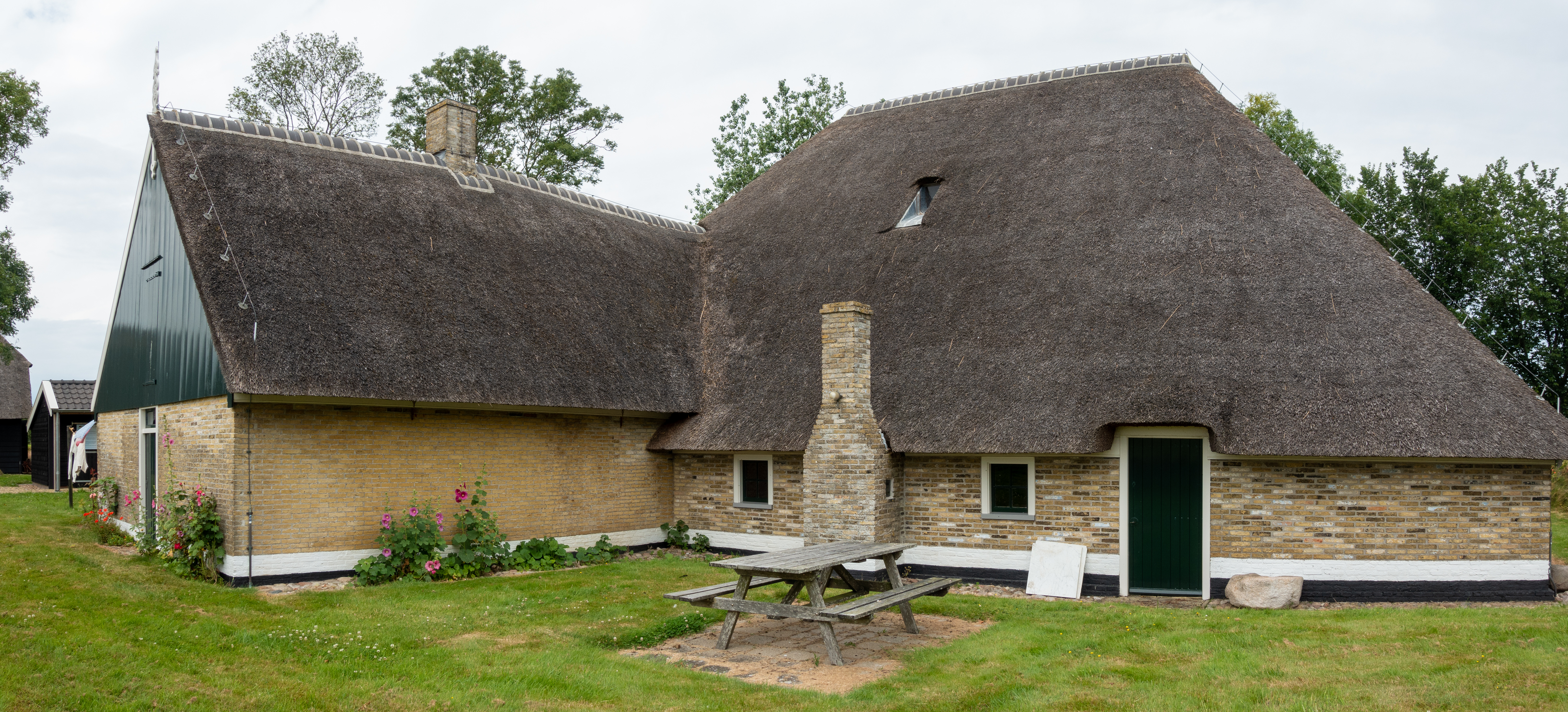
Nederlands: Achterzijde van het pand Stroeërweg 39 te Stroe (Wieringen). Het pand is een Wieringer stolp met een staart waarin het woongedeelte bevindt. Rechts de dars met ruimte voor hooi of zeewier. In de schoorsteen werd gekookt. Het pand is anno 2022 in gebruik als museum.
|
||
| Date | |||
| Source | Own work | ||
| Author | Dqfn13 |
| Camera location | | View this and other nearby images on: OpenStreetMap |
|---|
Licensing edit
I, the copyright holder of this work, hereby publish it under the following license:
This file is licensed under the Creative Commons Attribution-Share Alike 4.0 International license.
- You are free:
- to share – to copy, distribute and transmit the work
- to remix – to adapt the work
- Under the following conditions:
- attribution – You must give appropriate credit, provide a link to the license, and indicate if changes were made. You may do so in any reasonable manner, but not in any way that suggests the licensor endorses you or your use.
- share alike – If you remix, transform, or build upon the material, you must distribute your contributions under the same or compatible license as the original.
File history
Click on a date/time to view the file as it appeared at that time.
| Date/Time | Thumbnail | Dimensions | User | Comment | |
|---|---|---|---|---|---|
| current | 09:26, 10 August 2022 | | 6,531 × 2,966 (14.94 MB) | Dqfn13 (talk | contribs) | Uploaded own work with UploadWizard |
You cannot overwrite this file.
File usage on Commons
There are no pages that use this file.
File usage on other wikis
The following other wikis use this file:
- Usage on nl.wikipedia.org