File:Pavlovsk park - plan.svg

Original file (SVG file, nominally 2,719 × 2,175 pixels, file size: 3.99 MB)
Captions
Captions
Summary edit
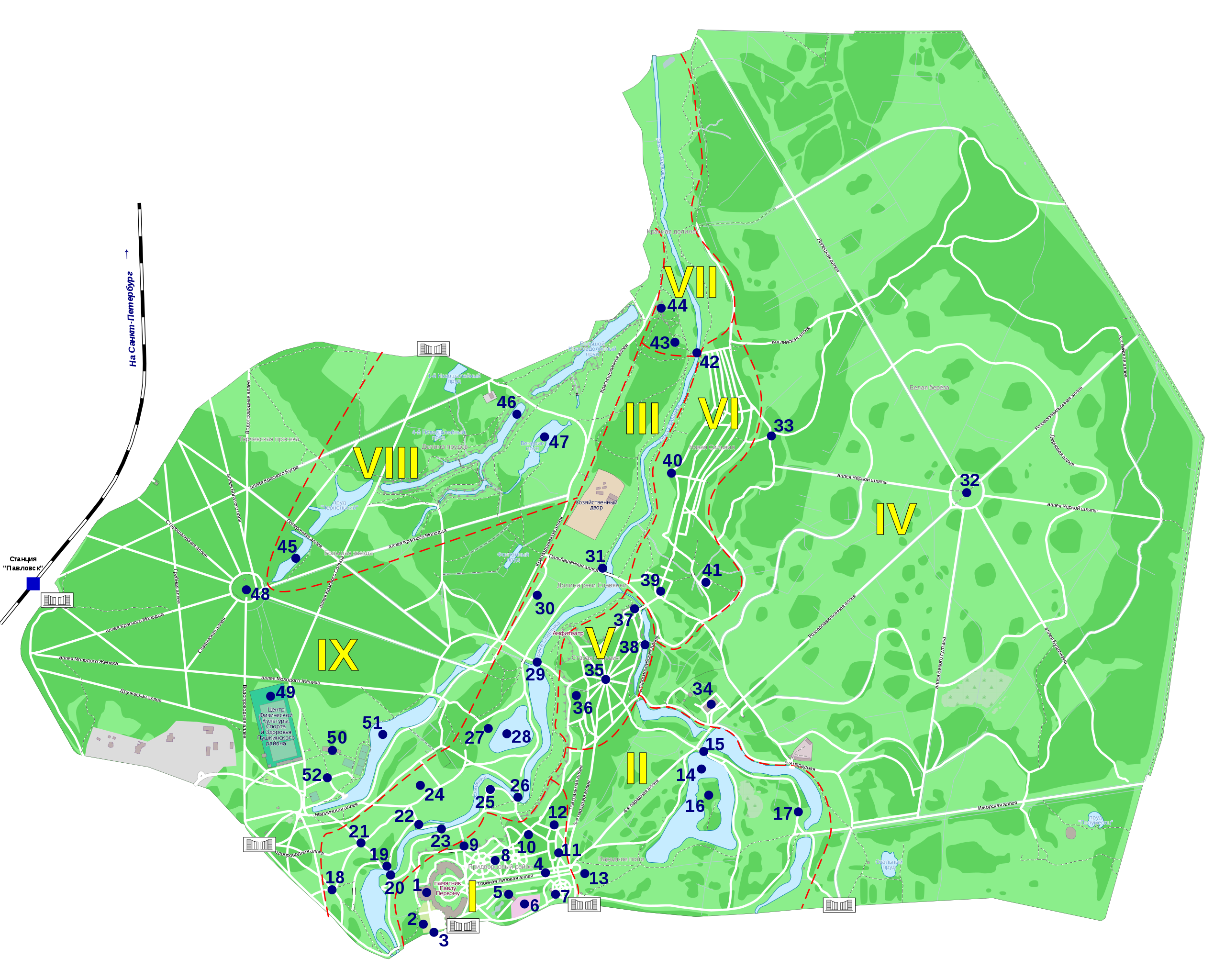
| Description |
Русский: План Павловского парка под Санкт-Петербургом |
|||
| Date | ||||
| Source | Own work | |||
| Author | Kaidor | |||
| Permission (Reusing this file) |
I, the copyright holder of this work, hereby publish it under the following license: This file is licensed under the Creative Commons Attribution-Share Alike 3.0 Unported license.
|
|||
| Legend | Russian I Центральный район 1. Большой дворец II Парадное поле 13. Мемориал памяти жертв Революции III Долина реки Славянки 18. Колоннада Аполлона IV Белая Береза 32. Круг белых берез V Старая Сильвия 35. Двенадцать дорожек VI Новая Сильвия 39. Статуя «Аполлон-Мусагет» VII Красная долина 42. Новосильвийский мост VIII Долина прудов 45. Круглозальные пруды IX Большая Звезда 48. Круглый зал French I Secteur central 1. Palais de Pavlovsk et statue de Paul Ier II Champ de Parade 13. Mémorial en souvenir des victimes de la Révolution III Vallée de la rivière Slavianka 18. Colonnade d'Apollon IV Bouleau Blanc 32. Rond-point des bouleaux blancs V Vieille Sylvie 35. Douze chemins VI Nouvelle Sylvie 39. Statue d'Apollon Musagète VII Vallée Rouge 42. Pont de la Nouvelle Sylvie VIII Vallée des Étangs 45. Étangs de la Salle Ronde IX Grande Étoile 48. Salle Ronde |
| Camera location | | View this and other nearby images on: OpenStreetMap |
|---|
File history
Click on a date/time to view the file as it appeared at that time.
| Date/Time | Thumbnail | Dimensions | User | Comment | |
|---|---|---|---|---|---|
| current | 16:37, 14 February 2013 | | 2,719 × 2,175 (3.99 MB) | Kaidor (talk | contribs) | Приглушены цвета. |
| 19:47, 20 December 2012 |  | 2,719 × 2,175 (3.99 MB) | Kaidor (talk | contribs) | Добавлена железнодорожная ветка и входы в парк. | |
| 20:06, 18 December 2012 |  | 2,719 × 2,175 (3.95 MB) | Kaidor (talk | contribs) | Изменены контуры зеленых насаждений. Условные обозначения участков перенесены на основную схему. | |
| 18:39, 15 December 2012 |  | 2,719 × 2,175 (4.31 MB) | Kaidor (talk | contribs) | User created page with UploadWizard |
You cannot overwrite this file.
File usage on Commons
The following page uses this file:
File usage on other wikis
The following other wikis use this file: