File:Persian Gulf Tentative Water boundary Proposals - DPLA - b79bf13a17d47a0d74e0a46922430a76.jpg
Size of this preview: 696 × 599 pixels. Other resolutions: 279 × 240 pixels | 558 × 480 pixels | 892 × 768 pixels | 1,189 × 1,024 pixels | 2,379 × 2,048 pixels | 6,358 × 5,474 pixels.
Original file (6,358 × 5,474 pixels, file size: 2.03 MB, MIME type: image/jpeg)
Captions
Captions
Add a one-line explanation of what this file represents
Summary edit
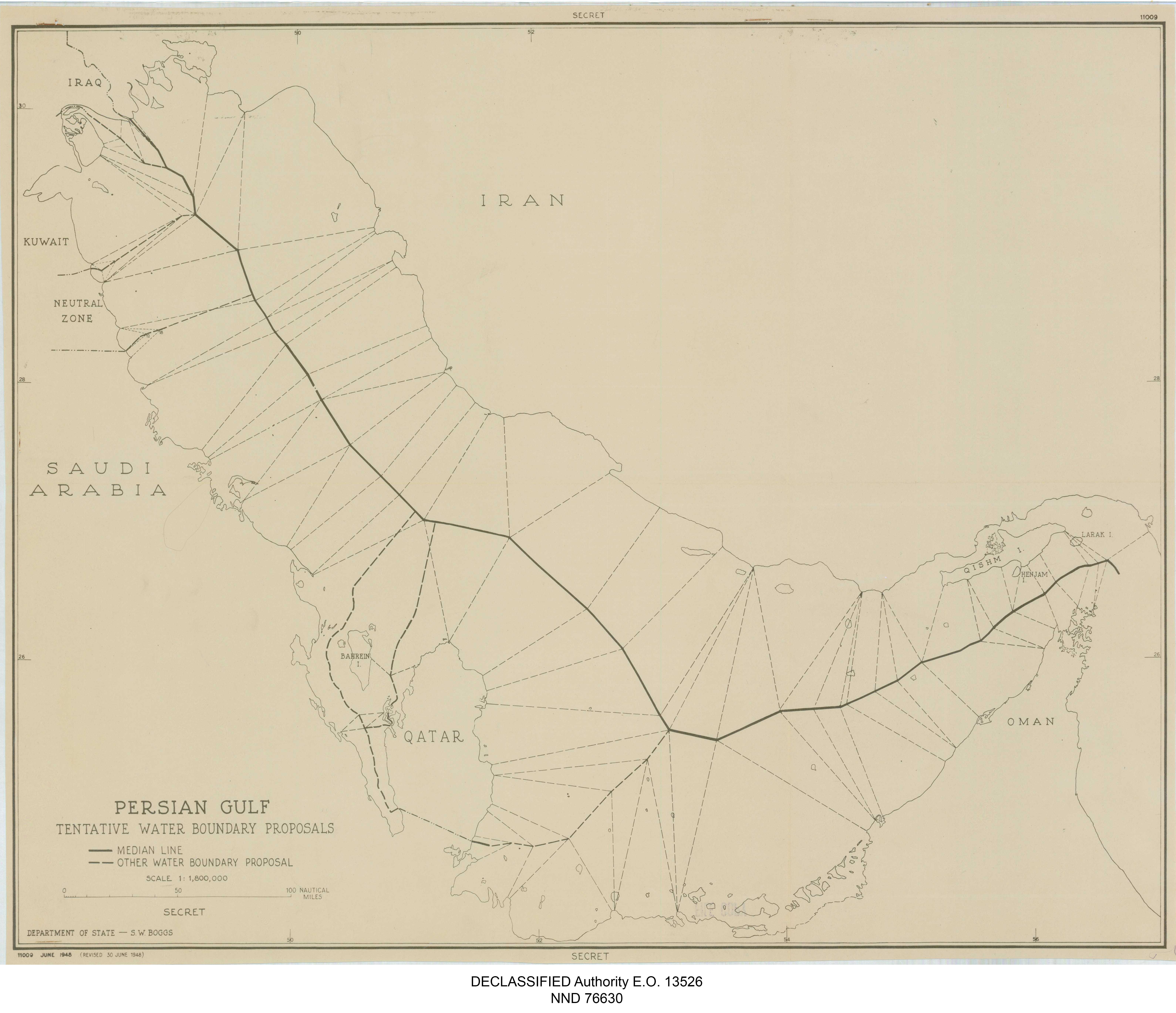
| Persian Gulf Tentative Water boundary Proposals
( |
||||||||||||||
|---|---|---|---|---|---|---|---|---|---|---|---|---|---|---|
| Author |
Central Intelligence Agency |
|||||||||||||
| Creator | Central Intelligence Agency. 12/4/1981 | |||||||||||||
| Title |
Persian Gulf Tentative Water boundary Proposals |
|||||||||||||
| Date | 1948 | |||||||||||||
| Collection |
|
|||||||||||||
| Source/Photographer |
|
|||||||||||||
| Permission (Reusing this file) |
|
|||||||||||||
| Standardized rights statement |
|
|||||||||||||

File history
Click on a date/time to view the file as it appeared at that time.
| Date/Time | Thumbnail | Dimensions | User | Comment | |
|---|---|---|---|---|---|
| current | 20:54, 10 November 2022 | | 6,358 × 5,474 (2.03 MB) | DPLA bot (talk | contribs) | Uploading DPLA ID b79bf13a17d47a0d74e0a46922430a76 |
You cannot overwrite this file.
File usage on Commons
The following page uses this file: