File:Petres - panoramio.jpg
Size of this preview: 800 × 600 pixels. Other resolutions: 320 × 240 pixels | 640 × 480 pixels | 1,024 × 768 pixels | 1,280 × 960 pixels | 2,048 × 1,536 pixels.
Original file (2,048 × 1,536 pixels, file size: 1.52 MB, MIME type: image/jpeg)
Captions
Captions
Add a one-line explanation of what this file represents
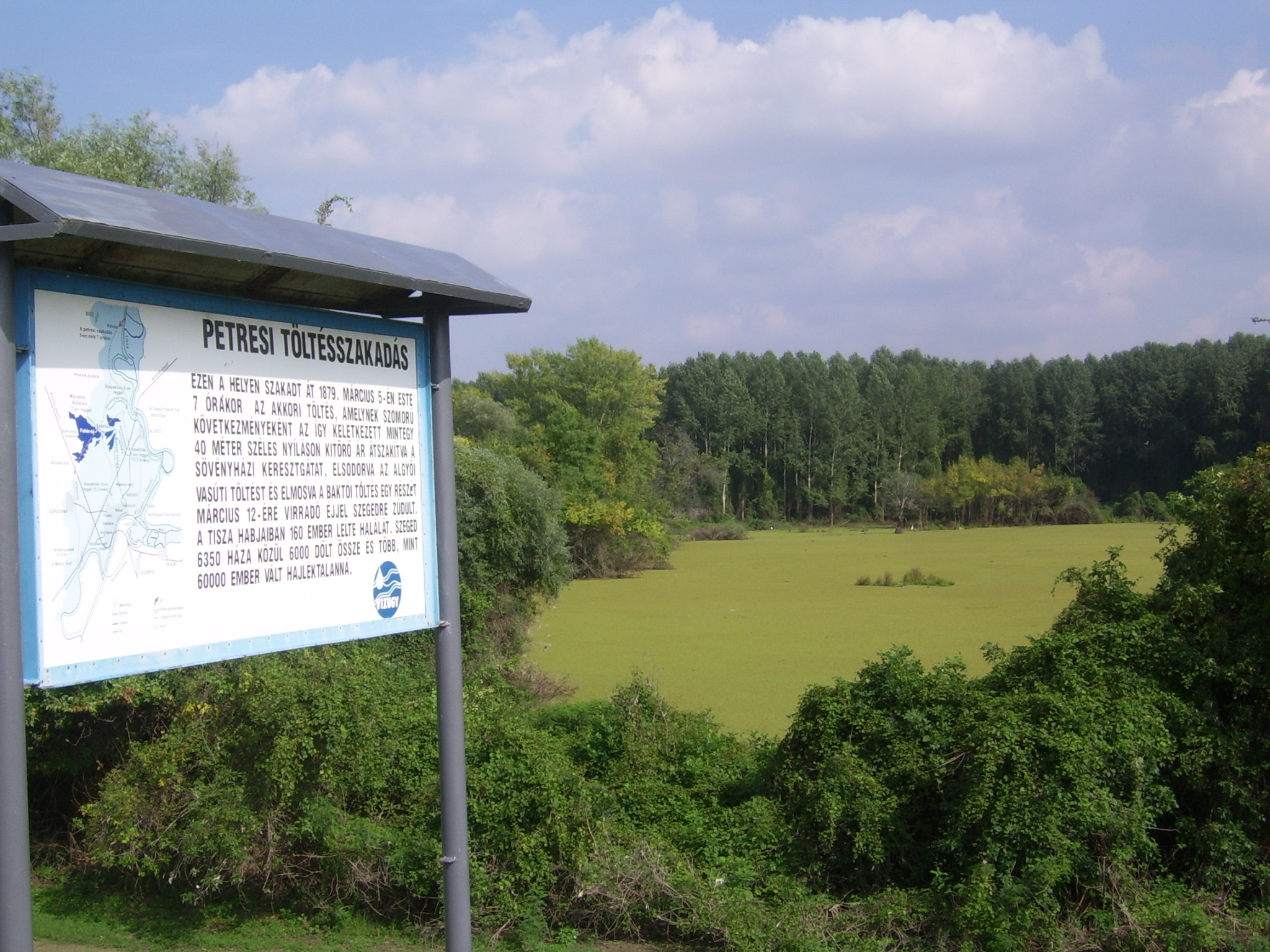
| Description | Petres, Csongrád m. Dóc község. A község területének több mint fele védett. A tájvédelmi körzet a Tisza jobb partján lévő hullámteret és az árvédelmi töltésen kívül elterülő mentett területet foglalja magában. A Kiskunsági Nemzeti Park részeként a Pusztaszeri Tájvédelmi Körzet része. A táblán a térképes leírás mellett a következő olvasható: „Ezen a helyen szakadt át 1879. március 5-én este 7 órakor az akkori töltés, amelynek szomorú következményeként az így keletkezett mintegy 40 méter széles nyíláson kitörő ár átszakítva a sövényházi keresztgátat, elsodorva az algyői vasúti töltést és elmosva a baktói töltés egy részét március 12-ére virradó éjjel Szegedre zúdult. A Tisza habjaiban 160 ember lelte halálát. Szeged 6350 háza közül 6000 dőlt össze és több mint 60.000 ezer ember vált hajléktalanná.” Source: Megyei értéktár és delinapfeny-turizmus.hu/Dóc | ||
| Date | Taken on 15 September 2010 | ||
| Source | https://web.archive.org/web/20161016154147/http://www.panoramio.com/photo/41136608 | ||
| Author | Beroesz | ||
| Permission (Reusing this file) |
This file is licensed under the Creative Commons Attribution-Share Alike 3.0 Unported license. Attribution: Beroesz
|
||
| Tags (from Panoramio photo page) | Dóc, 2010, Dóc |
| Camera location | | View this and other nearby images on: OpenStreetMap |
|---|
File history
Click on a date/time to view the file as it appeared at that time.
| Date/Time | Thumbnail | Dimensions | User | Comment | |
|---|---|---|---|---|---|
| current | 18:57, 10 November 2016 | | 2,048 × 1,536 (1.52 MB) | Panoramio upload bot (talk | contribs) | {{Information |description=Petres |date={{Taken on|2010-09-15}} |source=http://www.panoramio.com/photo/41136608 |author=[http://www.panoramio.com/user/2811807?with_photo_id=41136608 Beroesz] |permission={{cc-by-sa-3.0|Beroesz}} {{Panoramioreview|Panora... |
You cannot overwrite this file.
File usage on Commons
There are no pages that use this file.