File:Ph fil armm.png
Size of this preview: 384 × 599 pixels. Other resolutions: 154 × 240 pixels | 308 × 480 pixels | 492 × 768 pixels | 656 × 1,024 pixels | 2,000 × 3,120 pixels.
Original file (2,000 × 3,120 pixels, file size: 137 KB, MIME type: image/png)
Captions
Captions
Add a one-line explanation of what this file represents
Summary edit
| Description |
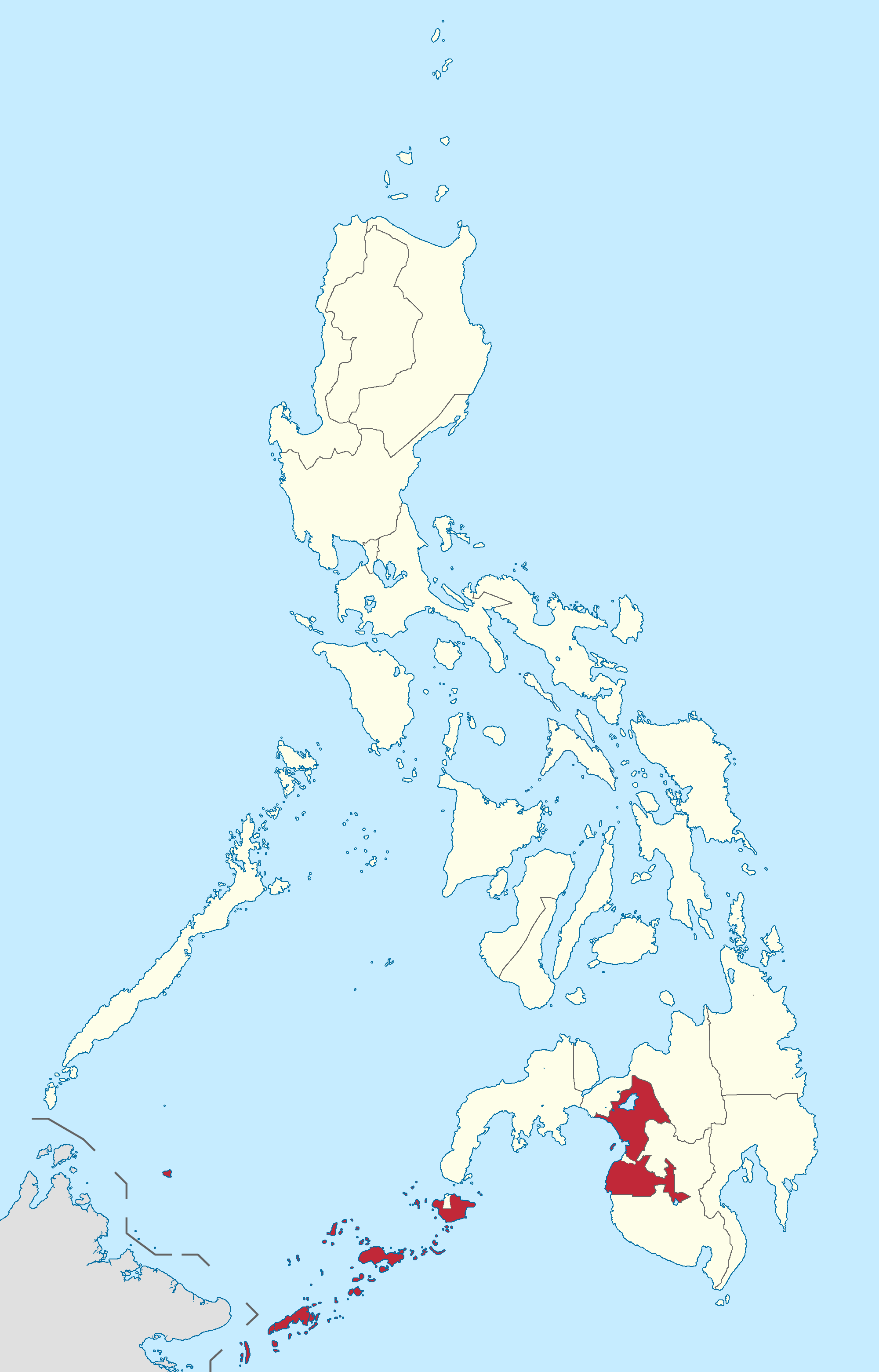
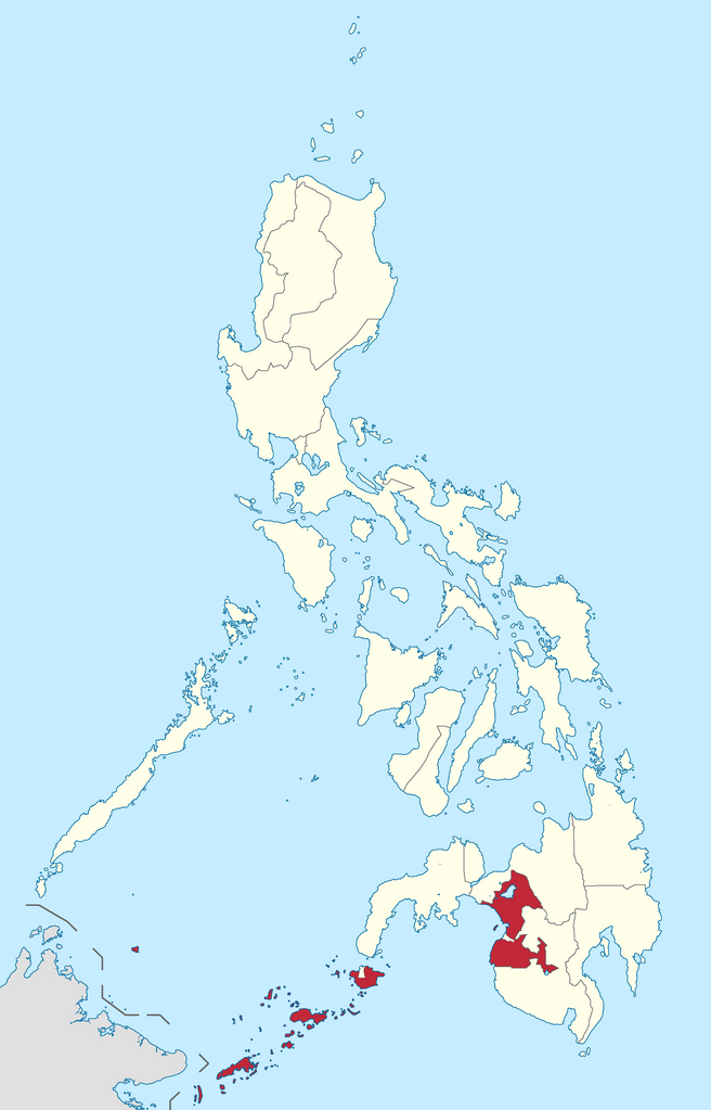
English: Autonomous Region in Muslim Mindanao location in the Philippines
Filipino: Kinaroroonan ng Rehiyong Awtonomus sa Muslim Mindanao sa Pilipinas |
| Date | |
| Source |
BlankMap-Philippines.png by User:TheCoffee
|
| Author | Roel Balingit |
Licensing edit
I, the copyright holder of this work, hereby publish it under the following license:
This file is licensed under the Creative Commons Attribution-Share Alike 3.0 Unported license.
- You are free:
- to share – to copy, distribute and transmit the work
- to remix – to adapt the work
- Under the following conditions:
- attribution – You must give appropriate credit, provide a link to the license, and indicate if changes were made. You may do so in any reasonable manner, but not in any way that suggests the licensor endorses you or your use.
- share alike – If you remix, transform, or build upon the material, you must distribute your contributions under the same or compatible license as the original.

|
If you choose to use this work under the Creative Commons license stated above, the author, Roel Balingit (Namayan), would like you to attribute the work to him (among other requirements such as indicating that the work is licensed under the Creative Commons) with the following text or similar:
© Roel Balingit, 2012.
His name should be a link to the Wikimedia Commons userpage Namayan. If a link is not possible, then the url should be placed in parentheses after the name. If the work has been substantially altered by other people (see the File history section below), then this particular attribution requirement is waived, which means you can attribute the work in any reasonable manner. This attribution requirement is provided pursuant to the Creative Commons Attribution mechanism where "you must attribute the work in the manner specified by the author or licensor (but not in any way that suggests that they endorse you or your use of the work)." (See "Attribution" in the Creative Commons website.)
|
File history
Click on a date/time to view the file as it appeared at that time.
| Date/Time | Thumbnail | Dimensions | User | Comment | |
|---|---|---|---|---|---|
| current | 10:50, 27 January 2019 | | 2,000 × 3,120 (137 KB) | Hariboneagle927 (talk | contribs) | Reverted to version as of 04:21, 6 August 2012 (UTC) |
| 10:16, 5 June 2015 |  | 2,000 × 3,120 (136 KB) | Namayan (talk | contribs) | Removed Region 6/7 boundaries, Negros Island Region created | |
| 04:21, 6 August 2012 |  | 2,000 × 3,120 (137 KB) | Namayan (talk | contribs) | Removed Camarines Norte and Camarines Sur boundaries | |
| 03:58, 6 August 2012 |  | 2,000 × 3,120 (137 KB) | Namayan (talk | contribs) | Removed error in Region 1 border | |
| 03:56, 6 August 2012 |  | 2,000 × 3,120 (137 KB) | Namayan (talk | contribs) | Demarcated Dinagat Islands boundary | |
| 09:27, 5 August 2012 |  | 2,000 × 3,120 (137 KB) | Namayan (talk | contribs) | Fixed border with Malaysia | |
| 18:55, 4 August 2012 |  | 2,000 × 3,120 (140 KB) | Namayan (talk | contribs) | Added border with Malaysia | |
| 17:02, 4 August 2012 |  | 2,000 × 3,120 (127 KB) | Namayan (talk | contribs) | Color changed, label removed | |
| 06:02, 4 August 2012 |  | 2,000 × 3,120 (154 KB) | Namayan (talk | contribs) |
You cannot overwrite this file.
File usage on Commons
There are no pages that use this file.
File usage on other wikis
The following other wikis use this file:
- Usage on az.wikipedia.org
- Usage on en.wikipedia.org
- Ganassi, Lanao del Sur
- Hadji Panglima Tahil
- Indanan
- Kalingalan Caluang
- Lugus, Sulu
- Luuk, Sulu
- Maimbung
- Panamao
- Pandami
- Panglima Estino
- Pangutaran
- Parang, Sulu
- Pata, Sulu
- Patikul
- Siasi
- Tapul
- Banguingui, Sulu
- Languyan
- Panglima Sugala
- Sapa-Sapa
- South Ubian
- Bacolod-Kalawi
- Balabagan
- Binidayan
- Buadiposo-Buntong
- Bubong
- Calanogas
- Ditsaan-Ramain
- Kapai
- Kapatagan, Lanao del Sur
- Lumba-Bayabao
- Lumbayanague
- Madalum
- Madamba
- Maguing
- Marantao
- Pagayawan
- Poona Bayabao
- Sultan Dumalondong
- Picong, Lanao del Sur
- Taraka, Lanao del Sur
- Wao, Lanao del Sur
- Tubaran
- Barira
- Lantawan
- Maluso
- Sumisip
- Tipo-Tipo
- Tuburan, Basilan
View more global usage of this file.