File:Philippe Briet. Palestinae delineatio ad geographiae canones revocata.jpg
Size of this preview: 800 × 588 pixels. Other resolutions: 320 × 235 pixels | 640 × 470 pixels | 1,024 × 753 pixels | 1,280 × 941 pixels | 2,560 × 1,882 pixels | 6,584 × 4,840 pixels.
Original file (6,584 × 4,840 pixels, file size: 7.05 MB, MIME type: image/jpeg)
Captions
Captions
Add a one-line explanation of what this file represents
Summary
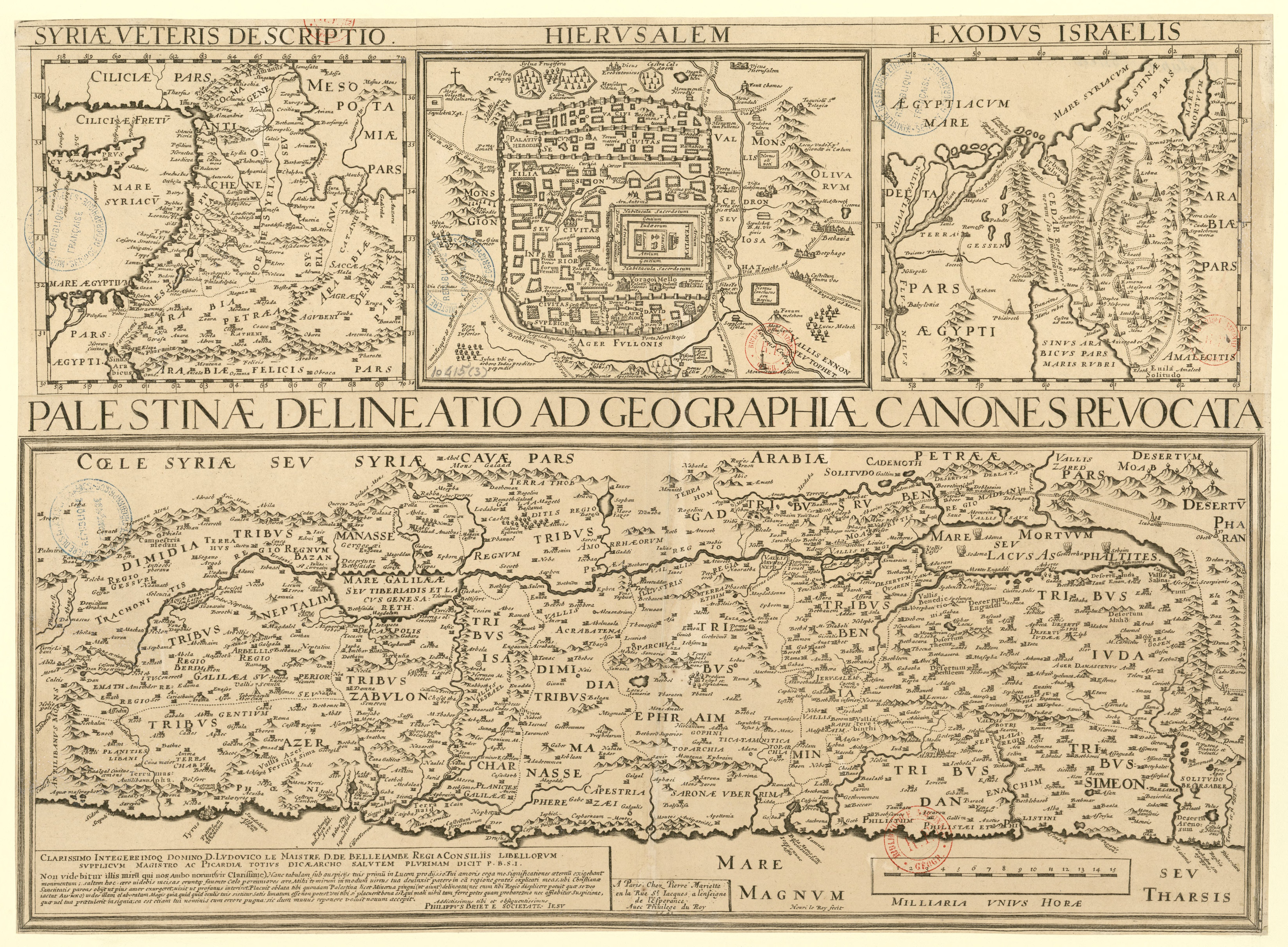
edit| Latina: Palestinae delineatio ad geographiae canones revocata.
( |
|||||||||||||||||||||||||||
|---|---|---|---|---|---|---|---|---|---|---|---|---|---|---|---|---|---|---|---|---|---|---|---|---|---|---|---|
| Artist |
Briet, Philippe (1601-1668). Cartographe; Le Roy, Henri (16..-16..? ; graveur) |
||||||||||||||||||||||||||
| Title |
Latina: Palestinae delineatio ad geographiae canones revocata. |
||||||||||||||||||||||||||
| Description |
Latina: Palestinae delineatio ad geographiae canones revocata / Philippus Briet e societate Iesu ; Henri le Roy fecit. |
||||||||||||||||||||||||||
| Date | 1641 | ||||||||||||||||||||||||||
| Dimensions | height: 39.5 cm (15.5 in); width: 54 cm (21.2 in) | ||||||||||||||||||||||||||
| Collection |
|
||||||||||||||||||||||||||
| Current location |
département Cartes et plans, CPL GE DD-2987 (10415) |
||||||||||||||||||||||||||
| Object history | Collection d'Anville | ||||||||||||||||||||||||||
| Notes | Publisher: chez Pierre Mariette (A Paris) | ||||||||||||||||||||||||||
| Source/Photographer |
|
||||||||||||||||||||||||||

Licensing
edit
Previous public domain rationale, no longer applicable
| ||
|---|---|---|
|
|
This is a faithful photographic reproduction of a two-dimensional, public domain work of art. The work of art itself is in the public domain for the following reason:
The official position taken by the Wikimedia Foundation is that "faithful reproductions of two-dimensional public domain works of art are public domain".
This photographic reproduction is therefore also considered to be in the public domain in the United States. In other jurisdictions, re-use of this content may be restricted; see Reuse of PD-Art photographs for details. | ||||
File history
Click on a date/time to view the file as it appeared at that time.
| Date/Time | Thumbnail | Dimensions | User | Comment | |
|---|---|---|---|---|---|
| current | 11:28, 30 May 2011 | | 6,584 × 4,840 (7.05 MB) | Geagea (talk | contribs) | == {{int:filedesc}} == {{LargeImage}} {{Artwork |artist=Briet, Philippe (1601-1668). Cartographe; Le Roy, Henri (16..-16..? ; graveur) |title={{la|1=Palestinae delineatio ad geographiae canones revocata.}} |description={{la|1=alestinae delineatio ad geogr |
You cannot overwrite this file.
File usage on Commons
The following 3 pages use this file: