File:Picard 1740 Figure de la Terre 199.jpg
Size of this preview: 399 × 599 pixels. Other resolutions: 160 × 240 pixels | 319 × 480 pixels | 511 × 768 pixels | 682 × 1,024 pixels | 2,454 × 3,686 pixels.
Original file (2,454 × 3,686 pixels, file size: 1.03 MB, MIME type: image/jpeg)
Captions
Captions
Add a one-line explanation of what this file represents
Summary edit
| Description |
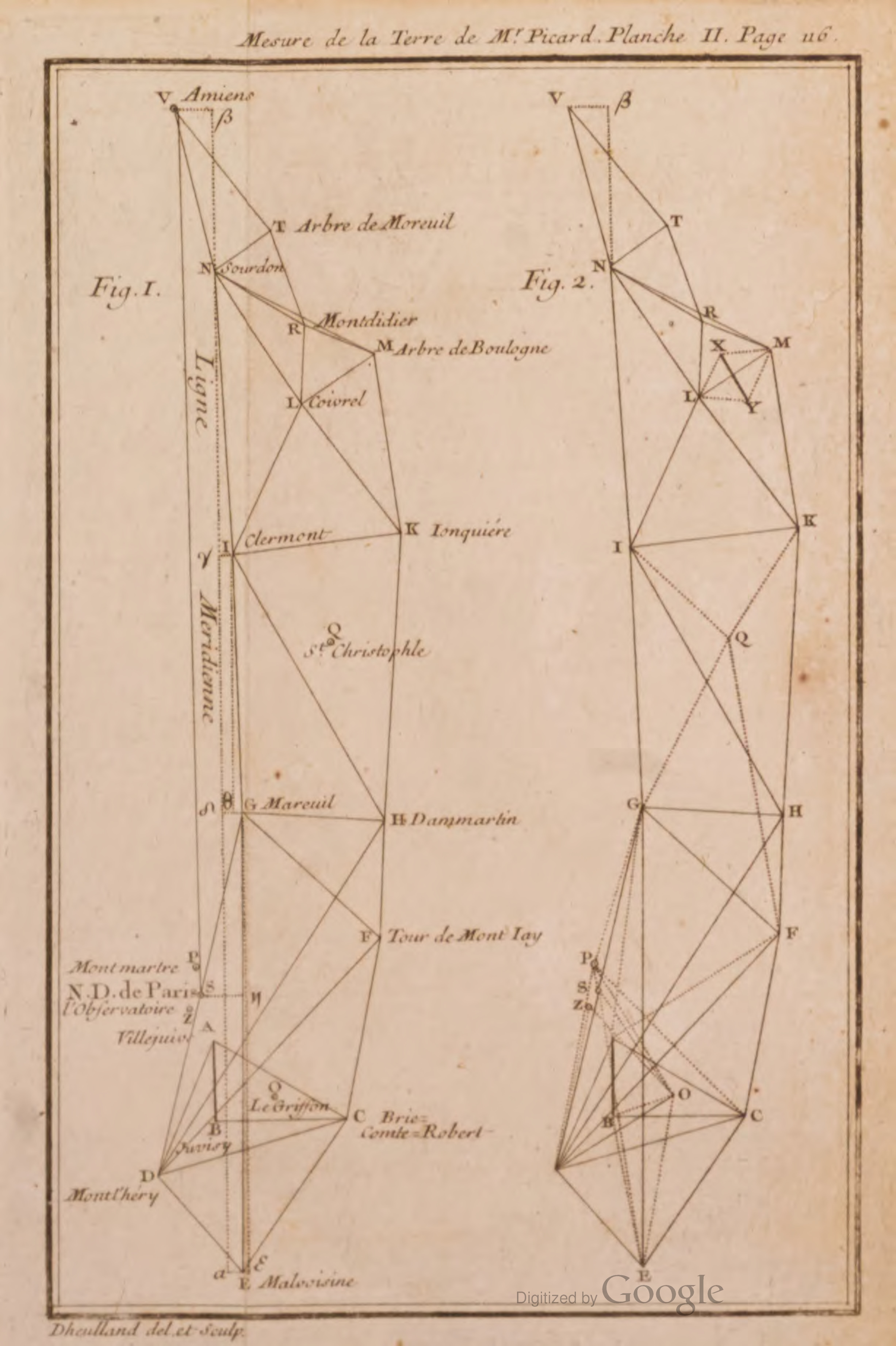
English: Plate from Dégré du méridien entre Paris et Amiens, déterminé par la mesure de M. Picard, et par les observations de Mrs de Maupertuis, Clairaut, Camus, Le Monnier... D'ou l'on déduit la figure de la terre, par la comparaison de ce dégré avec celui qui a été mesuré au cercle polaire. |
| Date | |
| Source | https://archive.org/details/picard-1740-degre-du-meridien-entre-paris-et-amie |
| Author | Picard, Jean (1620-1682); Pierre-Louis Moreau de Maupertuis (1698-1759); Category:Pierre-Charles Lemonnier (1715-1799) |
Licensing edit
|
This work is in the public domain in its country of origin and other countries and areas where the copyright term is the author's life plus 70 years or fewer. This work is in the public domain in the United States because it was published (or registered with the U.S. Copyright Office) before January 1, 1929. | |
| This file has been identified as being free of known restrictions under copyright law, including all related and neighboring rights. | |
File history
Click on a date/time to view the file as it appeared at that time.
| Date/Time | Thumbnail | Dimensions | User | Comment | |
|---|---|---|---|---|---|
| current | 19:25, 12 October 2023 | | 2,454 × 3,686 (1.03 MB) | Kognos (talk | contribs) | Uploaded a work by Picard, Jean (1620-1682); Pierre-Louis Moreau de Maupertuis (1698-1759); Category:Pierre-Charles Lemonnier (1715-1799) from https://archive.org/details/picard-1740-degre-du-meridien-entre-paris-et-amie with UploadWizard |
You cannot overwrite this file.
File usage on Commons
The following page uses this file:
File usage on other wikis
The following other wikis use this file:
- Usage on www.wikidata.org