File:PikiWiki Israel 4135 talithakumi.JPG
Size of this preview: 450 × 600 pixels. Other resolutions: 180 × 240 pixels | 360 × 480 pixels | 576 × 768 pixels | 1,200 × 1,600 pixels.
Original file (1,200 × 1,600 pixels, file size: 396 KB, MIME type: image/jpeg)
Captions
Captions
Add a one-line explanation of what this file represents
| Description |
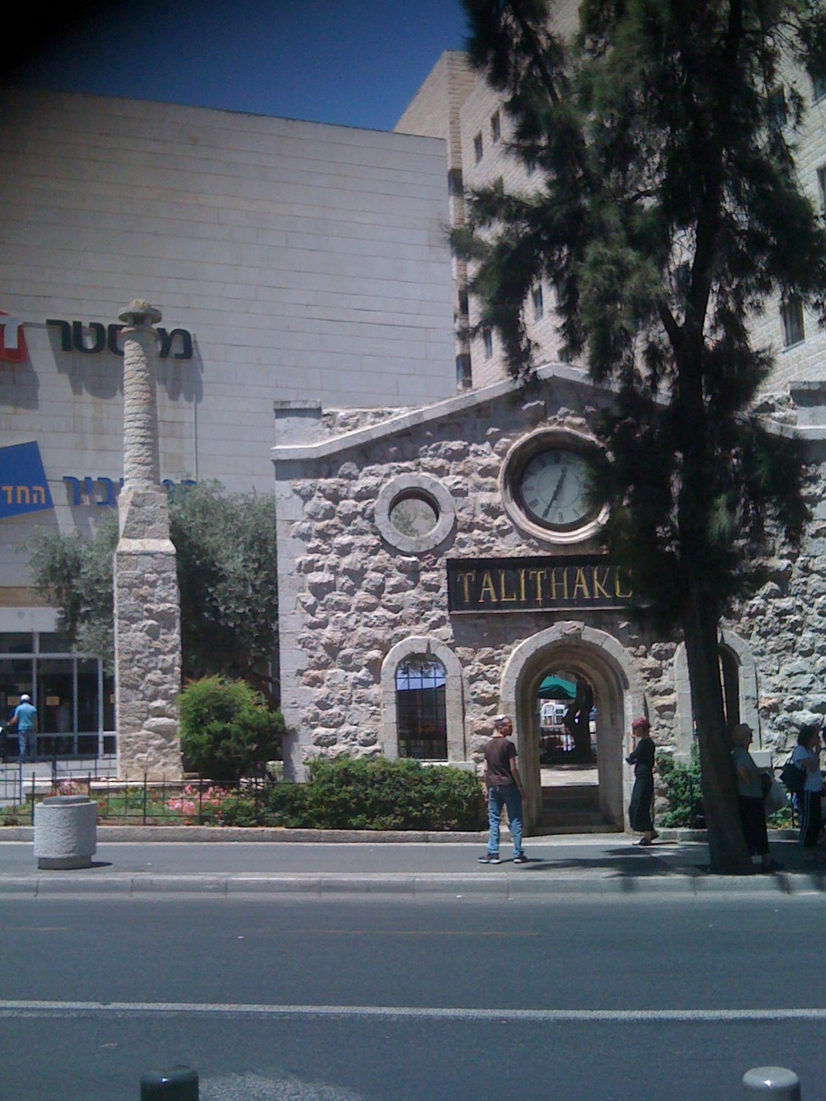
English: remains from demolished Talthakumi building
Français : Jerusalem - centre commercial "Nouveau Hamashbir Lazarchan" (המשביר החדש לצרכן)et "Monsieur Bon Marché", ("Mister Zol", מיסטר זול) au n° 20, rue du Roi George V. Au premier plan on peut voir quelques vestiges du bâtiment de l'école "Talitha KUmi" qui occupait l'endroit auparavant jusqu'à la seconde guerre mondiale. "Talitha KUmi" est une parole de Jésus en araméen qui figure dans l'évangile (Marc 5,41) et signifie "petite fille, lève-toi!". Cette école se trouve aujourd'hui à Beit Jala. A droite l'hôtel Lev Yerushalayim.
עברית: שרידים מבית היתומות טליטא קומי שנהרס ב- 1980, Original Image Name:טליטא קומי, Location:ירושלים |
| Date | circa 2009 |
| Source | shaula haitner via the PikiWiki - Israel free image collection project |
| Author | shaula haitner |
| Permission (Reusing this file) |
This file is licensed under the Creative Commons Attribution 2.5 Generic license. Attribution: shaula haitner
|
| Other versions |
|


| Camera location | | View this and other nearby images on: OpenStreetMap |
|---|

|
This file has been submitted through the Israeli Pikiwiki project and uploaded here automatically.
The project is cooperation between the Israel Internet Association and Wikimedia Israel in an effort to promote the concept of free content on the Web, by creating an image collection of digital-format, good quality photographs, documenting events relating to the history of Israel, or depicting places of distinction in Israel and the Middle East. The Pikiwiki Project is managed from 2021 by the "Heritage Stones" group.
Please consider notifying the project before renaming or deleting this file. Further information about the project can be found on the commons-l mailing list.
|
| Annotations | This image is annotated: View the annotations at Commons |
.jpg)
File history
Click on a date/time to view the file as it appeared at that time.
| Date/Time | Thumbnail | Dimensions | User | Comment | |
|---|---|---|---|---|---|
| current | 00:00, 11 August 2009 | | 1,200 × 1,600 (396 KB) | Pikiwikisrael (talk | contribs) | {{Information |Description={{en|remains from demolished Talthakumi building}} {{he|שרידים מבית היתומות טליטא קומי שנהרס ב- 1980, Original Image Name:טליטא קומי, Location:ירושלים}} |Source=shaula haitner via |
You cannot overwrite this file.
File usage on Commons
The following 5 pages use this file:
File usage on other wikis
The following other wikis use this file:
- Usage on he.wikipedia.org