File:Pine Valley Mountain from Lower Sand Cove at dusk 2009-06-10.jpg

Size of this preview: 800 × 600 pixels. Other resolutions: 320 × 240 pixels | 640 × 480 pixels | 1,024 × 768 pixels | 1,280 × 960 pixels | 2,592 × 1,944 pixels.
Original file (2,592 × 1,944 pixels, file size: 1,003 KB, MIME type: image/jpeg)
Captions
Captions
Add a one-line explanation of what this file represents
Summary edit
| Description |
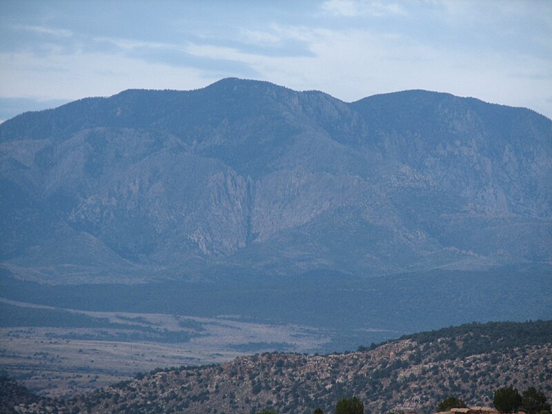
English: Photo of Pine Valley Mountain in Washington County, Utah, USA. The left-most peak is Burger Peak (10,321' elevation) and the right-most is Signal Peak (10,365' elevation). |
| Date | |
| Source | Own work |
| Author | Zettabyte |
| Camera location | | View this and other nearby images on: OpenStreetMap |
|---|
Taken at dusk from the Red Mountain Wilderness Study Area in the slickrock area south of Lower Sand Cove Reservoir.
Licensing edit
I, the copyright holder of this work, hereby publish it under the following license:
This file is licensed under the Creative Commons Attribution 3.0 Unported license.
- You are free:
- to share – to copy, distribute and transmit the work
- to remix – to adapt the work
- Under the following conditions:
- attribution – You must give appropriate credit, provide a link to the license, and indicate if changes were made. You may do so in any reasonable manner, but not in any way that suggests the licensor endorses you or your use.
File history
Click on a date/time to view the file as it appeared at that time.
| Date/Time | Thumbnail | Dimensions | User | Comment | |
|---|---|---|---|---|---|
| current | 23:08, 19 December 2011 | | 2,592 × 1,944 (1,003 KB) | Centpacrr (talk | contribs) | Reverted to version as of 21:47, 13 June 2009 (I now see that alteration request was not made by the original uploader) |
| 22:50, 19 December 2011 |  | 2,592 × 1,944 (1.09 MB) | Centpacrr (talk | contribs) | New version | |
| 22:07, 19 December 2011 |  | 2,592 × 1,944 (1,003 KB) | Jbarta (talk | contribs) | Reverted to version as of 21:47, 13 June 2009 - Are you serious? | |
| 22:02, 19 December 2011 |  | 2,592 × 1,944 (4.38 MB) | Centpacrr (talk | contribs) | Adjusted as requested. | |
| 21:47, 13 June 2009 |  | 2,592 × 1,944 (1,003 KB) | Zettabyte (talk | contribs) | Attempted to add geolocation exif data. | |
| 21:38, 13 June 2009 |  | 2,592 × 1,944 (1,003 KB) | Zettabyte (talk | contribs) | {{Information |Description={{en|1=Photo of Pine Valley Mountain in Washington County, Utah, USA. The left-most peak is Burger Peak (10,321' elevation) and the right-most is Signal Peak (10,365' elevation).}} |Source=Own work by uploader |Author=[[User:Zet |
You cannot overwrite this file.
File usage on Commons
The following page uses this file:
File usage on other wikis
The following other wikis use this file:
- Usage on arz.wikipedia.org
- Usage on ceb.wikipedia.org
- Usage on en.wikipedia.org
- Usage on lld.wikipedia.org
- Usage on www.wikidata.org