File:Pinus ponderosa subspecies range map.png
Size of this preview: 489 × 599 pixels. Other resolutions: 196 × 240 pixels | 609 × 746 pixels.
Original file (609 × 746 pixels, file size: 77 KB, MIME type: image/png)
Captions
Captions
Add a one-line explanation of what this file represents
| Description |
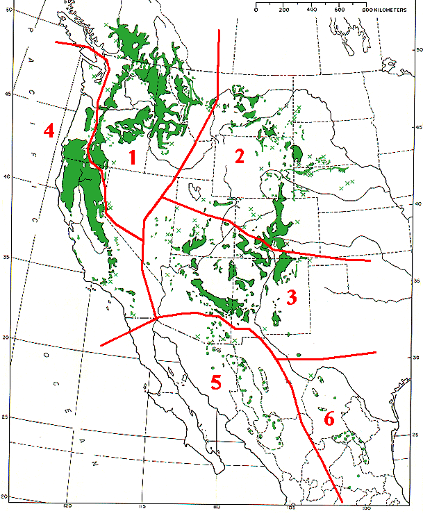
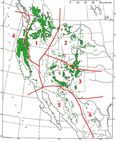
Range map of Pinus ponderosa and Pinus arizonica
|
|||
| Date | ||||
| Source | Base map (black outlines & green range map) is from USDA Forest Service Misc,.Publ. 991 (public domain-USGov); red delineation is my work, which I release into public domain | |||
| Author | MPF | |||
| Permission (Reusing this file) |
|
File history
Click on a date/time to view the file as it appeared at that time.
| Date/Time | Thumbnail | Dimensions | User | Comment | |
|---|---|---|---|---|---|
| current | 14:09, 7 December 2009 | | 609 × 746 (77 KB) | MPF (talk | contribs) | {{Information |Description=Range map of ''Pinus ponderosa'' and ''Pinus arizonica'' # ''Pinus ponderosa'' subsp. ''ponderosa'' - North Plateau Ponderosa Pine # ''Pinus ponderosa'' subsp. ''scopulorum'' - Rocky Mts Ponderosa Pine # ''Pinus ponderos |
You cannot overwrite this file.
File usage on Commons
The following 4 pages use this file:
- Pinus arizonica
- Pinus ponderosa
- File:Pondssp.png (file redirect)
- Category:Pinus ponderosa
File usage on other wikis
The following other wikis use this file:
- Usage on arz.wikipedia.org
- Usage on ca.wikipedia.org
- Usage on cs.wikipedia.org
- Usage on el.wikipedia.org
- Usage on es.wikipedia.org
- Usage on id.wikipedia.org
- Usage on nl.wikipedia.org
- Usage on pl.wikipedia.org
- Usage on pt.wikipedia.org
- Usage on sv.wikipedia.org
- Usage on tr.wikipedia.org
- Usage on uk.wikipedia.org
- Usage on www.wikidata.org