File:Plan de Luxembourg 1686.jpg

Size of this preview: 796 × 600 pixels. Other resolutions: 319 × 240 pixels | 637 × 480 pixels | 1,020 × 768 pixels | 1,280 × 964 pixels | 2,560 × 1,928 pixels | 7,744 × 5,833 pixels.
Original file (7,744 × 5,833 pixels, file size: 8.22 MB, MIME type: image/jpeg)
Captions
Captions
Add a one-line explanation of what this file represents
Summary edit
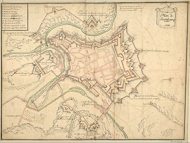
| Description | Plan de Luxembourg 1686 (Map of Luxembourg [City] 1686) |
| Date | |
| Source | Bibliothèque nationale de France, P154323 [Vc-77-Fol.] |
| Author | Gaignières, Roger de (1642-1715). Collectionneur |
| Permission (Reusing this file) |
Public domain (PD-old) |
Licensing edit
|
This work is in the public domain in its country of origin and other countries and areas where the copyright term is the author's life plus 100 years or fewer. | |
| This file has been identified as being free of known restrictions under copyright law, including all related and neighboring rights. | |
File history
Click on a date/time to view the file as it appeared at that time.
| Date/Time | Thumbnail | Dimensions | User | Comment | |
|---|---|---|---|---|---|
| current | 08:10, 24 January 2013 | | 7,744 × 5,833 (8.22 MB) | Ancalagon (talk | contribs) | higher resolution |
| 22:04, 31 December 2008 |  | 680 × 512 (100 KB) | Zinneke (talk | contribs) | {{Information |Description=Plan de Luxembourg 1686 (''Map of Luxembourg [City] 1686'') |Source=[http://gallica2.bnf.fr/ark:/12148/btv1b6903710k Bibliothèque nationale de France, P154323 [Vc-77-Fol.]] |Date=1686 |Author=Gaignières, Roger de (1642-1715). |
You cannot overwrite this file.
File usage on Commons
The following page uses this file:
File usage on other wikis
The following other wikis use this file:
- Usage on de.wikipedia.org
- Usage on lb.wikipedia.org