File:Plan de l'ille Royalle, de l'ille de Terre Neuve et du golf de Saint Laurent - M. Brémond - btv1b530900074.jpg

Size of this preview: 800 × 567 pixels. Other resolutions: 320 × 227 pixels | 640 × 453 pixels | 1,024 × 725 pixels | 1,280 × 907 pixels | 2,560 × 1,814 pixels | 9,213 × 6,527 pixels.
Original file (9,213 × 6,527 pixels, file size: 8.15 MB, MIME type: image/jpeg)
Captions
Captions
Add a one-line explanation of what this file represents
Summary edit
| Warning | The original file is very high-resolution. It might not load properly or could cause your browser to freeze when opened at full size. |
|---|
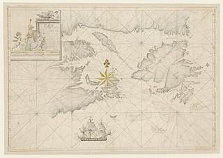
| Plan de l'ille Royalle, de l'ille de Terre Neuve et du golf de Saint Laurent / M. Brémond
( |
|||||||||||||||||||||||||||
|---|---|---|---|---|---|---|---|---|---|---|---|---|---|---|---|---|---|---|---|---|---|---|---|---|---|---|---|
| Title |
Plan de l'ille Royalle, de l'ille de Terre Neuve et du golf de Saint Laurent / M. Brémond |
||||||||||||||||||||||||||
| Description |
Français : Langue : français |
||||||||||||||||||||||||||
| Date | 1721 | ||||||||||||||||||||||||||
| Dimensions | height: 75 cm (29.5 in); width: 53 cm (20.8 in) | ||||||||||||||||||||||||||
| Collection |
|
||||||||||||||||||||||||||
| References |
Français : Notice de recueil : http://catalogue.bnf.fr/ark:/12148/cb43632209p
Appartient à : [Division 3 du portefeuille 122 du Service hydrographique de la marine consacrée aux cartes de grande étendue de l'Amérique septentrionale] ; 10 Notice du catalogue : http://catalogue.bnf.fr/ark:/12148/cb43632221j |
||||||||||||||||||||||||||
| Source/Photographer |
Français : Bibliothèque nationale de France, département Cartes et plans, GE SH 18 PF 122 DIV 3 P 10
Bibliothèque nationale de France |
||||||||||||||||||||||||||
| Permission (Reusing this file) |
|
||||||||||||||||||||||||||

File history
Click on a date/time to view the file as it appeared at that time.
| Date/Time | Thumbnail | Dimensions | User | Comment | |
|---|---|---|---|---|---|
| current | 03:49, 16 August 2022 | | 9,213 × 6,527 (8.15 MB) | Gzen92Bot (talk | contribs) | Gallica btv1b530900074 |
You cannot overwrite this file.
File usage on Commons
The following page uses this file: