File:Plan of square no. 378 - showing the true course of the creek running through it at the time it was changed in eighteen hundred & twenty six, & the present direction, since the change LOC 88693123.jpg

Size of this preview: 757 × 599 pixels. Other resolutions: 303 × 240 pixels | 606 × 480 pixels | 970 × 768 pixels | 1,280 × 1,013 pixels | 2,560 × 2,027 pixels | 6,528 × 5,168 pixels.
Original file (6,528 × 5,168 pixels, file size: 3.27 MB, MIME type: image/jpeg)
Captions
Captions
Add a one-line explanation of what this file represents
Summary
edit| Description |
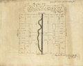
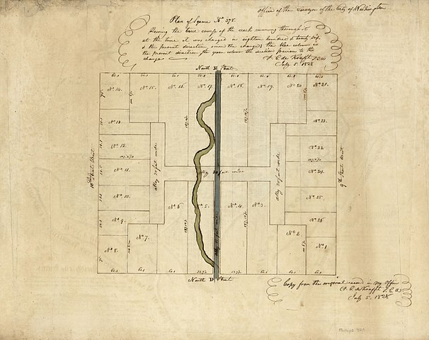
English: Cadastral map of block bounded by 10th, E, 9th, and D streets N.W. "Copy from the original record in my office, F.C. de Krafft S.C.W., July 5, 1828." Watermark: Budgen, (fleur-de-lis under crown). Pen-and-ink, green and blue watercolors. Fold-lined and cracked at edges. Printed 1792 Ellicott map on verso: Plan of the city of Washington in the territory of Columbia : ceded by the states of Virginia and Maryland to the United States of America ... after the year MDCCC / engrav'd by Sam'l Hill, Boston ; in order to execute this plan, Mr. Ellicott drew a true meridional line ... On verso in ink: P. Force Eng'r. Available also through the Library of Congress Web site as a raster image. Phillips. Washington, 905 Vault DCP |
||
| Title | Plan of square no. 378 : showing the true course of the creek running through it at the time it was changed in eighteen hundred & twenty six, & the present direction, since the change | ||
| Shelf ID | G3851.G46 1828 .D5 | ||
| Date | |||
| Source | https://www.loc.gov/item/88693123/ | ||
| Author | District Of Columbia. Office Of The Surveyor; De Krafft, F. C.; Hill, Samuel; Force, Peter; Ellicott, Andrew | ||
| Permission (Reusing this file) |
|
||
| Other versions |
|
||
| Location | United States · Washington D.C. · District Of Columbia · Washington | ||
| Part of | American Memory · Catalog · County Landownership Maps · Geography And Map Division · Cultural Landscapes | ||
| Subject | Washington (D.C.) · To 1800 · Washington · Maps, Manuscript · United States · Maps · District Of Columbia · Real Property · Manuscript Maps |

Licensing
edit
|
This is a faithful photographic reproduction of a two-dimensional, public domain work of art. The work of art itself is in the public domain for the following reason:
The official position taken by the Wikimedia Foundation is that "faithful reproductions of two-dimensional public domain works of art are public domain".
This photographic reproduction is therefore also considered to be in the public domain in the United States. In other jurisdictions, re-use of this content may be restricted; see Reuse of PD-Art photographs for details. | ||||
File history
Click on a date/time to view the file as it appeared at that time.
| Date/Time | Thumbnail | Dimensions | User | Comment | |
|---|---|---|---|---|---|
| current | 04:52, 31 May 2018 | | 6,528 × 5,168 (3.27 MB) | Fæ (talk | contribs) | LOC Maps https://www.loc.gov/item/88693123/ #572 |
You cannot overwrite this file.
File usage on Commons
The following page uses this file: