File:Plan of the Attack of Camaret Bay.jpg
Size of this preview: 746 × 600 pixels. Other resolutions: 299 × 240 pixels | 597 × 480 pixels | 956 × 768 pixels | 1,274 × 1,024 pixels | 2,150 × 1,728 pixels.
Original file (2,150 × 1,728 pixels, file size: 1.97 MB, MIME type: image/jpeg)
Captions
Captions
Add a one-line explanation of what this file represents
Summary edit
| Description |
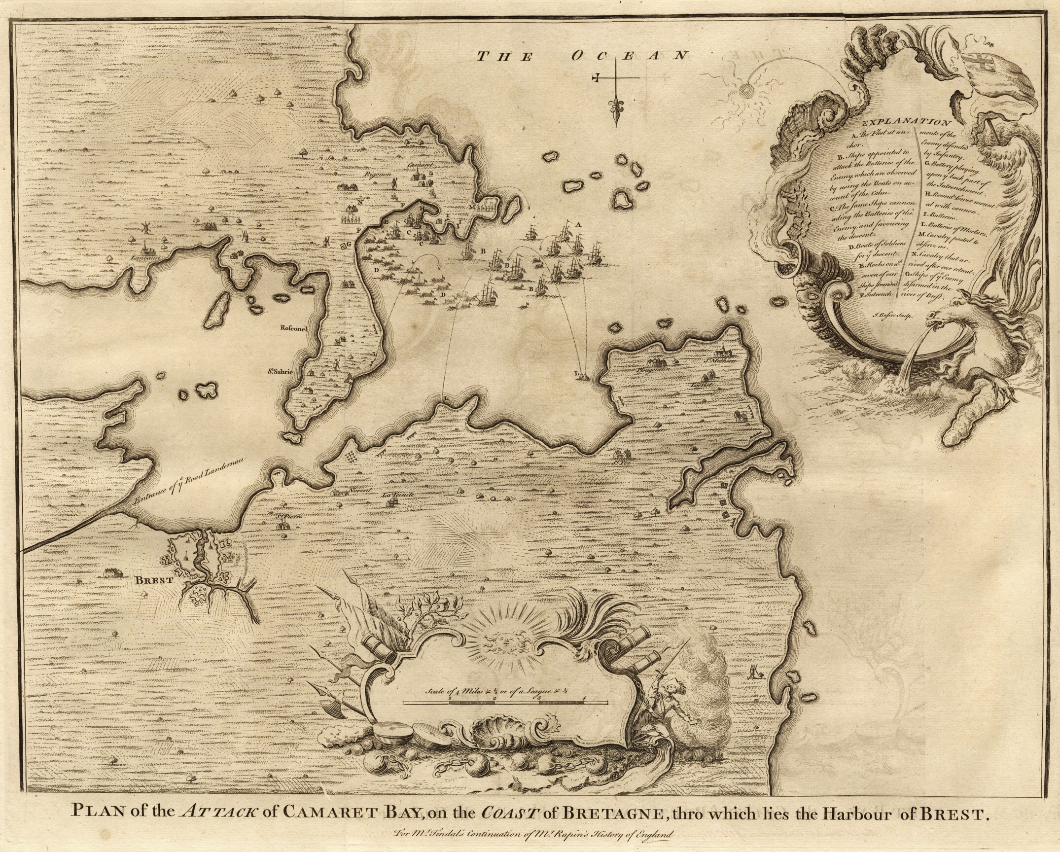
English: Plan of the Attack of Camaret Bay, on the Coast of Bretagne, thro which lies the Harbour of Brest.
For Mr. Tindal's continuation of Mr. Rapin's History of England Explanation:
Français : Plan de l'attaque dans la baie de Camaret, sur la côte de la Bretagne, où se trouve le port de Brest.
Deutsch: Angriffsplan der Bucht von Camaret, an der Küste der Bretagne, wo den Hafen von Brest liegt.
Español: Plan de batalla de la bahía de Camaret, en la costa de la Bretaña, donde se encuentra el puerto de Brest. |
| Date | |
| Source | own property |
| Author | Basire, James [engraver] |
Licensing edit
|
This work is in the public domain in its country of origin and other countries and areas where the copyright term is the author's life plus 100 years or fewer. | |
| This file has been identified as being free of known restrictions under copyright law, including all related and neighboring rights. | |
File history
Click on a date/time to view the file as it appeared at that time.
| Date/Time | Thumbnail | Dimensions | User | Comment | |
|---|---|---|---|---|---|
| current | 21:42, 10 November 2008 | | 2,150 × 1,728 (1.97 MB) | Mike bzh (talk | contribs) | {{Information |Description= |Source= |Date= |Author= |Permission= |other_versions= }} |
| 20:14, 4 November 2008 |  | 3,015 × 2,425 (3.02 MB) | Mike bzh (talk | contribs) | {{Information |Description={{en|1=Plan of the Attack of Camaret Bay, on the Coast of Bretagne, thro which lies the Harbour of Brest.}} {{fr|1=Plan de l'attaque dans la baie de Camaret, sur la côte de la Bretagne, où se trouve le port de Brest.}} {{de|1= |
You cannot overwrite this file.
File usage on Commons
The following 2 pages use this file:
File usage on other wikis
The following other wikis use this file:
- Usage on de.wikipedia.org
- Usage on en.wikipedia.org
- Usage on fr.wikipedia.org
- Usage on nn.wikipedia.org
- Usage on no.wikipedia.org
- Usage on ru.wikipedia.org
- Usage on www.wikidata.org
- Usage on zh.wikipedia.org