File:Plan of the fishing Town of Percee.jpg
Size of this preview: 800 × 352 pixels. Other resolutions: 320 × 141 pixels | 640 × 282 pixels | 1,024 × 451 pixels | 1,280 × 564 pixels | 2,388 × 1,052 pixels.
Original file (2,388 × 1,052 pixels, file size: 1.39 MB, MIME type: image/jpeg)
Captions
Captions
Add a one-line explanation of what this file represents
Summary edit
| Description |
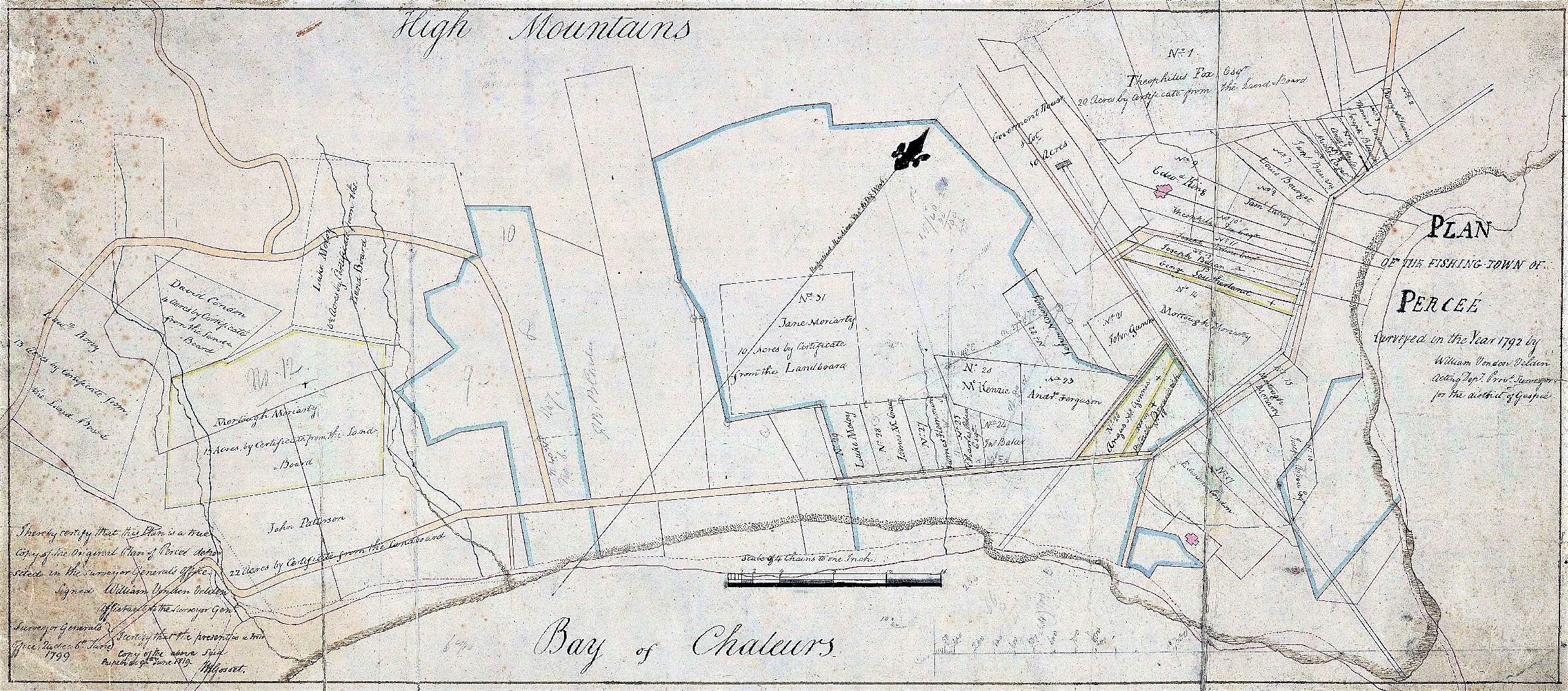
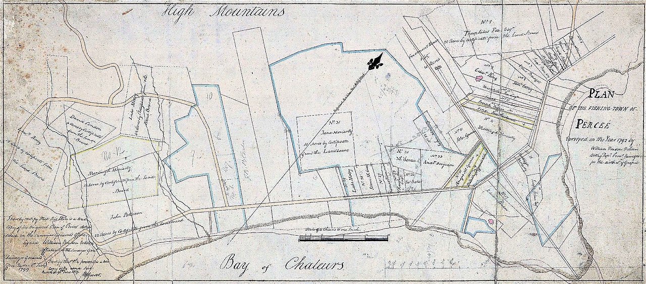
English: Plan of the fishing Town of Perceé, surveyed in the Year 1792
Français : Sur ce plan du village de Percé figurent la Baie des Chaleurs, les chemins, les bâtiments, le numéro des lots, les plages, les ruisseaux, l'église et le nom de 30 personnes. |
| Date | (original) - 1819 (copie) |
| Source | https://numerique.banq.qc.ca/patrimoine/details/52327/3142579 |
| Author | Copié par W. Gosset d'après l'original de William Vondenvelden |
Licensing edit
|
This work is in the public domain in its country of origin and other countries and areas where the copyright term is the author's life plus 70 years or fewer. This work is in the public domain in the United States because it was published (or registered with the U.S. Copyright Office) before January 1, 1929. | |
| This file has been identified as being free of known restrictions under copyright law, including all related and neighboring rights. | |
File history
Click on a date/time to view the file as it appeared at that time.
| Date/Time | Thumbnail | Dimensions | User | Comment | |
|---|---|---|---|---|---|
| current | 22:26, 17 September 2021 | | 2,388 × 1,052 (1.39 MB) | Jeangagnon (talk | contribs) | Uploaded a work by Copié par W. Gosset d'après l'original de William Vondenvelden from https://numerique.banq.qc.ca/patrimoine/details/52327/3142579 with UploadWizard |
You cannot overwrite this file.
File usage on Commons
There are no pages that use this file.