File:Plano de la Hacienda de Jaral de Berrio (siglo XVIII).jpg

Size of this preview: 800 × 598 pixels. Other resolutions: 320 × 239 pixels | 640 × 479 pixels | 1,024 × 766 pixels | 1,280 × 957 pixels | 2,560 × 1,914 pixels | 7,663 × 5,730 pixels.
Original file (7,663 × 5,730 pixels, file size: 9.41 MB, MIME type: image/jpeg)
Captions
Captions
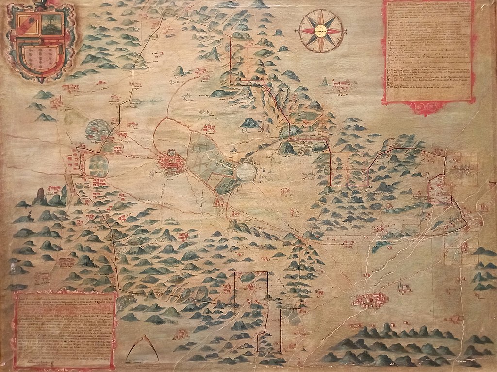
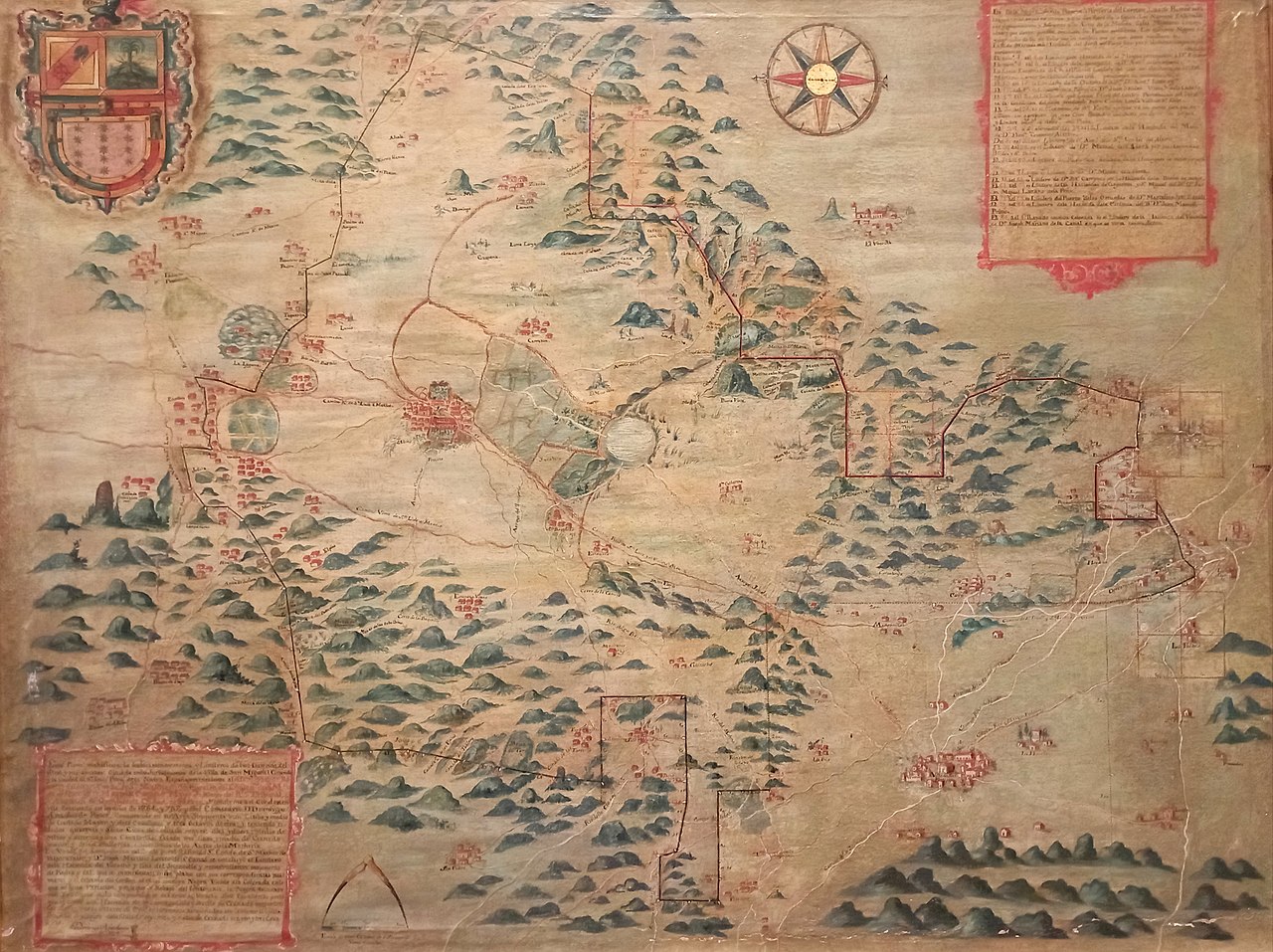
Map of the Jaral de Berrio Hacienda (18th century)
Summary edit
.jpg&action=edit§ion=1)
| Description |
Español: Plano de la Hacienda de Jaral de Berrio, siglo XVIII.
Óleo sobre tela. Colección Banco Nacional de México. |
| Date | |
| Source | Palacio de Cultura Citibanamex - Palacio de Iturbide |
| Author | Domingo Anastasio de Ponce |
| Camera location | | View this and other nearby images on: OpenStreetMap |
|---|
.jpg¶ms=019.433756_N_-099.139053_E_globe:Earth_type:camera__&language=en)
Plano de la Hacienda de Jaral de Berrio, ubicada cerca de San Felipe Torresmochas, al norte de Guanajuato, México.
Licensing edit
.jpg&action=edit§ion=2)
|
This work is in the public domain in its country of origin and other countries and areas where the copyright term is the author's life plus 70 years or fewer. This work is in the public domain in the United States because it was published (or registered with the U.S. Copyright Office) before January 1, 1929. | |
| This file has been identified as being free of known restrictions under copyright law, including all related and neighboring rights. | |
File history
Click on a date/time to view the file as it appeared at that time.
| Date/Time | Thumbnail | Dimensions | User | Comment | |
|---|---|---|---|---|---|
| current | 05:08, 2 November 2022 | | 7,663 × 5,730 (9.41 MB) | Juan Carlos Fonseca Mata (talk | contribs) | Uploaded a work by Domingo Anastasio de Ponce from Palacio de Cultura Citibanamex - Palacio de Iturbide with UploadWizard |
You cannot overwrite this file.
File usage on Commons
There are no pages that use this file.
File usage on other wikis
The following other wikis use this file:
- Usage on es.wikipedia.org
.jpg&oldid=770188202)