File:Plano topografico de fuerte de los remedios vulgarmente Sn. Gregorio y de los terrenos que lo circundan, defendido pr. la gavilla del rebelde cura forres, situiado en 1o. de septiembre de 1817 pr. las LOC 2005632501.tif

Size of this JPG preview of this TIF file: 770 × 599 pixels. Other resolutions: 308 × 240 pixels | 617 × 480 pixels | 987 × 768 pixels | 1,280 × 997 pixels | 2,560 × 1,993 pixels | 6,285 × 4,893 pixels.
Original file (6,285 × 4,893 pixels, file size: 87.98 MB, MIME type: image/tiff)
Captions
Captions
Add a one-line explanation of what this file represents
Summary edit
| Description |
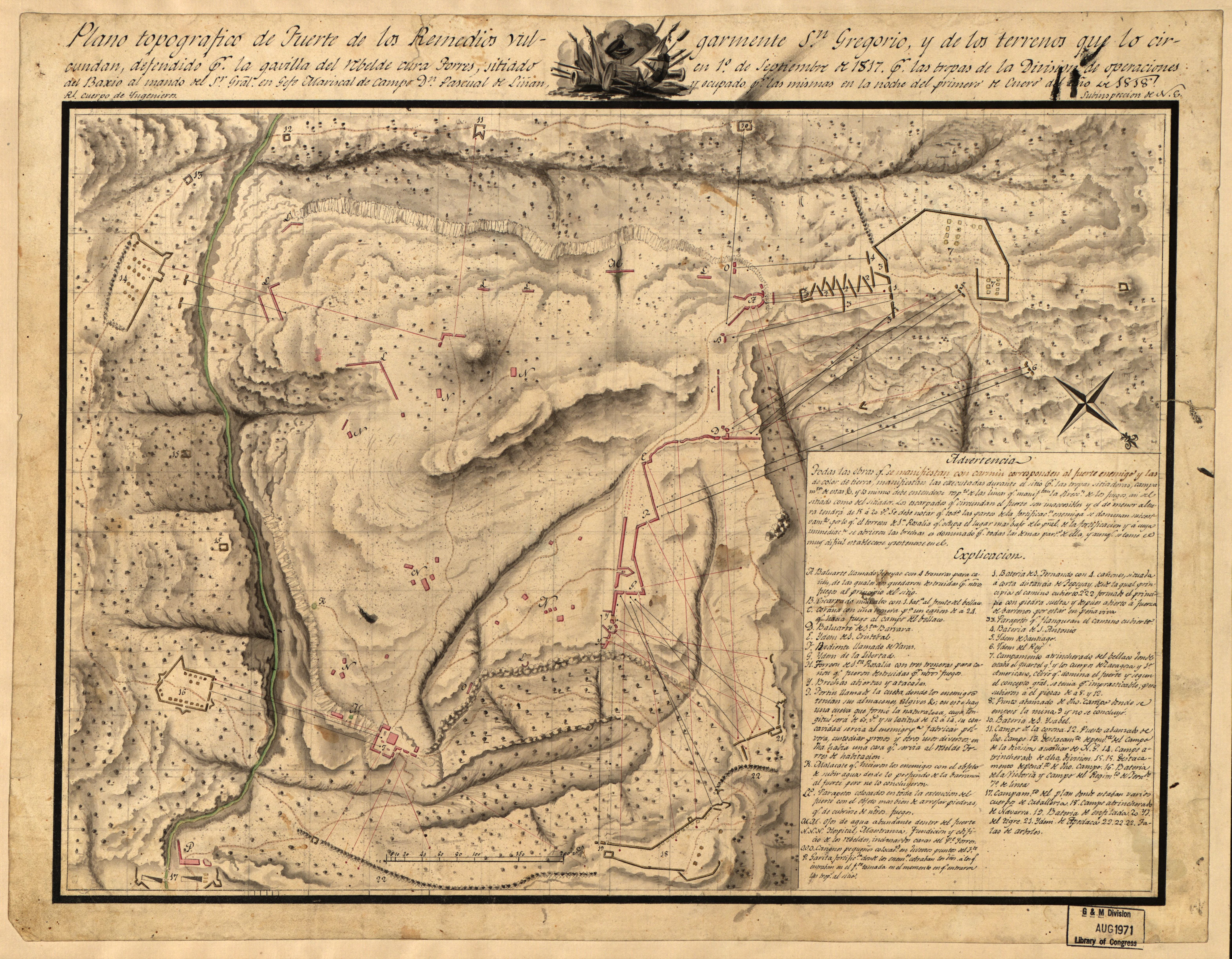
English: Location indeterminable. Relief shown by shading. Oriented with north toward the lower right. Pen-and-ink and watercolor. Available also through the Library of Congress Web site as a raster image. Includes text, index, and ill. LC Luso-Hispanic World, 578 |
||
| Title | Plano topografico de fuerte de los remedios vulgarmente Sn. Gregorio y de los terrenos que lo circundan, defendido pr. la gavilla del rebelde cura forres, situiado en 1o. de septiembre de 1817 pr. las tropas de la division de operaciones del baxio al mando del Sr. Gral. en Gefe Mariscal de Campo Dn. Pascual de Linan y ocupado pr. las mismas en la noche del primero de enero del año de 1818 : [Mexico] | ||
| Shelf ID | G4411.S42 1818 .S6 | ||
| Date | |||
| Source | https://www.loc.gov/item/2005632501/ | ||
| Author | Spain. Ejército. Cuerpo De Ingenieros | ||
| Permission (Reusing this file) |
|
||
| Other versions |
|
||
| Location | Mexico | ||
| Part of | American Memory · Catalog · Geography And Map Division · Cultural Landscapes | ||
| Subject | Campaigns · Maps, Manuscript · Wars Of Independence · History · Mexico |


Licensing edit
|
This is a faithful photographic reproduction of a two-dimensional, public domain work of art. The work of art itself is in the public domain for the following reason:
The official position taken by the Wikimedia Foundation is that "faithful reproductions of two-dimensional public domain works of art are public domain".
This photographic reproduction is therefore also considered to be in the public domain in the United States. In other jurisdictions, re-use of this content may be restricted; see Reuse of PD-Art photographs for details. | ||||
File history
Click on a date/time to view the file as it appeared at that time.
| Date/Time | Thumbnail | Dimensions | User | Comment | |
|---|---|---|---|---|---|
| current | 09:16, 18 May 2018 |  | 6,285 × 4,893 (87.98 MB) | Fæ (talk | contribs) | LOC Maps https://www.loc.gov/item/2005632501/ #10672 |
You cannot overwrite this file.
File usage on Commons
The following page uses this file: