File:Plate 71- Town of Patterson, Putnam Co. N.Y. NYPL1516851.tiff

Size of this JPG preview of this TIF file: 690 × 599 pixels. Other resolutions: 276 × 240 pixels | 553 × 480 pixels | 884 × 768 pixels | 1,179 × 1,024 pixels | 2,358 × 2,048 pixels | 6,043 × 5,248 pixels.
Original file (6,043 × 5,248 pixels, file size: 91.39 MB, MIME type: image/tiff)
Captions
Captions
Add a one-line explanation of what this file represents
Summary edit
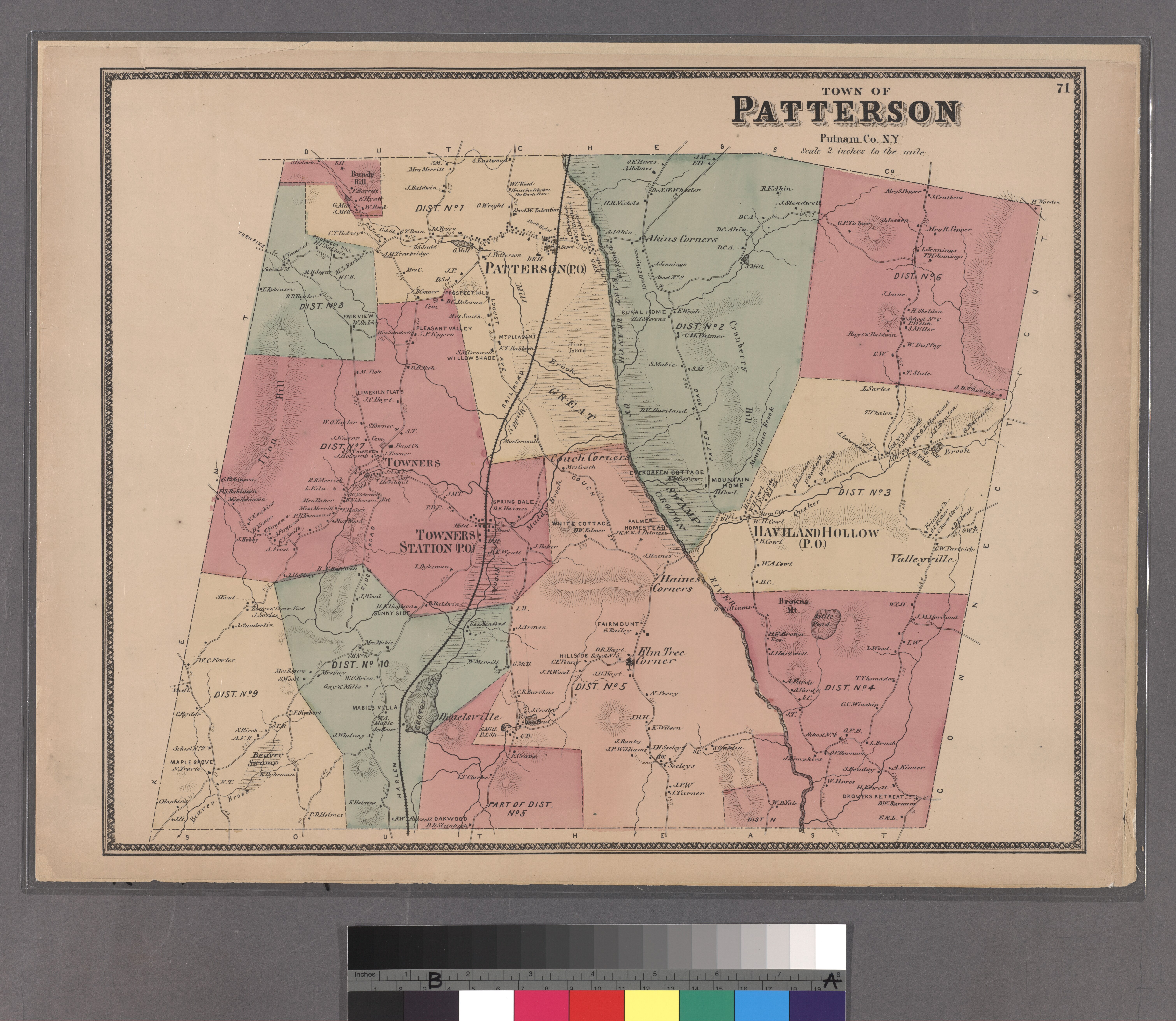
| Description | Plate 71: Town of Patterson, Putnam Co. N.Y.; Atlases of New York city. / Atlas of New York and vicinity : from actual surveys / by and under the direction of F. W. Beers, assisted by A. B. Prindle and others | |||||||||||||||||||||||
| Catalogue call number | Map Div.++ (New York State) (Beers, F. W. Atlas of New York and vicinity. 1868) | |||||||||||||||||||||||
| Item/Page/Plate | Plate 71 | |||||||||||||||||||||||
| Alternate title | Small folder - S2 | |||||||||||||||||||||||
| Date | ||||||||||||||||||||||||
| Source |
http://digitalgallery.nypl.org/nypldigital/dgkeysearchdetail.cfm?imageID=1516851
|
|||||||||||||||||||||||
| Author | F. W. (Frederick W.) - Cartographer Beers | |||||||||||||||||||||||
| Permission (Reusing this file) |
From The Lionel Pincus and Princess Firyal Map Division. http://maps.nypl.org
|
|||||||||||||||||||||||
| Source description | 72 [3] l. ill., maps; 46 cm. | |||||||||||||||||||||||
| Location | Stephen A. Schwarzman Building / The Lionel Pincus and Princess Firyal Map Division | |||||||||||||||||||||||
| Digital item published | 6-1-2006; updated 3-25-2011 | |||||||||||||||||||||||
| Digital ID | 1516851 | |||||||||||||||||||||||

The making of this file was supported by Wikimedia UK.
To see other files made with the support of Wikimedia UK, please see the category Supported by Wikimedia UK.
|
File history
Click on a date/time to view the file as it appeared at that time.
| Date/Time | Thumbnail | Dimensions | User | Comment | |
|---|---|---|---|---|---|
| current | 15:40, 4 May 2014 |  | 6,043 × 5,248 (91.39 MB) | Fæ (talk | contribs) | GWToolset:: Creating mediafile for Fæ. Tranche 3 17512-20314 @ 11:54, 3 March 2014 |
You cannot overwrite this file.
File usage on Commons
There are no pages that use this file.