File:Podział administracyjny Białegostoku 2013.svg

Size of this PNG preview of this SVG file: 535 × 600 pixels. Other resolutions: 214 × 240 pixels | 428 × 480 pixels | 685 × 768 pixels | 913 × 1,024 pixels | 1,827 × 2,048 pixels | 917 × 1,028 pixels.
Original file (SVG file, nominally 917 × 1,028 pixels, file size: 34 KB)
Captions
Captions
Add a one-line explanation of what this file represents
Summary edit
| Description |
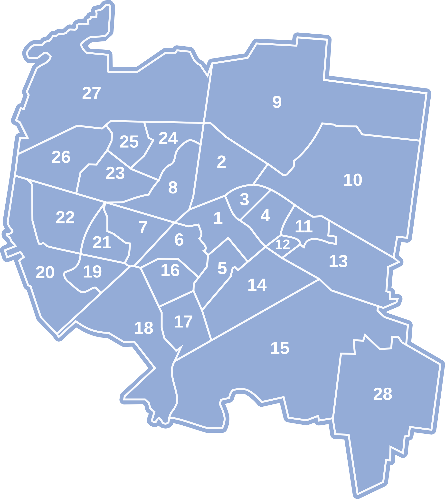
Polski: Podział miasta Białegostoku na osiedla obowiązujący od grudnia 2013r. Zostały wtedy zmienione granice dwóch osiedli: Dojlidy (nr 15) i Nowe Miasto (nr 18). |
| Date | |
| Source |
This file was derived from: Podział administracyjny Białegostoku 2006.svg:  |
| Author | File:Podział administracyjny Białegostoku 2006.svg: Ejkum; Polarbear8 |
Licensing edit
| This work has been released into the public domain by its author, Ejkum. This applies worldwide. In some countries this may not be legally possible; if so: |
File history
Click on a date/time to view the file as it appeared at that time.
| Date/Time | Thumbnail | Dimensions | User | Comment | |
|---|---|---|---|---|---|
| current | 18:10, 26 December 2020 | | 917 × 1,028 (34 KB) | Polarbear8 (talk | contribs) | Uploaded a work by Ejkum; Polarbear8 from https://commons.wikimedia.org/wiki/File:Podzia%C5%82_administracyjny_Bia%C5%82egostoku_2006.svg with UploadWizard |
You cannot overwrite this file.
File usage on Commons
The following page uses this file:
File usage on other wikis
The following other wikis use this file:
- Usage on pl.wikipedia.org