File:Point Western Isles NASA World Wind.png

Size of this preview: 800 × 541 pixels. Other resolutions: 320 × 216 pixels | 640 × 433 pixels | 1,024 × 692 pixels.
Original file (1,024 × 692 pixels, file size: 968 KB, MIME type: image/png)
Captions
Captions
Add a one-line explanation of what this file represents
Summary edit
| Description |
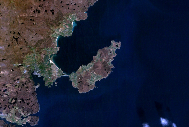
English: Satellite image of the district of Point on the Isle of Lewis, Scotland. |
| Date | 25 December 2006 (upload date) |
| Source | Satellite imagery taken from NASA World Wind software (by screenshot) |
| Author | NASA |
Licensing edit
| This image is in the public domain because it is a screenshot from NASA’s globe software World Wind using a public domain layer, such as Blue Marble, MODIS, Landsat, SRTM, USGS or GLOBE.
|
 |
File history
Click on a date/time to view the file as it appeared at that time.
| Date/Time | Thumbnail | Dimensions | User | Comment | |
|---|---|---|---|---|---|
| current | 12:19, 25 December 2006 | | 1,024 × 692 (968 KB) | JamesMorrison (talk | contribs) | Screengrab of the district of Point on the Isle of Lewis in Nasa World Wind |
You cannot overwrite this file.
File usage on Commons
There are no pages that use this file.
File usage on other wikis
The following other wikis use this file:
- Usage on de.wikipedia.org
- Usage on en.wikipedia.org
- Usage on gd.wikipedia.org
- Usage on nl.wikipedia.org
- Usage on nn.wikipedia.org