File:Poison Glen - Seen from arched bridge over stream - geograph.org.uk - 1189959.jpg
No higher resolution available.
Poison_Glen_-_Seen_from_arched_bridge_over_stream_-_geograph.org.uk_-_1189959.jpg (640 × 426 pixels, file size: 300 KB, MIME type: image/jpeg)
Captions
Captions
Add a one-line explanation of what this file represents
Summary edit
| Description |
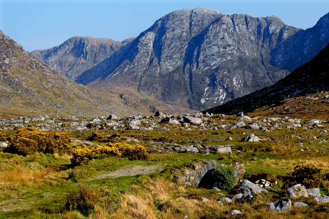
English: Poison Glen - Seen from arched bridge over stream Some people explore the entire inner area of the glen surrounded by the Derryveagh Mountains on three sides in either a CW or CCW direction, but the hike is probably not an easy one. The weather can change quickly to rain. The ground can be a wet, even on a dry day the footing on the rocks can be questionable. |
| Date | |
| Source | From geograph.org.uk |
| Author | Joseph Mischyshyn |
| Attribution (required by the license) | Joseph Mischyshyn / Poison Glen - Seen from arched bridge over stream / |
| Camera location | | View this and other nearby images on: OpenStreetMap |
|---|
_heading:135.00&language=en)
| Object location | | View this and other nearby images on: OpenStreetMap |
|---|
_heading:135.00&language=en)
Licensing edit

|
This image was taken from the Geograph project collection. See this photograph's page on the Geograph website for the photographer's contact details. The copyright on this image is owned by Joseph Mischyshyn and is licensed for reuse under the Creative Commons Attribution-ShareAlike 2.0 license.
|
This file is licensed under the Creative Commons Attribution-Share Alike 2.0 Generic license.
Attribution: Joseph Mischyshyn
- You are free:
- to share – to copy, distribute and transmit the work
- to remix – to adapt the work
- Under the following conditions:
- attribution – You must give appropriate credit, provide a link to the license, and indicate if changes were made. You may do so in any reasonable manner, but not in any way that suggests the licensor endorses you or your use.
- share alike – If you remix, transform, or build upon the material, you must distribute your contributions under the same or compatible license as the original.
File history
Click on a date/time to view the file as it appeared at that time.
| Date/Time | Thumbnail | Dimensions | User | Comment | |
|---|---|---|---|---|---|
| current | 21:38, 25 February 2011 | | 640 × 426 (300 KB) | GeographBot (talk | contribs) | == {{int:filedesc}} == {{Information |description={{en|1=Poison Glen - Seen from arched bridge over stream Some people explore the entire inner area of the glen surrounded by the Derryveagh Mountains on three sides in either a CW or CCW direction, but the |
You cannot overwrite this file.
File usage on Commons
There are no pages that use this file.