File:Pont-Rouge08a.jpg

Size of this preview: 800 × 600 pixels. Other resolutions: 320 × 240 pixels | 640 × 480 pixels | 1,024 × 768 pixels | 1,296 × 972 pixels.
Original file (1,296 × 972 pixels, file size: 227 KB, MIME type: image/jpeg)
Captions
Captions
Add a one-line explanation of what this file represents
Summary edit
| Description |
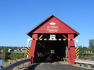
Français : Extérieur du Pont Marchand de Fort-Coulonge, Québec |
| Date | |
| Source | Own work |
| Author | Jljmt |
This photo is of a cultural heritage site in Canada, number 4463
|
| Object location | | View this and other nearby images on: OpenStreetMap |
|---|
Licensing edit
| I, the copyright holder of this work, release this work into the public domain. This applies worldwide. In some countries this may not be legally possible; if so: I grant anyone the right to use this work for any purpose, without any conditions, unless such conditions are required by law. |
File history
Click on a date/time to view the file as it appeared at that time.
| Date/Time | Thumbnail | Dimensions | User | Comment | |
|---|---|---|---|---|---|
| current | 20:04, 20 January 2009 | | 1,296 × 972 (227 KB) | Kilom691 (talk | contribs) | better resolution |
| 01:05, 5 November 2006 |  | 454 × 340 (41 KB) | Jljmt (talk | contribs) | Extérieur du Pont Marchand de Fort-Coulonge, Québec |
You cannot overwrite this file.
File usage on Commons
There are no pages that use this file.