File:Ponte de Ferro do Distrito da Guia, Cuiabá, Mato Grosso, Brasil (fotografia analógica - Nikon F401s, 28-80mm, Kentmere 400). (39737142570).jpg

Original file (1,300 × 867 pixels, file size: 296 KB, MIME type: image/jpeg)
Captions
Captions
Summary
edit._(39737142570).jpg&action=edit§ion=1)
| Description |
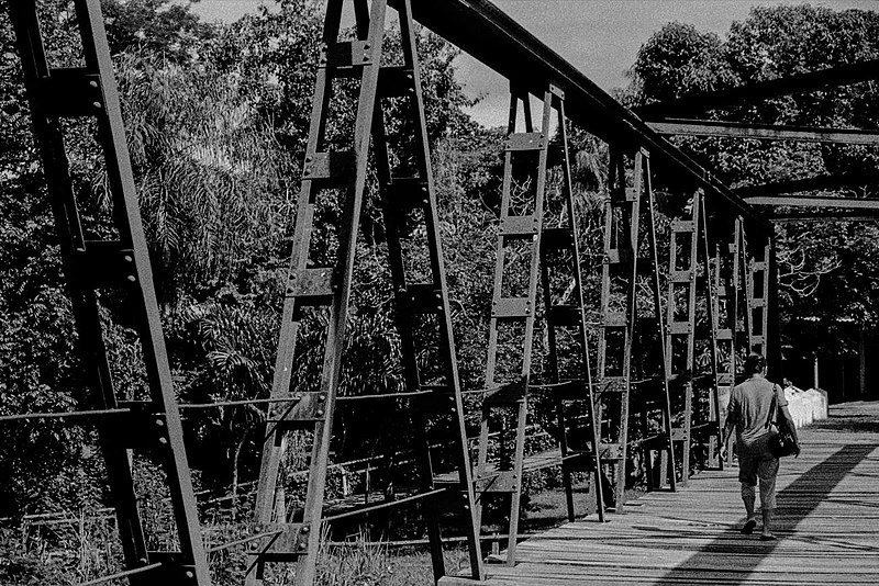
Nikon F401s, 28-80mm, Kentmere 400. Revelação e scan por [https://www.facebook.com/venturafineart" rel="nofollow">Ventura FineArt</a>. Foto por Paulisson Miura. Distrito da Guia, Cuiabá, MT, Brasil. Março de 2018. "Ponte de ferro forjada pela Dalzell Steel Works - siderúrgica localizada no distrito escocês de Motherwell, desde 1871 até o presente - e projetada pela David Rowell & Company Engineers - de Westminster, área central de Londres, estabelecida em 1855 e fechada em 1970 - para ser construída durante o governo de Arnaldo Estevão de Figueiredo, entre 1947-1951." Fonte: [http://pau-rodado.blogspot.com.br/2007/11/ponte-de-ferro-do-distrito-da-guia.html" rel="nofollow">pau-rodado.blogspot.com.br</a> Facebook / Instagram "http://projetarfotografia.tumblr.com Tumblr] "https://twitter.com/paulissonmiura Twitter] |
| Date | |
| Source | Ponte de Ferro do Distrito da Guia, Cuiabá, Mato Grosso, Brasil (fotografia analógica - Nikon F401s, 28-80mm, Kentmere 400). |
| Author | paulisson miura from Cuiabá, Brasil |
| Camera location | | View this and other nearby images on: OpenStreetMap |
|---|
._(39737142570).jpg¶ms=-15.357445_N_-056.230816_E_globe:Earth_type:camera_source:Flickr_&language=en)
Licensing
edit._(39737142570).jpg&action=edit§ion=2)
- You are free:
- to share – to copy, distribute and transmit the work
- to remix – to adapt the work
- Under the following conditions:
- attribution – You must give appropriate credit, provide a link to the license, and indicate if changes were made. You may do so in any reasonable manner, but not in any way that suggests the licensor endorses you or your use.
| This image was originally posted to Flickr by Paulisson Miura at https://flickr.com/photos/42143754@N04/39737142570 (archive). It was reviewed on 3 June 2018 by FlickreviewR 2 and was confirmed to be licensed under the terms of the cc-by-2.0. |
File history
Click on a date/time to view the file as it appeared at that time.
| Date/Time | Thumbnail | Dimensions | User | Comment | |
|---|---|---|---|---|---|
| current | 03:54, 3 June 2018 | | 1,300 × 867 (296 KB) | Sturm (talk | contribs) | Transferred from Flickr via #flickr2commons |
You cannot overwrite this file.
File usage on Commons
There are no pages that use this file.
._(39737142570).jpg&oldid=866631798)