File:Pontosmap en.svg

Size of this PNG preview of this SVG file: 800 × 442 pixels. Other resolutions: 320 × 177 pixels | 640 × 354 pixels | 1,024 × 566 pixels | 1,280 × 708 pixels | 2,560 × 1,415 pixels | 1,172 × 648 pixels.
Original file (SVG file, nominally 1,172 × 648 pixels, file size: 261 KB)
Captions
Captions
Add a one-line explanation of what this file represents
Summary edit
| Description |
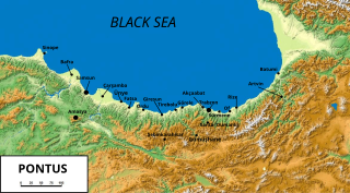
English: Map of Pontus with most important settlements, before 1922 |
| Date | |
| Source | File:Pontosmap.png |
| Author | Dipa1965 (derivative work=text conversion to svg + a few additions, original bitmap by Trbz1461) |
Licensing edit
This file is licensed under the Creative Commons Attribution-Share Alike 3.0 Unported license.
- You are free:
- to share – to copy, distribute and transmit the work
- to remix – to adapt the work
- Under the following conditions:
- attribution – You must give appropriate credit, provide a link to the license, and indicate if changes were made. You may do so in any reasonable manner, but not in any way that suggests the licensor endorses you or your use.
- share alike – If you remix, transform, or build upon the material, you must distribute your contributions under the same or compatible license as the original.
File history
Click on a date/time to view the file as it appeared at that time.
| Date/Time | Thumbnail | Dimensions | User | Comment | |
|---|---|---|---|---|---|
| current | 22:17, 7 January 2013 | | 1,172 × 648 (261 KB) | Dipa1965 (talk | contribs) | Converted all placeholders of cities to vectors. Compressed the bitmap background to jpg (much less file size) |
| 10:01, 2 January 2013 |  | 1,172 × 648 (1.68 MB) | Dipa1965 (talk | contribs) | removed boundaries after discussing with original map author (no means to define exact ethnic, linguistic or religious boundaries) | |
| 21:32, 7 December 2012 |  | 1,172 × 648 (1.67 MB) | Dipa1965 (talk | contribs) | User created page with UploadWizard |
You cannot overwrite this file.
File usage on Commons
There are no pages that use this file.
File usage on other wikis
The following other wikis use this file:
- Usage on bg.wikipedia.org
- Usage on ca.wikipedia.org
- Usage on cs.wikipedia.org
- Usage on es.wikipedia.org
- Usage on fy.wikipedia.org
- Usage on kk.wikipedia.org
- Usage on pl.wikipedia.org
- Usage on ru.wikipedia.org
- Usage on tr.wikipedia.org
- Usage on war.wikipedia.org