File:Port of Ramsgate aerial.jpg

Size of this preview: 800 × 522 pixels. Other resolutions: 320 × 209 pixels | 640 × 417 pixels | 1,024 × 668 pixels | 1,280 × 835 pixels | 2,560 × 1,670 pixels | 3,795 × 2,475 pixels.
Original file (3,795 × 2,475 pixels, file size: 5.96 MB, MIME type: image/jpeg)
File information
Structured data
Captions
Captions
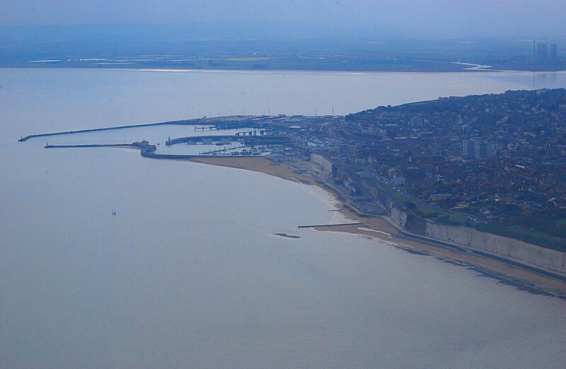
Aerial photograph of Ramsgate Harbour, Kent
Luchtfoto van de haven van Ramsgate, Kent
Summary edit
| DescriptionPort of Ramsgate aerial.jpg |
English: Aerial photograph of the port of Ramsgate, Kent, England, taken from the northeast. In the upper right corner are the mouth of the river Stour and the cooling towers of the former Richborough Power Station which was demolished one year later. Nikon D60 f=55mm f/18 at 1/1250s ISO 800. Processed using GIMP 2.6.11.
Nederlands: Luchtfoto van de haven van Ramsgate, Kent, Engeland, genomen vanuit het noordoosten. In de rechterbovenhoek bevinden zich de monding van de rivier de Stour en de koeltorens van de voormalige elektriciteitscentrale van Richborough die een jaar later zou worden afgebroken. Nikon D60 f=55mm f/18 bij 1/1250s ISO 800. Bewerkt met GIMP 2.6.11. |
| Date | GMT |
| Source | Own work |
| Author | Lieven Smits |
Licensing edit
I, the copyright holder of this work, hereby publish it under the following license:
This file is licensed under the Creative Commons Attribution-Share Alike 4.0 International license.
- You are free:
- to share – to copy, distribute and transmit the work
- to remix – to adapt the work
- Under the following conditions:
- attribution – You must give appropriate credit, provide a link to the license, and indicate if changes were made. You may do so in any reasonable manner, but not in any way that suggests the licensor endorses you or your use.
- share alike – If you remix, transform, or build upon the material, you must distribute your contributions under the same or compatible license as the original.
File history
Click on a date/time to view the file as it appeared at that time.
| Date/Time | Thumbnail | Dimensions | User | Comment | |
|---|---|---|---|---|---|
| current | 22:06, 17 April 2023 |  | 3,795 × 2,475 (5.96 MB) | Lieven Smits (talk | contribs) | Uploaded own work with UploadWizard |
You cannot overwrite this file.
File usage on Commons
The following page uses this file:
Metadata
This file contains additional information such as Exif metadata which may have been added by the digital camera, scanner, or software program used to create or digitize it. If the file has been modified from its original state, some details such as the timestamp may not fully reflect those of the original file. The timestamp is only as accurate as the clock in the camera, and it may be completely wrong.
| JPEG file comment | Port of Ramsgate |
|---|