File:Post route map of the State of Colorado - DPLA - dead92060869f2e6e65b7b43947a542b.jpg

Size of this preview: 800 × 560 pixels. Other resolutions: 320 × 224 pixels | 640 × 448 pixels | 1,024 × 716 pixels | 1,280 × 896 pixels | 2,560 × 1,791 pixels | 9,000 × 6,297 pixels.
Original file (9,000 × 6,297 pixels, file size: 5.77 MB, MIME type: image/jpeg)
Captions
Captions
Add a one-line explanation of what this file represents
Summary
editThis file was uploaded by the Digital Public Library of America, and the following item metadata was created by the contributing institution's staff.
Note: this data is being maintained by an automated bot, synced with the source data.
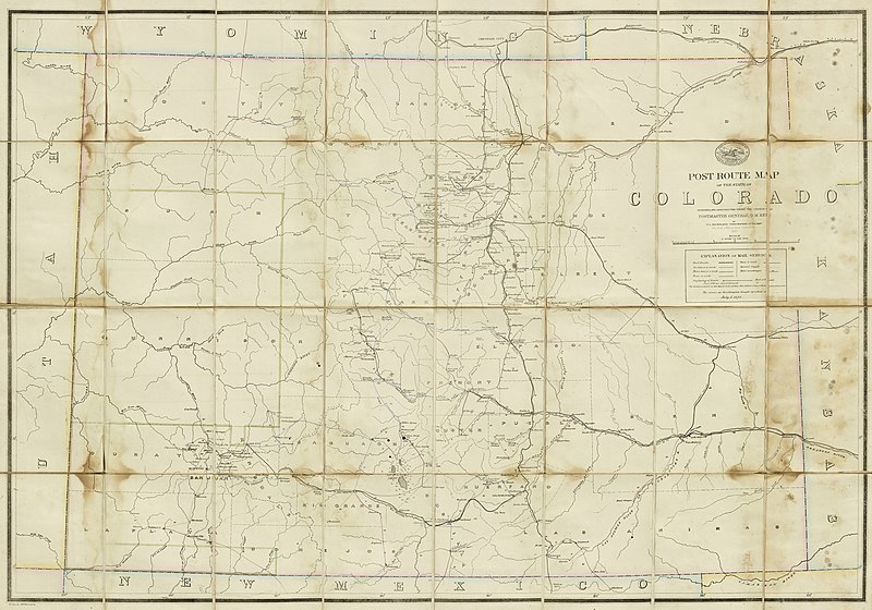
| Description | [2nd edition?]. Linen backing. "The service on this diagram brought up to date of July 1, 1878." "The first edition was issued in 1877"; Shows county boundaries, rivers, towns, railroads, and postal delivery routes, delivery frequency and service types. Two panels have paperboard covers., 1:696,960. [11 miles to the inch] | ||||||||||||||||||||
| Title | Post route map of the State of Colorado | ||||||||||||||||||||
| Institution |
|
||||||||||||||||||||
| Subject | |||||||||||||||||||||
| Source |
Plains to Peaks Collective |
||||||||||||||||||||
| Author |
United States. Post Office Department |
||||||||||||||||||||
| Permission (Reusing this file) |
Copyright determination made by Denver Public Library (Q69470198) using RightsStatements.org
|
||||||||||||||||||||
| Partnership |
|
||||||||||||||||||||


File history
Click on a date/time to view the file as it appeared at that time.
| Date/Time | Thumbnail | Dimensions | User | Comment | |
|---|---|---|---|---|---|
| current | 12:37, 18 December 2020 | | 9,000 × 6,297 (5.77 MB) | DPLA bot (talk | contribs) | Uploading DPLA ID dead92060869f2e6e65b7b43947a542b |
You cannot overwrite this file.
File usage on Commons
There are no pages that use this file.