File:Powiat gorzowski location map.png

Size of this preview: 800 × 428 pixels. Other resolutions: 320 × 171 pixels | 640 × 343 pixels | 1,024 × 548 pixels | 1,544 × 827 pixels.
Original file (1,544 × 827 pixels, file size: 156 KB, MIME type: image/png)
Captions
Captions
Add a one-line explanation of what this file represents
| Description |
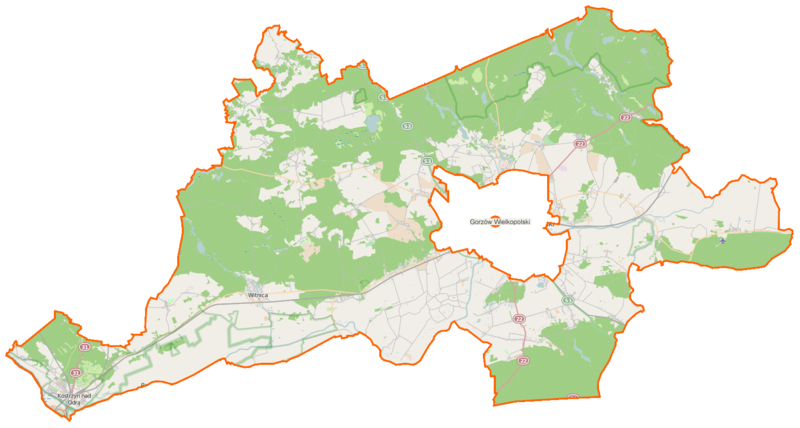
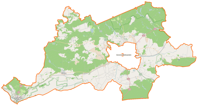
Polski: Mapa powiatu gorzowskiego, Polska
English: Map of Powiat gorzowski, Poland |
|||||||||
| Date | ||||||||||
| Source | You may find a page on the OpenStreetMap wiki page for Powiat gorzowski | |||||||||
| Creator |
OpenStreetMap contributors OpenStreetMap contributors |
|||||||||
| Permission (Reusing this file) |
OpenStreetMap data is available under the Open Database License (details). Map tiles are licensed under the Creative Commons Attribution-ShareAlike 2.0 license (CC-BY-SA 2.0).
This file is licensed under the Creative Commons Attribution-Share Alike 2.0 Generic license.
|
|||||||||
| Geotemporal data | ||||||||||
| Bounding box |
|
|||||||||
| Georeferencing | If inappropriate please set warp_status = skip to hide. | |||||||||
File history
Click on a date/time to view the file as it appeared at that time.
| Date/Time | Thumbnail | Dimensions | User | Comment | |
|---|---|---|---|---|---|
| current | 06:31, 20 April 2015 | | 1,544 × 827 (156 KB) | VanWiel (talk | contribs) | {{OpenStreetMap | name = Powiat gorzowski | location = Powiat gorzowski | description = {{pl|Mapa powiatu gorzowskiego, Polska}} {{en|Map of Powiat gorzowski, Poland}} | top = 52.9100 | bottom = 52.... |
You cannot overwrite this file.
File usage on Commons
There are no pages that use this file.
File usage on other wikis
The following other wikis use this file:
- Usage on eo.wikipedia.org
- Usage on pl.wikipedia.org
- Kostrzyn nad Odrą
- Witnica
- Racław (województwo lubuskie)
- Świerkocin (województwo lubuskie)
- Wawrów
- Kostrzyńsko-Słubicka Specjalna Strefa Ekonomiczna
- Santok
- Ściechów
- Białczyk
- Bogdaniec (województwo lubuskie)
- Bolemin
- Chłopiny
- Ciecierzyce
- Deszczno
- Dziersławice
- Dzierżów
- Jasiniec
- Jenin
- Jeninek
- Jeniniec
- Jeżyki
- Kłopotowo (województwo lubuskie)
- Krasowiec
- Krześniczka
- Krzyszczyna
- Krzyszczynka
- Kamień Wielki
- Karnin (województwo lubuskie)
- Lipki Małe
- Lipki Wielkie
- Lubczyno
- Lubiszyn
- Ludzisławice
- Łagodzin
- Łąkomin (wieś)
- Łośno
- Mironice (wieś)
- Mościczki
- Nowe Dzieduszyce
- Nowe Polichno
- Nowiny Wielkie
- Orzelec
- Osiedle Poznańskie
- Płomykowo
- Podjenin
- Pyrzany
- Oksza (wieś)
- Rybakowo (wieś)
- Santocko
View more global usage of this file.