File:Praha4.Lhotka.Zalesi.cp.48.47.46.JPG

Original file (3,072 × 2,304 pixels, file size: 1.1 MB, MIME type: image/jpeg)
Captions
Captions
Summary edit
| Description |
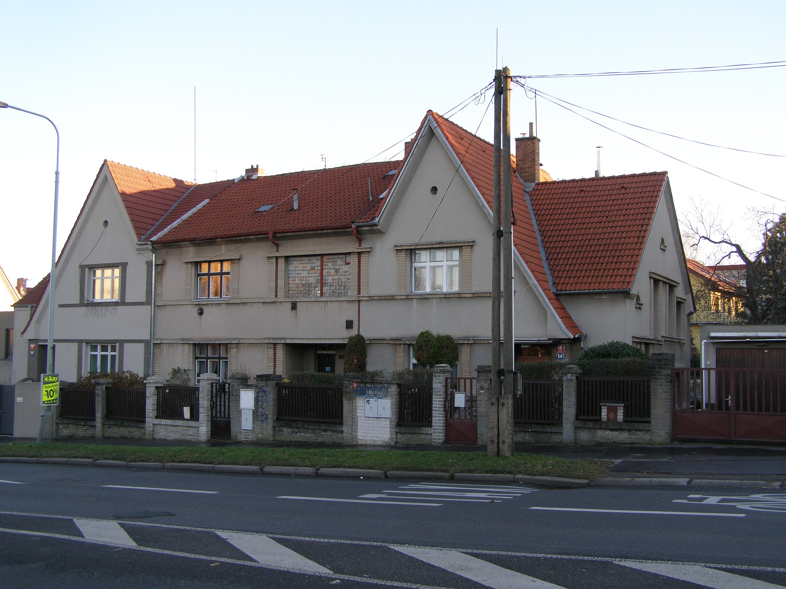
Čeština: Trojitý rodinný řadový dům na adrese (zleva doprava, nejprve číslo popisné /pak číslo orientační) 142 00 Praha 4 – Lhotka, ulice Zálesí 48/60, 47/58 a 46/56.
English: Three in one line family house at the address (from left to right) 142 00 Prague 4 - Lhotka, street Zálesí 48/60, 47/58 and 46/56. In the middle house (47/58) lived during the First Republic (and during the Protectorate) leader of an illegal resistance organization PVVZ in eastern Bohemia (the Chrudim and Nasavrky regions) and one of many of the organizers of intelligence services Ing. Josef Friedl (* 1907 - † 1945) with his wife and two children. |
| Date | |
| Source | Own work |
| Author | Mojmir Churavy |
| Camera location | | View this and other nearby images on: OpenStreetMap |
|---|
Licensing edit
- You are free:
- to share – to copy, distribute and transmit the work
- to remix – to adapt the work
- Under the following conditions:
- attribution – You must give appropriate credit, provide a link to the license, and indicate if changes were made. You may do so in any reasonable manner, but not in any way that suggests the licensor endorses you or your use.
- share alike – If you remix, transform, or build upon the material, you must distribute your contributions under the same or compatible license as the original.
File history
Click on a date/time to view the file as it appeared at that time.
| Date/Time | Thumbnail | Dimensions | User | Comment | |
|---|---|---|---|---|---|
| current | 14:08, 6 February 2016 | | 3,072 × 2,304 (1.1 MB) | Mojmir Churavy (talk | contribs) | User created page with UploadWizard |
You cannot overwrite this file.
File usage on Commons
There are no pages that use this file.
File usage on other wikis
The following other wikis use this file:
- Usage on cs.wikipedia.org