File:Prince George Circuit.png
Size of this preview: 800 × 555 pixels. Other resolutions: 320 × 222 pixels | 640 × 444 pixels | 1,024 × 710 pixels | 1,195 × 829 pixels.
Original file (1,195 × 829 pixels, file size: 143 KB, MIME type: image/png)
Captions
Captions
Add a one-line explanation of what this file represents
Summary edit
| Description |
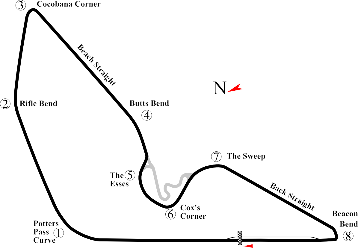
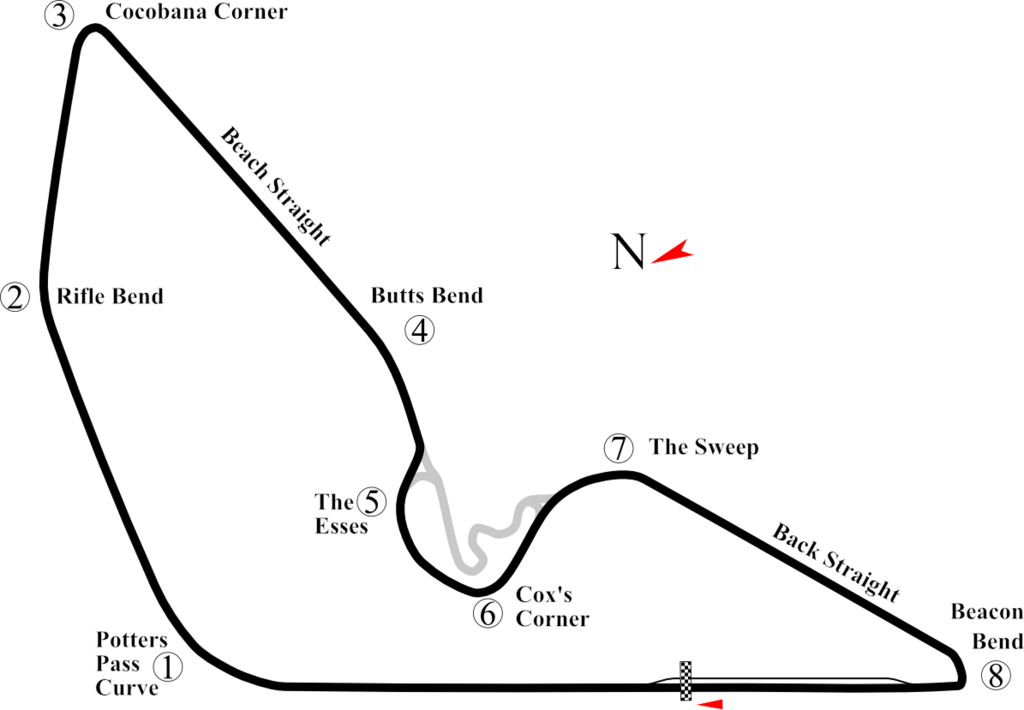
English: Track Map for Prince George Circuit. This PNG version was created for use with browsers like IE7 that don't support SVG. |
| Date | |
| Source | Own work |
| Author | Will Pittenger |
| Other versions |
|

| Camera location | | View this and other nearby images on: OpenStreetMap |
|---|
Licensing edit
| I, the copyright holder of this work, release this work into the public domain. This applies worldwide. In some countries this may not be legally possible; if so: I grant anyone the right to use this work for any purpose, without any conditions, unless such conditions are required by law. |
File history
Click on a date/time to view the file as it appeared at that time.
| Date/Time | Thumbnail | Dimensions | User | Comment | |
|---|---|---|---|---|---|
| current | 07:39, 16 July 2008 | | 1,195 × 829 (143 KB) | Will Pittenger (talk | contribs) | {{Information |Description={{en|1=Track Map for w:Prince George Circuit. This PNG version was created for use with browsers like IE7 that don't support SVG.}} |Source=Own work by uploader |Author=Will Pittenger |Date=7-16-200 |
You cannot overwrite this file.
File usage on Commons
The following page uses this file: