File:Provadiyska river map.svg

Size of this PNG preview of this SVG file: 788 × 599 pixels. Other resolutions: 316 × 240 pixels | 631 × 480 pixels | 1,010 × 768 pixels | 1,280 × 974 pixels | 2,560 × 1,948 pixels | 2,366 × 1,800 pixels.
Original file (SVG file, nominally 2,366 × 1,800 pixels, file size: 2.92 MB)
Captions
Captions
Add a one-line explanation of what this file represents
Summary edit
| Description |
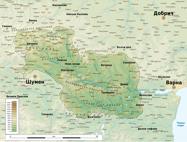
Български: Карта на водосборния басейн на Провадийска река в България |
| Date | |
| Source |
Own work
|
| Author | Ikonact |
| Permission (Reusing this file) |
Any use of this map is subject of the license(s) stated below with the condition that you credit (Wikimedia Commons user: Ikonact) as the author . A message with a reply address would also be greatly appreciated. |
Licensing edit
I, the copyright holder of this work, hereby publish it under the following license:
This file is licensed under the Creative Commons Attribution-Share Alike 4.0 International license.
- You are free:
- to share – to copy, distribute and transmit the work
- to remix – to adapt the work
- Under the following conditions:
- attribution – You must give appropriate credit, provide a link to the license, and indicate if changes were made. You may do so in any reasonable manner, but not in any way that suggests the licensor endorses you or your use.
- share alike – If you remix, transform, or build upon the material, you must distribute your contributions under the same or compatible license as the original.
File history
Click on a date/time to view the file as it appeared at that time.
| Date/Time | Thumbnail | Dimensions | User | Comment | |
|---|---|---|---|---|---|
| current | 22:24, 8 March 2020 | | 2,366 × 1,800 (2.92 MB) | Ikonact (talk | contribs) | More names |
| 15:19, 8 March 2020 |  | 2,366 × 1,800 (2.91 MB) | Ikonact (talk | contribs) | font corrections | |
| 23:06, 7 March 2020 |  | 2,366 × 1,800 (2.9 MB) | Ikonact (talk | contribs) | {{Information |description={{en|1=Map of the drainage basin of Provadiya river in Bulgaria}} {{bg|1=Карта на водосборния басейн на Провадийска река в България}} |date=2020-03-07 |source={{own}} *Sources of data:<br/> **Topography: SRTM v4(public domain);<br/> **Rivers and water bodies: Produced using Copernicus data and information funded by the European Union - EU-Hydro layers **Other data: © OpenStreetMap contributors;<br/... |
You cannot overwrite this file.
File usage on Commons
There are no pages that use this file.
File usage on other wikis
The following other wikis use this file:
- Usage on bg.wikipedia.org
- Usage on ru.wikipedia.org